Firstly, let me apologize to you, the reader, for the failure of me, the writer. I didn’t take any notes on July the 31st, because that was the day (*spoiler alert*) that I arrived at my sister’s. So, please be forgiving if as you read through you notice a certain lack of detail that is present in other entries.
I woke up in the Super 7, packed my things, and checked out. Then, I drove next door, to the local Barstow Napa Autoparts, and bought a shiny new air filter for my truck. Then I drove to the cheapest gas I could find, a little ways down the road, which was $3.139 per gallon (take that supposed lack of detail!), and filled up my truck. I think I bought some ice, too.
Back onto the road again, mostly interstate for quite some time, with little bits of the Old Road thrown in there for good measure. Everything was going along swimmingly until I saw a great cloud hovering in the distance. As I got closer, I would learn that the cloud was not, in fact, hovering, but instead resting gently on the mountains I was to drive down into. Not only was I wrong about the clouds relationship to the ground with respect to distance, but also wrong about the sort of traffic I would be driving in. Being as the cloud was on the ground, that meant that the fog was also thick on and about the ground, and I got the distinct feeling that fog is not something that the Southern Californian’s who don’t live on or near the coast experience too often. In fact, being as I was still mostly in the desert, I’d say that fog in those parts is something of a rarity.
What’s that? Did you say you want proof? Well, you’re in luck, I’ve got just the vague sort of proof you’re looking for. I just happen to have a photograph that, with the proper analysis, will reflect the accuracy of some of my assertions. Here we go, but first, here’s the photograph:
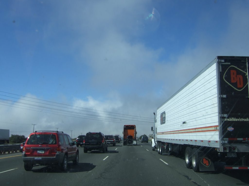
The picture was taken from within the confines of my truck, or just to the outside of the driver’s side window. It is plain to see that the traffic is thick, the clouds somewhat distant. If memory serves, which it does in this case, the speed was less than 20 miles per hour, or so. And please, don’t be fooled by the distance between the point of view that the picture is taken from and the vehicle to the fore—I like to leave a safe following distance, that’s all. Hmmm, that didn’t take nearly as much analysis as I was anticipating. However, traffic became even thicker and slower once we (the trafficked automobiles and their operators) entered the cloud. Shortly after the time of cloud entry and the time that my slow descent began, I was instructed by my book to take an exit to drive one of the best parts of what parts of Route 66 that
The freeway continued, and at some point split into Is 15 and 215, I believe. I was on I-15, and the book said nothing about any 215, so I continued on 15. The book said what exit (street name) to take, so I was on the lookout. The interstate split happened, and a moment after I chose beyond revocation to take the 15, I saw a sign on the 215 that had the street name that I was to take as the next exit. One straw to go. I continue on I-15, in the hopes of finding out that the road I needed was long and winding and that I would find another exit for it. This was not to be the case. I stopped at a strip mall in
I took that exit. Although, after having reversed my direction I found it unnecessary to merge with 215, because the 15 eastbound had an exit for whatever street it was I needed to be on. I think, anyway. I got on the road, and drove it. It was boring. Then I got into San Berdoo, which is
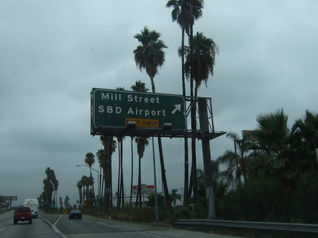
Alright, alright, this may be a little childish, so I won’t go into any real detail, but I thought this sign was rather funny:
I glanced at my map, and decided that I was close enough, and it was early enough, that I would give visiting my friend Matthew in
Matthew was out in the parking lot, and took me into the place of his summer employment. I was introduced to various people, whose names I cannot recall, and it was fun. Matthew said that I had arrived in that places from Seattle, via
After various conversations about Route 66 and the local festivities, Matthew and I went to lunch at the local Chipotle. Which brings my total times eating at that restaurant chain up to two—and I still haven’t had their guacamole, which I hear is pretty good.
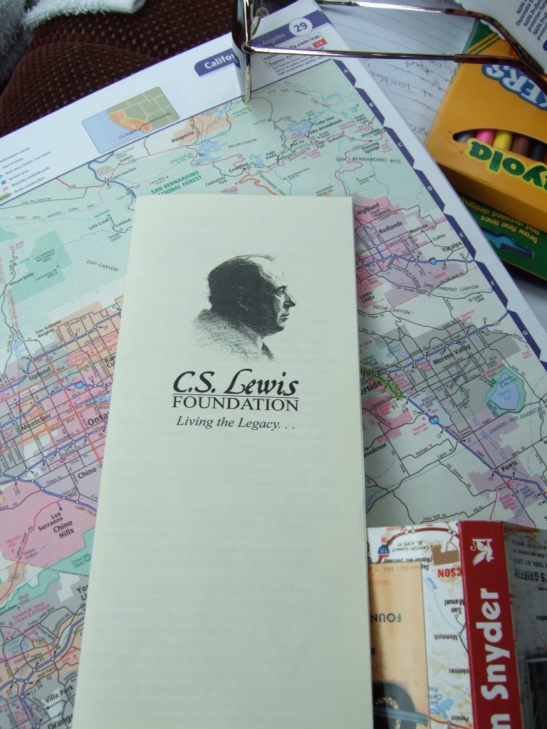
Matthew went back to his place of work, he gave me a brochure, and then I left. I thought I was going to finish Route 66 that day, and was looking forward to it. At some point as I was driving away, I realized that I hadn’t taken a picture of my friend, and should have, for documentation purposes. The only way I could think to suitably amend this was with a stand-in, of sorts. So I took a picture of the brochure he’d given me and my map. The corner of the brochure is very near to
I continued on my merry way. I found
I passed through several towns, and eventually came to
At this point the memories of what occurred at my sister’s are sort of a blur, because it took place over the course of two plus weeks. So, while I can tell you with some confidence that we had fried chicken that night, I can’t tell you with any certainty what conversations may or may not have taken place (other than the fact that they both agreed with me that the book I had been using was confusing and didn’t make much sense).
It was good.
No comments:
Post a Comment