Wednesday, August 16, 2006

An Afternoon In Zion (CNP)

The day of July the 28th began for me like many other days that had come before it. I woke up in the back of my truck. After gathering my things together, I headed toward the general bathroom area to take a shower, only to get there and find out that it was a coin operated shower. It was supposedly 8 quarters for 8 minutes, but the water started when I hit 7 quarters, and who am I to complain? Then I gathered up the rest of my stuff, and headed out, in the general direction of Zion. This meant I had a bit of backtracking to do.

I knew that my digital camera was out of the question for the day in question, after having thoroughly exhausted its picture-taking capacity the day before in Bryce Canyon, so I went back to the old, reliable 35mm camera I have. It isn’t anything super spectacular, but I do feel a little guilty for how under-used it’s been on this trip. Anyway, I had run the batteries down on it sometime back, and as coincidence would have it, bought new batteries for it the previous day in Cedar City. Since I was passing back through Red Canyon, I decided to stop and take some pictures on my old camera. I pulled of to the side of the road, took out the camera, took out the old batteries, loaded the new ones, and the camera came to life ever so briefly. This was followed by the camera having its switch in the ‘on’ position, but giving no signs of actually being ‘on.’ To make kind of a long story kind of short, the contact on the battery door of the camera is slightly recessed, making it below a raised plastic ring placed there for I cannot think of any good reason. So, as I was closing the battery door, I would briefly get contact between the door, the battery, the other battery, and the rest of the camera, before the plastic ring would push the battery away from the contact. It seems like a pretty big design flaw, except for the fact that somehow it had never been an issue before. And I have no idea why it would be one now. In any event, after many instances of getting the camera to light up briefly and then die, I was able to get the camera’s readout to have display things when it was off (which is normal), but as soon as I would turn it on, everything would go blank. This happened many, many times. I was quite fearful of going through a day with no pictures. There were plenty of thoughts racing through my head regarding things like taking the day off to find a motel and charge the digital camera, trying to find a camera repair shop, or any number of other things that would allow me to keep some kind of visual memory outside of my mind of the remainder of the day that was to come. Finally, after literally minutes of messing around with the machine, I got it to turn on, stay on, and even work-that is, until I hit the shutter button, then it would turn off again. It was extremely frustrating. There were several instances of me thinking that I’d gotten everything working again, but then something would go wrong in a new and unexpected sort of way. The next time I tried it, I was actually able to take a picture of Red Canyon. I was well pleased, and the remainder of the day was fairly problem free, picture-taking wise. Although, there were several more instances of turning the camera on, lining up the near-perfect picture, pressing the shutter button, and having the camera turn off. Indeed, it was quite frustrating, but some pictures were by far better than none, in my opinion.

After stopping at several scenic turnouts along the road through Red Canyon for picture-taking purposes, stopping to take another picture of the abandoned car, and turning south on the highway that would get me to the road that went through Zion Canyon, I stopped at a gas station for to buy some ice. After I went in the store and came back out and drained my cooler and then filled it up again, a strange thing happened. Two cop cars rolled up into the gas station parking lot, two more passed by on the road, a minivan with lights on it rolled up on the other side of the road, and a semi truck with a positively monstrous machine on its trailer pulled off to the side of the road (as much as it could). It’s been a while now, so I don’t remember quite what the monstrous thing was, but I did take some pictures of it with the then-functioning filmic camera. That thing was huge, though, it was probable more than twice as wide as the trailer it was on (that might be a slight, slight exaggeration). I was heading the other direction, so I finished up with what I was doing, hopped in my pickup truck and drove onward toward Zion.

After a time, I arrived in Zion. I paid to get in, or would have, had I not had my handy dandy park pass. Then I went and saw the checkerboard mesa, which had criss-crossing lines on its surface which were both vertical, and horizontal. I drove around some more, decided to go on a little hike up to a canyon view lookout, which was pretty great, and then back down. Shortly after reentering my truck, again, I went through the longest most hypnotic tunnel I may ever have passed through. The tunnel had windows, five of them. I didn’t really have time to look out them though, for many reasons. I reached the end of the tunnel, and exited accordingly. Rounding some turns, and switching back some switchbacks, I found a view of the viewing area at the end of the trail. I took some pictures and then continued down the mountainside. I was looking for a wherever it was that the shuttles stopped, and wasn’t having any luck. Finally I saw some signs that said to turn for shuttle parking. Unfortunately, they also said that the parking lot was full. I continued on, and found myself quite quickly on the outside of the park. I then found a parking spot, and walked back into the park. What I didn’t realize, however, was that I had to pay to get back in, or rather, would have had to pay to get back in if I had paid to get in in the first place. They just swiped my card (again) and I went on my less than merry way. After boarding a shuttle bus, I rode it around. I didn’t get off until the last stop, which was called ‘Riverside walk,’ or something equally ‘nice’ sounding. It was exactly that, a riverside walk. And it was fun. Then I got back on another shuttle bus, and headed back down the canyon.

Wow, I can’t believe how much I was just about to leave out. Let me try this again. The riverside walk was pretty neat, it was paved all the way, and had a couple of interesting hills, but was not difficult at all (except for the fact that, again, I’m not a very ‘prepare for a hike’ kind of person. Besides the level of interesting hills and non-difficulty, the setting was pretty amazing. There were basically sheer cliffs that would rise mere feet away from the river to heights of (supposedly) “2000-3000 feet above the canyon floor.”* It was pretty amazing. There were little trees growing out of the cliffs up toward the top, that I would have to guess to be around 30 feet tall. So maybe that height is actually kind of reasonable. I can’t think of any other worthwhile descriptions right now, but Zion Canyon was pretty awesome (I do maintain, however, that Bryce Canyon was way awesomer). There were a lot of people that had climbed down and were wandering around in the river, some shod, some swam in clothes, it appeared as though all had fun.

Back down the mountain, I decided to disembark at a trail for the location entitled ‘Weeping Rock.’ That was a pretty great experience, and a very neat sight. There was a fairly short trail up to the attraction, and the attraction was a cliff with a little bit of a recess at the bottom. There were all sorts of reasons written on various little plaques and signs about why the water collected and fell, but I don’t really remember those reasons right now, but I do remember that it was great. You pass under the cliff face to the recess and walk through a curtain of water falling from earth to earth.

I walked back through the curtain after observing it for several minutes, and went back to the bus stop. I got back on the first bus I’d ridden that day, and rode it back to the visitor center. Then I left the park, went back to my truck, and had to reenter the park again. I needed to get back to the road I had been on before I turned to get on the road that went through the park because my goal was to see the Grand Canyon the next day. So, I got to go up the switchbacking road that I had traveled down, then back through the windowed tunnel, and past the checkered mesa before heading south once more.

The result, was me stopping in Kanab, UT. It was a town with not much there. I stopped at a motel that was the cheapest deal to date and had the best wireless internet to date. It was boring but maybe a little fun. I stopped there pretty early, but I knew that I wasn’t necessarily going to have another sure chance to charge up my digital camera before the Grand Canyon. I did so, watched some television, and eventually went to sleep.

* http://www.nps.gov/zion/ParkProfile.htm

Wednesday, August 09, 2006

Thursday, July the 27th, 2006. A Utah Day.

On Thursday morning, the 27th of the July, I awoke in a campground somewhere in the south of Utah. It was (and most likely still is) called the Quail Creek State Campground (or some variation thereof). The campground was alright. I didn’t really care for how open it was, and how there was only one other group there, but I hadn’t had a whole lot of options as to other places to say in the gathering darkness of the previous night. Everything worked out alright, though, so I’m ok with it. I organized my stuff, got out of the truck, sat at a nearby picnic table and downloaded the previous day’s digital photographs. On my way back to the truck, with my newly digitally emptied camera, I spotted a small, cold-blooded creature. This wasn’t the first instance a lizard had crossed my path, but this was probably the closest I’d gotten to one (and that also happened to be the biggest one I’d seen). Here you go:

The previous night, I had spoken to my mom on the phone at length, and she had mentioned that she had been camping somewhere in Utah when she was a kid, and that she remembered some picnic tables that looked like ‘prairie schooners,’ due to a wind shielding shelter of sorts. At some point it was revealed to me that a ‘prairie schooner’ was just another name for a covered wagon (I had no idea previous to that point about such things). When I realized what she was talking about, I said that they did indeed have those same sorts of things at the campground I was at. Here, for your visual edification, is a photograph of such a thing:

After picturing such things, I made my way to the bathroom, because I needed to fill my water bottles. I would have filled them up at any old water spigot, but there didn’t appear to be any old water spigots about. I was forced to take my many bottles to the bathroom and attempt to fill them up with the faucet of inconvenience. I call it the faucet of inconvenience because really, I can think of no better name for it. Most faucets I’ve dealt with in the past have been some form of automatic water on/off, or something you turn or otherwise shift in one direction, but that will allow the water to keep flowing for at least a few seconds once you take your hand away from the dial/lever/switch. Well, this faucet had a plug coming out from the bottom of it, and you needed to shift the plug to one side, thus creating a gap, and allowing the water to flow out. The only problem is, that you have to keep at least one finger on the plug for as long as you’d like water to keep flowing. This was difficult enough just trying to wash my hands, but trying to fill water bottles in a sink with this faucet was particularly nightmarish. I persisted, overcame adversity, and won the day. My bottles became filled with water.

From Quail Creek, I drove generally northward. The plan was to stock up on Red Crème Soda in Cedar City, site of the place my friend Matt had bought his last summer. I drove through the town, found the store that was called “Lin’s,” and went inside. I looked around various ‘soda pop’ looking areas of the store, and found but one half case of Dad’s Red Soda. I inquired with one of Lin’s’ workers as to whether or not there was more Red Soda to be had, and he gave me the unfortunate ‘no.’ I was stunned, perplexed even. What was I to do? Well, I bought that half case, and back tracked to the “Smith’s” store, and then the “Albertson’s” store. The Smith’s had absolutely nothing in the way of Red soda. The Albertson’s, however, was in some small way like hitting the jackpot. I went inside the store and found that they didn’t have any of the kind that I’d already bought. They did, however, have scads of Barq’s Red Crème Soda. This large metaphorical question mark required a call to Matt for clarificatory purposes. He told me that the kind of soda pop he’d bought last year and enjoyed so much had been Barq’s. So I bought a bunch of it. The cashier said something like, ‘you must really like this stuff,’ and I told her the brief version of how Matt had brought some back from Utah last year, and how the stories in the greater Seattle area just don’t seem to carry the stuff. Then the cashier told me that she knew someone who drove in regularly from Las Vegas to get the stuff. I am not alone. From there, after organizing my loot, I headed out for Bryce Canyon.

As I left Cedar City on the road for Bryce Canyon, I couldn’t help but take note of all the signs advising, nay, commanding semi-trucks and otherwise big rigs to turn around now, while they still had a chance. Other signs referenced steep grades and sharp turns, but I didn’t pay as much attention to those ones. Upon starting up into the mountains, I realized just why the trucks weren’t meant to come this way. It was because of the steep grades and sharp turns. I got caught behind a motorhome and I thought, no, that there’s an RV. Anyway, this RV had no concept of slow vehicle-hill-driving-etiquette (and apparently neither did its driver), so I decided to stop and have lunch. After I finished my lunch of pop tarts and granola bars, I awaited my opportunity to pull back into traffic. Unfortunately my first opportunity came right after a dump truck, and the subsequent string of cars. It was kind of an ‘out of the pot and into the frying pan’ situation. Oh, and as I was sitting and eating my lunch, I took a picture of the scenic landscape in the distance:

Then I really merged back into traffic. The very, very, excruciatingly slow traffic. It wound up the mountain, then the road construction trucks made their polite exits, to add their labor to the road construction effort that was going on, but which was not actually effecting the flow of traffic. The road then wound around through the tops of the hills, and I found a scenic view. It turns out that that’s Zion Canyon in the distance, and I would be there the next day. And with no digital pictures to show for it. But that’s another entry entirely...

I was pretty surprised at the amount of meadows up there at the top. I wasn’t sure I’d ever really seen a meadow before, and all I could think of was how foolish Bambi had been when his mother had shown him the meadow. Silly faun. Winding back down the from the mountains, I eventually came to the ‘T’ in the road at which I needed to make my right turn. Just after I made the turn, I crossed a river or creek, and saw an abandoned car near one of the banks. I couldn’t resist the photographic opportunity, and being as I’m somewhat pleased with outcome, I present the photograph to you now:

It wouldn’t be long before I reached the Bryce Canyon National Park. Before I did, however, I had to pass through (what I believe was called) Red Canyon. It was pretty awesome. Especially for me, a person who hadn’t ever really seen this kind of landscape before. Here’s a picture of the left (north) side of the canyon as I entered it:

Here’s another photograph, a little bit closer now, of some of the rock formations:

After passing through the canyon, I tuned dutifully to 1610 AM for instructions and information regarding the Bryce Canyon Shuttle. I stopped at the shuttle parking lot, I boarded the shuttle, and road it on into the park. I disembarked, walked out to Bryce point, and was utterly stunned at what I beheld. It was unlike anything I’d ever seen before. I don’t think I’d ever even seen pictures of this place before that moment. It was awesome, and in many different ways. This is a picture of what I think was the southeasterly rim. The holes in the hillside are called ‘grottos.’

This is a slightly zoomed in picture of what visual spectacle Bryce Canyon has to offer:

And here is the zoomed out version (you can see it’s quite interesting):

This is a different view of the grottos, though I fear the main difference is in lighting only:

Another photograph showing off the visual splendor of Bryce Canyon, and further exemplifying just how taken with the scenery I was:

The next photograph shows off a little of the top side of the grottos, the descent of the basin into the canyon, and the manifold spires. The resolution isn’t super, but I believe you can see a couple of lookout points as well:

As I rounded the basin, I was able to get closer to the spires and spikes, and see just how crazy and neat they really are. Sometimes shapes would make me think of gnarled fingers grasping for something in vain, other times the spires would make me think of an ancient crown that has warped with age. Enough of my imaginings and the visual approximate of similes, here’s the picture:

I was nearing the end of my several mile walk, which I was severely under-prepared for, by the way (no water), when I saw that there were people entering what’s known as the “Wall Street Canyon.”

I felt that I needed to know more about this ‘canyon within a canyon.’ I rounded another bend, and found a switchback filled trail with a posted dead-end sign. Feeling fired by the adventurous spirit of youth, I pursued this trail to the bottom, knowing in advance that every step down would be followed by a step up a little later that would most likely be twice as difficult. And I still didn’t have any water. As I neared the bottom, I turned around and found the people following me down to be an interesting enough sight to warrant a picture. Here it is:

I continued on my merry way toward the bottom, almost reached it, and was blocked from my destination by a dastardly rock pile which has apparently blocked the trail from being a loop since sometime in the 1980’s. There was a family taking their own pictures right by the pile of rocks, so you might notice that the picture is somewhat lacking in terms of ground in the foreground.

Oh, when I turned around to head back, I went ahead and took a picture of that family of whom I said I avoided taking a picture.

Here’s what a view of the sky looks like from the canyon floor:

As I was heading up out of the Wall Street Canyon, back up the windy, steep, switch-backing trail, something in the rock caught my eye-which is completely unlike the time earlier when something on a tree caught my head. Anyway, I noticed that the rocks were more colorful than just the general red/orange/earth color that you can see from afar. The rock actually had fairly wide streaks of yellow and lavender. Don’t believe me? “Check it out:”

I headed back up and out of the canyon once again, and passed the family a couple of times as they stopped to regroup. Climbing the hill didn’t turn out to be nearly the chore I thought it would be. Also, at one point the parents of the family loosed their younger son, and he gave the last third of the very steep trail a brisk jogging that I imagine it won’t soon forget.

Once I ultimately reached the top, I looked around, and noticed that a cloud was currently covering the sun. I also noticed that the lavender and yellow I’d seen down in the canyon were also making themselves more apparent on a larger scale. Or else I was going crazy. But even now, I still feel like I can see those colors fairly well in this next photograph. See for yourself, if you wish:

I finished up the rim trail, saw a few more horses down in the canyon, which I now realize I’ve previously neglected to mention. At times, they would look like ants with swishing tails. Anyway, I got to the last parking lot, found a drinking fountain, and occupied it for some time. Then I caught my shuttle back to the shuttle parking lot, hopped in my truck, and made like a camper in search of a campground. The campground search didn’t go well, because I felt that I desperately needed a campground with power outlets to recharge my ailing digital camera that I’d spent nigh-completely on the sights of Bryce Canyon. Nary an affordable-power-outlet-bearing campground was to be found. So, with no other reasonable choices, I back tracked all the way to Red Canyon before stopping at the national forest campground there. While there, I met with the hosts, found myself a spot, and directed a family to camp in the open spot next to mine. I had been hoping that they wouldn’t, especially after I admitted to them that I didn’t actually sleep in a tent, and then after the father yelled at the children for disagreeing about what to do with the grill. It was an innocent enough argument, but suddenly became the biggest deal in the world. The younger boy, say, 4 years old, decided that the grill needed to be up. The older boy felt that his wise old age of 6 or so gave him the knowledge and experience to know with extreme certainty that the grill needed to be down. The young one pulled up on the grill as the older one pushed down, and the combination of age and strength (I hesitate to say maturity) prevailed. Until the father got involved, by giving them what I can only describe as quite possibly the sternest whispering-to that I have ever been privy to. Bear in mind I was a good 50 feet away. In all honesty, though, I didn’t care where the grill ended up, but I thought the younger one was in the right. I don’t think either of them knew what they were doing, but the older one jumped in with an “I’m older, so I know better” attitude, which was needless and pointless. Maybe it’s because I’m the youngest, and have certain sympathies for children in the younger position, but I’d like to think that here, at least here, I’m being objective.

It was hot, so I went to sleep.

Wednesday, July 26, The Three or Four State Day

As per my usual routine, thus far into the journey, I awoke, organized some things, typed a bit, and made ready for departure. Then I was approached. One of the members of the large family gathering had realized his gumption was raised, and decided to inquire as to my doings. I told him about my road trip, where I’d been, and where I was generally headed. He, in exchange, told me about his 9 siblings and how they had decided to gather with their parents and all of their scads of children at a KoA outside of Williams, AZ. I knew that it was a large gathering, but I had no idea there were ten siblings there, each potentially there with bunches of children. It was interesting.

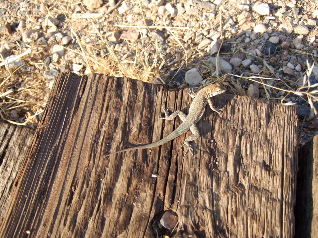
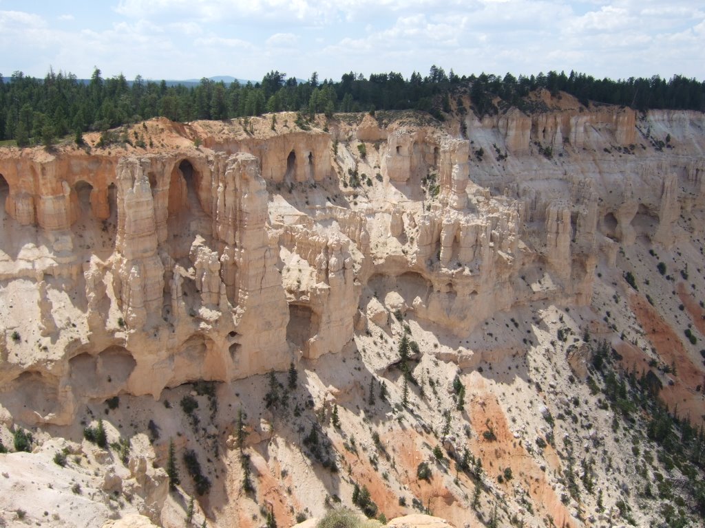
Then it was time for me to move on. I gave the man a wave, and pulled out into the KoA circle of traffic. It was time to get back on the road. I drove into Williams from there, and found another small city that had two one-way roads running through it. I think towns like that are strange. Anyway, I stopped, purchased the gasoline and ice, and continued on my way. As I passed out of town, I saw something off to the left that rather astounded me. It was perhaps the best cemetery I have ever seen. I don’t mean to get morbid or anything here, and don’t really think I will, but I just like to reassure people of my non-intentions, so here’s my description and reasoning: The cemetery was sort of built into a forest of cedars. I guess that’s a pretty accurate description. Anyway, the reason I liked it so much is that there seemed to be a really nice interplay between nature and our culture. The two seemed to go together (pun sort of intended) rather naturally. Other cemeteries seem overly dominated by maintenance and control. I really liked this one because it had the appearance of being a little wild. It struck a really good balance between nature and human caring. I guess other cemeteries always seem like there is someone who maintains things just for the paycheck, and you can’t really see evidence of people caring about their no-longer-living friends and/or relatives. I just liked it. As far as cemeteries go. I took some pictures of it, but none of them depicted it very accurately. Here is one anyway:

Shortly after I saw the cemetery, I was forced back onto the interstate. I drove around the interstate until I found the exit to Ashfork, which I drove through. Ashfork wasn’t particularly interesting, in my opinion, but it did have a historical marker that I stopped at, and while I was stopped there viewing it, everyone who drove by waved at me. I guess it was interesting, after all. I viewed the historical marker, but I don’t remember exactly what it was concerning at this point. I do know that there was something referring to the railroad (I think it was supposed to run through there, but something had happened so that it didn’t), and I also remember that there was a famous hotel that had been in the town until sometime in the last thirty years or so, when someone decided to tear it down, and a society that was started couldn’t raise enough money to prevent the destruction.

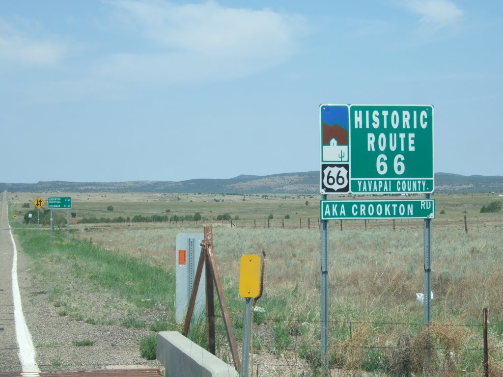
From there it was back to the freeway for me. That is, until I found the exit for Crookton Road. Then I saw what I have called the ‘Sign of Many Signs.’ See for yourself:

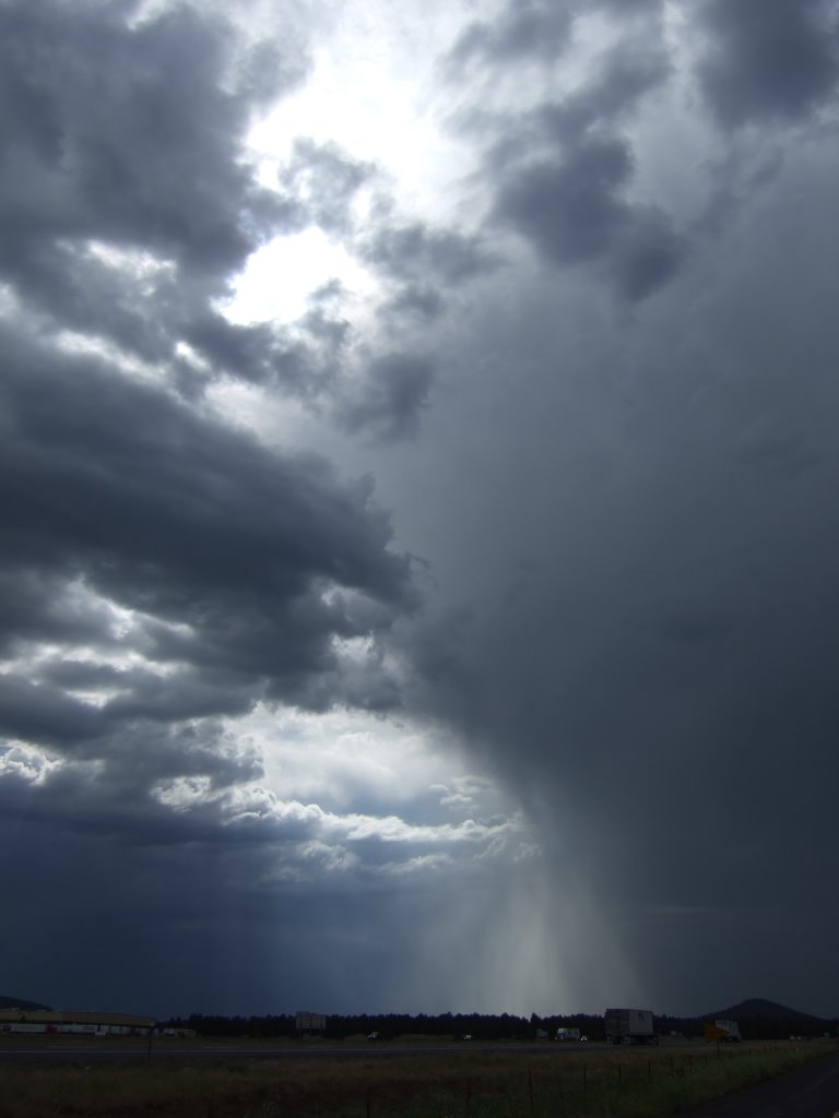
The next major city/town/group of buildings I was to pass through would be Seligman, AZ. Before I got there, however, I saw a sight:

Those, for the uninformed, are antelope. Real ones. Much as they may look like plastic lawn decorations, I have pictures of them in other positions and from different angles. Oh, they’re real, alright.

From there, I drove over some interesting bridges that had rather ominous signs just before them, which read “Ice Forms on Bridge First,” or something like that. After those, I entered the fantastical town of Seligman. Of all the towns I’d passed through from Illinois to Arizona, I felt that this town called ‘Seligman’ most embodied the original spirit of Route 66 (as interpreted by me). Part of this is due to the Drive-In Restaurant called the “Delgadillos Snow Cap,” which I highly recommend. It’s run by two brothers now, and they have quite the senses of humor. I’m not sure how many of you all will ever get the chance to go there, so I’m going to go ahead and spoil some of their jokes (that, and I’m sure they have far more than I saw there on that particular day).

I walked up to the counter, after having stood in the line for a few minutes, and said, “Can I get a double cheese burger?” To which the man behind the counter replied, “But, don’t you want me to get it for you?” Then I awkwardly responded, “Oh, well, yes.” The other joke I recall came about when I asked the difference between a shake and a malt. The man responded by putting out his hand in a gesture of greeting. We shook hands, and he said, “That’s a shake. A malt’s got flavor.”

After I placed my order, I went on outside and waited for the name he’d given me to be called. I was ‘Y,’ while the man ahead of me had been ‘Yellow,’ and the man ahead of him had been ‘Blue.’ When I went outside, I saw something amazing. A backyard full of cars. Old cars. Old, awesome cars. Beyond that, however, and besides the fact that several of the cars had eyes painted on their windshields (in a presumed effort to resemble the cars from “Cars”), was one car in particular. Some of you out there are car fans, I know, so I’ll describe it slowly, and using multiple sentence fragments. It was a Camaro. A 1969 Camaro. It was a 1969 Camaro Convertible. It was a Camaro RS SS. It was also white with orange racing stripes. Now, I know that my assessment may or may not be accurate, but I’m guessing from the above qualities that this Camaro was built as an Indy Pace Car. It probably didn’t actually pace anything, but it was one of those models. I was pretty impressed. Here’s the picture:

While I was there at the Snow Cap, I met some fellow Route 66 travelers. Three generations of Route 66 travelers, to be exact. They apparently had the same guide book as me, and had the same problems with the guide book as I have had. They had kind of a neat story, in that the father and son had somehow traveled from Southern California back to Kansas to pick up the Grandfather, and had begun the Old Road in Kansas, headed west. They told me that they had stayed in the Wigwams, which I believe were in Holbrook. The father had said that he’d been trying to get his dad to take him there for forty years. I thought it was really neat that they’d gone there. I wished them well, and departed. On my way out of town I saw a large ‘S’ on a hillside to the north. I like it when old towns have a letter on a hillside signifying the town’s name.

Nothing terribly interesting happened to me for a long while. I drove westward on the old Route 66 until Kingman, and then turned north. My plan was to make what I guessed to be about a 600 mile loop. When I turned north, I was on a highway that was very interstate-like, save the fact that the off-ramps were crossroads. I stopped at a historical marker because I was thirsty, so I got out, got a drink out of my cooler, and read the sign. It said something about a ghost town about five miles to the north and east. I thought to myself that since there appeared to be only one road going in that direction, that I would head on out there and observe the ghostiness of the town for myself. Well, I drove that five miles north and east, and I found a couple of really old looking buildings along the banks of a dry creek bed. Up the road a ways, the road came to an end in a modern day mineral extraction plant of some kind. Actually, I don’t even know if what I just said even makes any sense. So, I turned around, and headed back through the open range, dodged the cattle, and got back on the highway heading north, north to Nevada.

After the stop in Mineral Park, which I believe is what the ghost town’s name was supposed to be (wherever it is), nothing really happened until I was just short of the Arizona-Nevada border. There was a police checkpoint that nothing could get through. I was worried that they were going to stop me because I’m driving a pickup truck with a canopy and a sheet over everything in back—which seems to me that if anything were going to be suspicious, it would be something like that. They waved me through almost immediately, but stopped a couple on a motorcycle. The motorcycle was towing a tiny trailer, however.

Onward to Hoover Dam, and the crossing of the Colorado River! I saw a sign that said something about the Hoover Dam, so I stopped and took this picture:

It was just an overlook, but it was super hot there, and they had a visitor center. I spent a little over two dollars on a ‘Strawberries and Crème Fruit-cicle.’ It was extremely good. In that heat, I don’t even know that I’d say it was overpriced, it was so good.

Then I drove down to and across the dam, paid my seven dollars for parking, got out, and had a look around. I wasn’t terribly impressed. There was one thing (I didn’t know it at the time, however) that would have made it awesome, and I was fooled—it didn’t have it. 
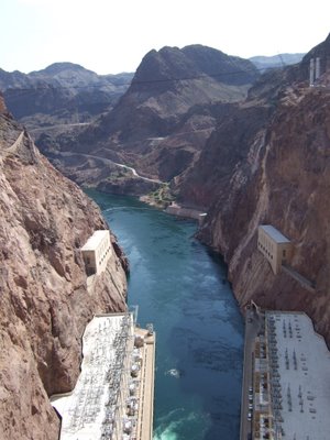
It was hard to get a good angle because the place is so massive and there are no good distance lookouts to get a shot from, but here’s what the river below looks like from atop the dam (I believe I was just about on the border at this point). Here’s a picture of the Dam face:

Now, what would have made the whole thing awesome is this: do you see in the picture the little towers that rise from the top of the dam face? Well, one of those was home to the men’s bathroom. I had passed by the restroom at some point earlier, and noticed that you needed to take stairs up to the actual facility. This piqued my curiosity, and I decided to explore. On my way back, I went inside and climbed the stairs. For whatever reason, I had gotten my mind set (and my hopes very high) on the idea that there would be urinals with windows above them that afforded the user to view the river while... taking care of business, so to speak. I thought that that would have been great. But I got up there, and there were no such windows. I wondered what the point of a bathroom in a tower was if there were to be no windows. I was disappointed, and made my escape. Before I left, however, I wanted to check out the tour situation. I went down the escalator, sort of joined a family group, didn’t get my picture taken before entering, and found that tours were 11 dollars. In my opinion, that was just too much, considering the fact that I’d just paid $7 to park. So, I made my way back up the escalator, and held up other people in the process. I was about a third of the way up when they got on, and by the time I was halfway up, they were already 2 steps behind me. I did my best to move to one side, but the escalator was pretty narrow, and beyond that, I really didn’t feel like walking up the stairs. I knew I had enough stairs ahead of me in the parking garage. Before I got to the parking garage, however, I decided to stop in at the gift shop. It always amazes me when I see toy guns and things like that in the gift shop for a national icon. When I went back outside, I saw the sculpture to be pictured shortly. I don’t remember what he was called, other than that the first word was ‘High,’ but I do recall that he had a jackhammer or drill, so I’ve taken to saying that it’s a picture of the “High Jacker.”

I went back to my truck, left the parking garage after having been asked for the third time if I could help out some people with a dead battery, and made my way deeper into Nevada. I had a desire to know more of the camping situation in Nevada, so I stopped at the nearby visitor center at about 5 in the afternoon. Not only had it closed at 4:30, however, but the bathrooms were locked. Visitor Centers and I don’t seem to have a good thing going. So, I left there, and stopped in Henderson to buy gas. While in the establishment of my choosing, I asked the clerk if he knew of any campgrounds in the area, to which he responded with a look of laughter and said, “Not around here.” Bear in mind, that at this point I was ten or so miles from Las Vegas. I knew that there was a campground about an hour north of Las Vegas, but I was hoping for something that wasn’t in the “Valley of Fire State Park.” I passed into and out of Las Vegas without incident, but once I was out, I called my brother-in-law for a bit of information. I asked him to look up the temperature in the greater LV area. It was strange, because I knew that I’d been in some exceptionally hot places, but this place, to the north of Las Vegas, was by far the hottest-feeling place. As many of you know, I don’t have the air conditioning, and have just been driving around with my window down. This practice was difficult to maintain in such heat, because when I have my window down, I have a tendency to put my left arm out of it. The heat actually stung my arm when it was outside. I didn’t care for it. When I heard back from my brother-in-law, he informed me that it was 105. Now, I don’t know what was going on there that made it feel so hot, because I know I have been to hotter places than that. But I still maintain, that that place felt the hottest.

I eventually got to the turn-off for the Valley of Fire, but decided that 18 miles was just too far to travel just to travel 18 more miles in the morning to get back to the interstate, and only to sleep in a place that already felt like it was the hottest place I’d ever been, and to head into a place called the Valley of Fire. There were just so many things about that scenario that I didn’t particularly care for, that I decided to continue on, and see what the northlands would bring.

Unfortunately they brought nothing in the way of camping, for a good long while. I had looked at my map, and decided that there was a place in Utah that seemed reasonably close. What I hadn’t noticed that there were about thirty miles of the interstate in Arizona. So it ended up taking me about an extra 45 minutes to get there, and when I eventually did, it was quite dark. But first, the Arizona: Most of the Arizona I-15 runs through the Virgin River Canyon (or something to that effect), and I must say, that was probably the most interesting/scariest run of interstate I’ve ever driven. It was all windy curves, with sharp inclines and declines, and the occasional strong wind. Also, there was no room to pull off the road, nearly all of it was elevated, and there were canyon walls rising sharply on either side.

I saw a sign for a campground, and went to check it out. It seemed alright, except for the fact that the campground area was closed. I thought that they could have posted that on the sign out on the freeway.

Returning to the interstate, I continued northward, heading for the campground in Utah that I’d seen on my map. Upon entering Utah, the landscape changed dramatically. It was quite amazing to see. I exited the canyon, and suddenly was probably closer to cliffs that were larger than I’d seen before. Some looked like part of the mountain had just been shorn off, and others looked like gigantic mesas. This picture doesn’t exactly show the sights I’ve just described, but that’s not what it was meant to depict. It’s a sunset picture.

Soon it got quite dark, and I found the exit that I thought I needed to take. I took it, drove around a bit, and found the state park I was looking for. It took me a while to actually locate the campground however, because the signs didn’t mark anything very well, and the park was probably a couple miles long on the shores of a dammed river. When I eventually found the campground, I realized why I’d missed it for so long, and the reason was the fact that there was no one else there. It was in a wide open spot with very few small trees, and only one other group of campers who were down a hill and behind a building. I was a little frustrated at the debacle, but I made the best of it, watched the lightning storm to the south and east, called the parents, and went to sleep. It was still a little hot there, but I was able to withstand it. I don’t know if it was only a three state day, or if it can be considered four states. Arizona-Nevada-Arizona-Utah. I just don’t know.

Friday, August 04, 2006

Tuesday the 25th of July, 2006

I awoke at 7 in the morning on Tuesday the 25th of July. It was in a Super 8 in Holbrook, AZ. After awakening, I showered, laundered, and consumed. Whilst I was in the lobby of the Super 8, I looked around at all the award they had on the wall. It was a small award, just generally talking about what a great establishment the Super 8 of Holbrook, AZ happened to be. The thing that stuck out in my mind, however, was the fact that it was signed by presumed dignitaries, for example, there was a name, and underneath was the word ‘President,’ and I wondered to myself, ‘president of what?’ I hadn’t noticed any organization that the ‘undersigned’ was attached to. Interesting, interesting. After finishing up with the breaking of the fast and the observing of signage, I headed back for purposes of bloggery and laundry retrieval. Unfortunately, the Super 8’s internet crapped out, and I could not upload any pictures. So, I packed up and headed out. After checking out and forgetting to ask where I could get my truck’s oil changed, I went in search of a place to get my truck’s oil changed. It took a little while to accomplish this feat, but accomplish it I did. Then someone changed my truck’s oil. It was probably my best oil changing experience, now that I think about it. It was the lowest price I’ve yet paid, and the people were very friendly and didn’t try and tell me anything else was wrong with my truck. It was pretty good. Then I got out of there, and headed for the interstate. I got on the interstate, and immediately saw signs for the historic route 66. I got off the freeway, followed the signs, including one that said “No stopping any time, inmates at work,” and ended up heading eastward along the road that I’d come into town on the previous night. I was ok with it though, it afforded me the opportunity to take some pictures I hadn’t gotten to in the darkness. So, here’s a picture of the Pow Wow Trading Post (or at least the sign for it): Then, I got myself turned around, got back out on the interstate, and took the next-next exit that had a sign for the historic route 66. At this point, it’s been a couple of weeks since I passed though there, so I’m not sure of the exact order (my notes have failed me), but I passed the Jack Rabbit Trading Post (which is apparently pretty famous) and got a picture of a roadside sign: Either before or after that, I had passed through Winslow, Arizona. I may have even stood on a corner. The thing that sticks out in my mind about Winslow, however, is the man who questioned me at a ‘rest stop.’ He was a very persistent, if toothless, man who was incredibly hard to understand. The man was there with someone else, and they both looked quite homeless. During the conversation (if such it can be called), I was able to understand that he was on his way back to Albuquerque, that he was stuck in Winslow (out of gas), and that a couple of dollars would help. I remember that the only other vehicle at the rest stop was a pretty nice looking mid-nineties Chevrolet pickup truck. I also remember him sticking out his hand, and him saying in some form of broken English the word ‘Albuquerque’ about ten times. Much as I tried to tell him that I had just enough to get where I was going, he would not leave me alone. I just kind of held up my hands helplessly and made my way back to my truck. It started just as he turned and started back my way for some unknown reason, and I drove off, deeper into the center of Winslow, AZ. After leaving Winslow, I headed for Meteor Crater, which is apparently one of the most well-preserved Meteor Craters on the planet. It wasn’t a national park or anything, and I think I had to pay 15 dollars to get in, but it was pretty interesting. I didn’t like the labyrinthine layout of the visitor center, however. You see, upon walking in, I was directed toward the theater so that I could watch the movie about the crater’s discoverers and the implications the crater has on the bigger picture. Immediately following the short film, I came back out of the theater and tried to find the crater. I saw a sign that pointed to the gift shop, and another that pointed in the opposite direction and was labeled ‘crater.’ I went that way. It was a bunch of scientific stuff which asked you, the tourist, to do all sorts of thinking puzzles and reading. One mini-exhibit had me putting things in order by weight: I don’t remember what the lightest thing was, but there was also a picture of a horse, a replica of a space rock about the size of a cooler, and a picture of a Volkswagen beetle. The space rock was actually about 1,400 pounds, I believe. I wandered around a bit more, found a place where families can stand in front of a picture of the crater floor, thought it was silly, and continued wandering. There were all sorts of mini-exhibits on the end of the dinosaurs and whether or not ‘we’re next.’ Finally, I rounded a corner, and there it was, the exit to the viewing area of the crater. Man, what a sight that was. I went outside and saw the crater, and it was pretty huge. Bear in mind that your average camera of today (digital or 35mm) has a pretty wide viewing area. With that in mind, my camera could only record about half the crater in one photograph. This picture may give you an idea of the immensity of the large dent in the ground: Here’s another example of how big it is (notice that you can’t see any of the lateral edges in this picture): If you look closely (I don’t think you can actually look closely enough) at the area in the lower right corner, you’ll see a couple of white patches. Those are the approximate center of the crater floor. Also, there is a decently sized fence around those white patches, and there is a 6 foot tall astronaut cut-out on one of the fences—it’s supposed to be a scale reference—and a flag the size of the one the first astronauts on the moon planted there. This crater’s pretty big. On my way out, I had to pass back through the visitor center, and as I did so, the storm clouds were gathering to the west. Then came the lightning. Oh, the lightning. I’d been virtually surrounded by it for days, and here it was again (or still, for that matter). I could see it approaching, I felt like I could gauge how fast it was going to get there. I was thinking about how I’d left the windows open a little on my truck because it was so hot. I was thinking about how, one way or another, I was going to be in the middle of that storm. So, I decided to head out into it. Once under way, I stopped alongside the road to watch the storm for a few minutes before proceeding into it. As is my habit now, I grabbed my digital camera. I took a couple of shots as the lightning struck, but nothing was appropriately timed. Suddenly, and without warning, I finally got the shot I’d been after for weeks. Maybe it was just luck, but maybe it wasn’t. In any event, I, with the aid of my camera, captured the image of a bolt of lightning, from start to finish, in digital format. Here it is:I drove on, toward the lightning storm. I never actually got there, though. I kind of split the storm, so to speak. By the time I got to where the storm had been, it had gone north and south. An example of the asexual reproductive capacity of storms. Or maybe I’m wrong, maybe it was some sort of optical illusion, and there was no storm directly in front of me to begin with. On that path I continued, and passed through the thoroughly unimpressive Flagstaff. My guidebook said that I would soon be passing through a town on the south side or the freeway, and I was very much looking forward to it. The town sounded pretty neat. It was called Bellemont, and the book even said to drive quietly through the town, so as not to disturb the locals. Well, I got on what must have been the proper road, and promptly found no such town. I drove that road until the pavement became rough pavement, which soon went away entirely and became an extremely uneven dirt road that ended abruptly in a gravel pit. Sure, I hadn’t seen what I wanted to, but a gravel pit’s alright, too. I never did find the town, and turned back. I took the road on the north side of the freeway, and passed through and by some neat stuff. But before I saw the neat stuff, I saw a hole in the clouds: Then, I entered the Kaibab National Forest, I passed a Deer Farm (and petting zoo!), and passed by an extremely colorful field between the road I was on and the nearby interstate: Shortly thereafter, I stumbled upon an original section of Route 66, and couldn’t resist two things: taking pictures of it, and taking a loose pebble of the Old Road. Here’s one of the pictures: Very, very soon after that, I found a KoA, and stopped for the night. The assigned me a bit of an awkward spot because it was on a hill that sloped in a weird direction. I made do, and used the internet for a long time, which drew the attention of many people nearby. Including a large family reunion that was East, West, and South of my camping space. I also saw this guy: That’s right, he took his massive RV out into the wilds of Williams, AZ, so that he could watch television. I thought it both confusing and noteworthy. Once the bugs set in at me, I closed up shop, climbed in my truck, and went to sleep. Plus, the internet was not allowing me to upload pictures. This seems to be a recurring theme. Then I went to sleep. Aside: Oh, I had gone to check out the family movie that the KoA was going to be showing at 6, and found that Angels in the Outfield was about one third over at 5:45. I was a combination of confused and disinterested.