Wednesday, September 06, 2006

Day the Last

The following morning, I awoke, peeked through my curtains, and found that many more people had arrived during the night. I found that highly odd, considering I had arrived at about 9:30, and stayed awake until sometime between eleven and midnight, and there had been no audible sign of any one else’s arrival. Anyway, I got my things in order, and drove away from that campground. I was none too fond of it.

After regaining the real road, I traveled for some time before coming to what I believe was a town called South Bend. I decided that it was time to buy some gasoline for my poor little truck. After that decision was reached, I stopped at some nondescript gas station, inquired within as to whether or not they accepted traveler’s checks, and then attempted to pay with credit card. This took me quite a while, because I kept on sliding the card in the wrong way without realizing it. It was incredibly frustrating. I finally figured out what I was doing wrong, fixed it, and bought the gasoline. Then I got back on the road and headed toward the rain forest.

Not knowing where a rain forest (the rain forest?) was to be found on the peninsula, I didn’t want to take any chances, so I closely inspected each road sign for clues as I passed slowly by them. At some point, I decided to go down a road to some national forest lands, thinking that it might just be an unmarked rain forest—which I kind of think that it was, but cannot tell for sure. So, I went down this forest road, drove for a long time, found other roads and driveways and even a small town, but nothing rain foresty. So, I decided to go down one of the roads. I made my turn, went about a hundred yards, and found a no trespassing sign. After that, I turned to go back to the 101, but decided to try again on the way back. There was another road that I’d had thoughts of driving, so I took my chances, and made that right turn. Again, after about a hundred yards, I saw something I did not expect. The road came to a T. I took the right turn, and the road suddenly became something that only bulldozers are meant to travel down. For some time, I found this road quite an enjoyably bumpy ride. I felt as thought I were getting some of the off-roading out of my system. There were some twists and some turns that were more than unexpected, but what really caught me off guard was the point at which the road abruptly ended. If it was anything, I’d have to say the road was not a two lane, nor a one lane, but a 7/8 or 3/4 lane road. There were gnarly stumps and the jagged ends of trees protruding impolitely into my driving space, and were avoided as needed, but when it came time to turn around in that space, that’s when the challenge of the situation really set in. There’s such a thing as a three point turn, and what I had to do was somewhat related, but in the double digits, I’m fairly certain. Anyway, I made my turn, was dissatisfied at not having seen anything but regular forest, and made my way back out to the forest road.

On my way back out of the forest I remembered I’d passed by a park on my way in. So I decided to keep watch for it and stop when I passed it again. After I passed it again, I stopped, turned around, and went back to it. It was there that I saw my first hints of rain forest. From what I’m told, the Olympic rain forest has a lot of moss, and that’s really the big (at least visible) difference between it and most other kinds of traditional Olympic forests. Here’s a picture of some moss on a tree:

I wandered around the park for a while, including crossing a stream by way of wet rocks, then crossing back by the same method but different wet rocks, then got in my truck and headed back to the coast highway.

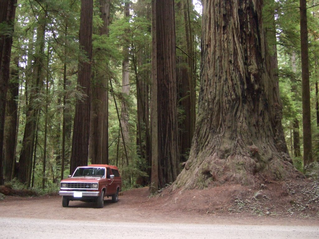
Once there and after a few miles, I saw a sign that said something to the affect of “Giant Cedar,” and a number of miles to go before making a right turn. This, I didn’t think, could be simply passed by. This, I thought, required further investigation. So, after however many miles, I made that right turn, and drove up a nice little road to a parking lot and thought to myself, ‘I sure hope this isn’t going to require some giant hike,’ and it sure didn’t. There was a path from the parking lot (clearing) to the tree that was probably less than fifty yards. And there to greet me, was the biggest cedar tree I’ve ever seen. Have a look:

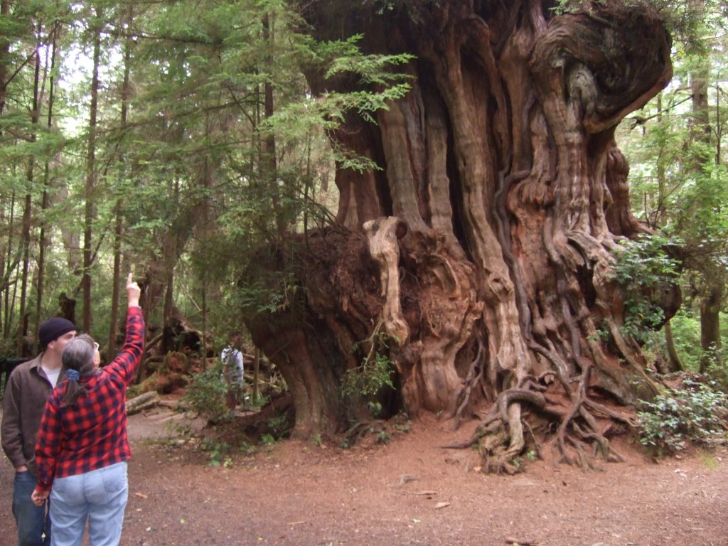
It looked like something from a fairy tale or something. Or maybe from The Lord of the Rings, yeah, more Lord of the Rings. It reminds me of the tree that tries to capture the hobbits. Anyway, it’s all gnarly and bendy and whatnot (oh, and huge). Here’s a closer look:

The only thing about it that sort of takes away from its authenticity, I guess, is that it looked more like it was four or five trees that all grew together. I can’t really discount its hugeness just because of that, however. Here’s another picture:

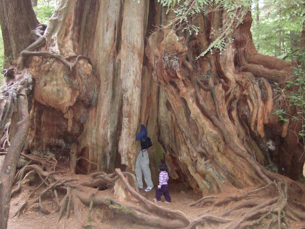
You know, after I took that picture and downloaded it, I really wished I’d maneuvered myself a little better, to a position where only the little girl was showing, and none of her dad. That way, I could have made some kind of comment about the scale of the full grown adult to the tree. Alas, that joke cannot now be made. Alas, and alack.

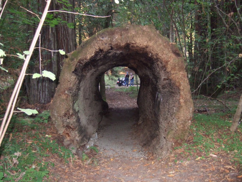
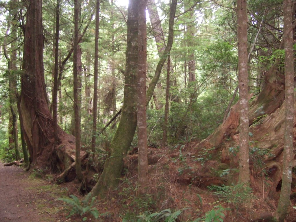
Here’s another interesting tree that was right nearby. There was one that had fallen down many long years ago (presumably), and another tree growing vertically. However, it looks as though there is only one tree there that has a sort of ‘L’ shape to it.

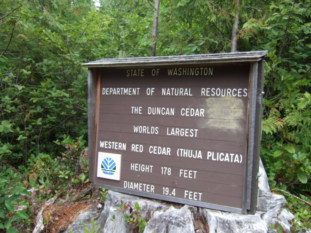
A ways further north on the Pacific Coast Highway was another sign saying vaguely the same thing about a giant cedar in so many miles on the right. I thought to myself that the other one was so awesome that there was no way I could pass up a second one. After the first one, however, the second was a little disappointing. Here it is:

It is only one tree, it looks kind of dead, but still has leaves so apparently is not, and I could get far enough away from it to get the whole tree in frame. And here is a picture of the sign commemorating the tree’s bigness:

After a while, I found the entrance to the Hoh Rain Forest. I got all excited, and drove down the road to the rain forest. After another long while, I officially entered the Hoh Rain Forest, and nothing looked any different from the twenty some mile drive from the highway to the entrance check point. The road in was the same as the road out, which is to say that you drive in, you turn around, then you drive back out. There is no cutting through to the other side of the peninsula or anything. From where I was, it was still a pretty good sized drive to the end of the road, so I decided to stop and examine the rain forest for rain forestyness. There was a lot of moss. And a river. Here is a picture of a branch in the river:

And here is an example of how mossy things can get in the rain forest:
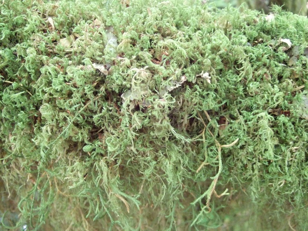
Further mossyness:

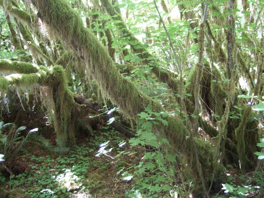
An extreme mossy close-up:

After that, I decided that the end of the road was not worth going to, so I turned around, and headed back out. Unfortunately, I was kind of unimpressed by the rain forest. I’m not entirely certain what I was expecting, but it wasn’t simply moss. Oh well.

Back on the 101, I rounded the peninsula, began the trek eastward on 101 (which kind of weirded me out, that there was an odd numbered highway going east-west). I procured further gasoline in Port Angeles, and continued on my merry way.

I passed by some things with surprisingly odd names, like the John Wayne Marina:

And various others.

After that, the endingness of the trip really began to set in. I realized that the water I was seeing at that time was the Puget Sound. The water I’d looked at basically all my life. Things stopped feeling new and different. The moment that that feeling of the trip being over really hit home was shortly after 101 became a freeway. I saw this sign:

So, I got on the northbound side of things and drove the road I’d driven many, many times before. After that, pretty much everything felt ordinary. I thought it was a thoroughly bad way to end something of the magnitude that this trip had been for me.

When I got into Seattle, I decided to surprise a couple of my friends. The first wasn’t home. Then, I proceeded to the second, for whom I’d procured many, many cans of Barq’s Red Crème Soda. I felt it was a good time to make a surprise delivery. In fact, a few hours earlier, I’d taken a couple cans out and put them in the cooler to be enjoyed upon delivery. It was pretty good. We sat on my truck’s tailgate and did a bit of catching up. A little while later it was time to go home.

I’ve made the drive from Seattle home a ridiculous number of times, so everything felt incredibly ordinary by that point. Nothing felt strange, or momentous when I rolled up into my yard, only that my parking spot had been taken over by a different vehicle.

In no way did it feel like I’d been to 17 or so states, traveled about 8,000 miles, been gone for nearly two months. It was very strange to me how nothing felt different.

The next day, I felt that it was in some way required of me to go back to the beach that I’d gone to immediately upon leaving. Here’s a picture from that brief excursion, which I don’t officially consider to be a part of the trip, but for personal reasons feel needed to happen.

It’s a bird. A bird on a sign.

(south of) Florence, OR to (south of) South Bend, WA (9/21/06): The Penultimate Day

Ah ha! The next morning, the very next morning, I woke up! It was the day that was Monday, the 21th of August, this year of 2000 and 6. I was in Honemyan S.P., OR, and it was a good day. I took a shower, brushed my teeth, and ate my breakfast (though most likely not in that order), before heading out of the campground. As I was passing through and out of the campground, I decided to take a photograph of the sand-hill that I’d climbed the night before, and, as it happened, the sand-hill that so many sandboarders had sandboarded down the night before, and, I would guess, many other nights. Here it is:

I drove into Florence, stopped for gas at a Safeway, and saved big with their club card program! Seriously, I think I saved five cents per gallon, for a grand total of 50 cents or so, on the 30 or so dollars I spent! Big savings! Please pardon the profuse sarcasm, I’m not entirely certain what’s come over me.

I trekked onward (after going into the Safeway proper, and buying various juices and chicken parts). Which reminds me, it turns out that I didn’t actually eat breakfast at the campground, so if you could just politely disregard the part that you will already have read by the time you will have gotten to this point, and know to what I knowingly now refer, that would just be peachy. Thanks again!

After Safeway, I drove northward, and stopped at an overlook. I thought I’d have more time at the dunes, but it was not to be. Other than the darkness, this is basically the closest I got to them:

From that same general area, I took this photo. I had to check both directions of traffic and then scurry across the road to get it, but I thought it was worthwhile just because of how absurd and out of place it seemed.

There must be a bus stop right there or something, because it seems like the sign is stating the insanely obvious, especially when considering the extremely sharp curve just past the sign. Oh well, I felt it was worth documentation, so documented is has been.

Upon my sister’s advice, I ventured forth to the Sea Lion Cave. She seemed quite taken with it, but I wonder now if that isn’t because of her two small children and the wonder in their eyes at the sight of all those sea lions. She told me that it was the world’s tallest sea cave, and I’m inclined to believe it, but that’s all I can do. I didn’t actually get to see it, because that’s where all the sea lions were hanging out and it was totally off limits to the human kind. There was an opening in the cave, a chain-link fence, and a smaller portion of the cave into which humans were allowed. I wasn’t exactly satisfied with the interior confines of the cave. There was a vantage point on one end of the public area which used to be the entrance, and there were several (nay, many) sea lions hanging out below. There was a similar scene a couple hundred yards to the south, and I may have my pictures mixed up, but here is one of the pictures:

This is what I could see of the cave and the sea lions. Apparently the cave is many stories tall directly above the sea lions. I couldn’t tell.

This is a picture of the staircase to the left of the elevator within the confines of the cave. It leads to the first overlook (former entrance) referred to earlier. I got my order mixed up, and this is a picture from the overlook. The black specks are birds. Weird, huh?

On my way out of the Sea Lion Cave tourist complex and just before I got to my truck, there was a couple who were curiously conversing concerning the cost of the cave. I hollered back to them that it was eight dollars per person. They continued on for a moment, then came back and asked me if it was worth it. I told them that it was a unique experience, and that people have different opinions on things like this (for example, my sister apparently very much like it, whereas I, for the most part, did not care much one way or the other). They saw my ruse of trying politely to not say that no, it’s not worth it. They said they were going to save their money and head for some underwater aquarium in Newport. Which brings me to my next photograph, the bridge into (from the south) Newport:

There was no place to get a good angle on it, so I ended up driving through the tourist-filled town, and into a marina. I tried to frame the main span of the bridge between masts, but I’m not super-psyched about how the picture came out. Oh, well. I continued on my way.

A ways north of there I stopped at a scenic overlook, here is a picture of this place which looks over scenery:

Not much occurred between then and my next stop, which was to be exceptionally cheesy. It may be the place with the highest cheese density of any place I have ever been. It was (dramatic pause) the Tillamook Cheese Factory. See for yourself:

And the zoo aspect:

I really hope that the workers can’t see out of that room. Something about the eye contact that a couple of them kept making with me tells me that’s not the case, however. I just have to think of myself, and I’m fairly certain that I would find a continuously publicly observed work environment to be nothing more than barely tolerable. Now, a casual observation is one thing, and that’s not what I’m talking about here. I’m talking about the public coming into these rooms just to look through the windows and down onto the factory workers. It would bother me. As if I were an exhibit in a zoo, hence the ‘zoo aspect,’ comment.

I had fun at the cheese factory. Well, as much fun as can be had by a roving tourist at a stationary cheese factory, anyway. I bought a two-scoop ice cream cone. The flavors were mountain blackberry and Tillamook mudslide. It was very good, and it took someone casually commenting to one of their friends about how large it was for me to realize that the comment was very much true. I just hadn’t thought about it. On the downstairs side of things, I randomly got into a line, and decided to sample all their kinds of sampleable cheese. It was a very interesting experience, my only regret is that I went so fast through all the cheeses. I think there were five kinds, one of which wasn’t so good, but it soured all the other ones when they were all in my mouth at the same time. Also, the cheese market in the factory has a whole lot of cheese. But, I somehow don’t suppose that’s much of a surprise.

From there, it wasn’t a terribly far drive to Astoria, where I saw a giant bridge over the wide part of the Columbia. Here is a picture of a part of that bridge, which is neatly framed in a road sign-posting-setup.

I stopped at a hotel that was under construction to take some more pictures of the bridge, but none of them turned out very well. Then, I got back on the road and found myself crossing the river on that very bridge. Also, I found myself back in the Evergreen State for the first time in almost seven weeks.

There was a state park near Ilwaco that I went to. It was full of campers, however, so I just decided to explore it a bit. I thought I could find the plaque designating the end of the Lewis and Clark expedition, but found no such thing. Instead, I walked really far out on a man made jetty (is that redundant? I’m not sure), and came back. Then, when I had trouble getting out of the state park, I found what looked like a headstone but turned out to actually be but a marker, marking a trailhead. It was for a trail that led to a house or hut or something that had been constructed in approximately the same location as the one that some the members of the Corps of Discovery had built and stayed in. I thought this was very similar to the fort that I’d stopped at in Illinois, but couldn’t stop and walk the trail because it was almost dark. The picture I took of the marker will verify:

After I found my way out, I drove on, into the night. Then I stopped. I stopped and took a picture. A picture of what is probably my favorite road sign. It’s the tsunami hazard zone sign.

I just look at that sign and think, ‘That little guy looks so frantic it’s comical! Plus, there’s no way he’s getting away from that wave.’

Post awesome picture, I found myself at a loss. I had to find a place to sleep, and I was getting to the point that I needed gas, as well. Fortunately, and after about an hour and a half of further driving, I happened upon the creepiest campground I’d yet stayed at. There were no lights, it was totally dark, and there was only one person there besides me. I was a little nervous, but nothing else had presented itself, plus it was in the tiniest of small towns that actually had a campground that I’d come across in some time. So, I found a parking spot, or made my own—I’m still not quite sure, took the money to the pay box, and avoided the other camper. Then, I climbed back into my truck, took off my shoes, and climbed through the back window to sleep in the back of my truck for the last time on my journey.

(north of) Eureka, CA to (south of) Florence, OR (8/20/06)

It was Sunday the 20th of August, and I woke up in the cab of my truck at a rest stop north of Eureka, Ca. This was not a pleasant experience. I was able to adapt to the confines a little better, this being the second night in a row I’d had to endure such limited accommodations, and was able to sleep most of the night through. Which is not to say that I was comfortable, and is also not to say that I very much welcomed waking up at 6:30 in the morning at an over-crowded rest area approximately (and this is a really rough guess) seven or eight hundred miles from home.

All of that aside, the morning was quite beautiful. There were dewey spider-webs in obscure corners of the rest area building, giant redwoods everywhere, and I was surrounded by people sleeping in their cars. I would say that, all things considered, I got out of there fairly quickly (and with special care, fairly quietly), and got back on the road. Here’s what the morning looked like, once the freeway reverted back to highway:

During the course of my travels I met some interesting characters, some colorful, some boring; some large, some small; and some who seemed to be the stuff of myth and legend:

I’m pretty sure that, behind the beard, that man’s always got a smile.

At some point I turned inland on what I believe was the 199. I felt that I should see Crater Lake while I was in the neighborhood, and thusly, I chose a path that would get me there without a lot of silly back-tracking. Taking my time is one thing, but the idea of driving up the coast, then driving straight inland for several hours, then looking at what may very well be the world’s largest puddle, then driving several hours back down the road I’d just traveled for several hours just didn’t seem to appeal to me. So I cut out some of the 101, and headed inland just before the Oregon border (basically... I’m hoping to be granted some leniency in my estimations, because after driving several thousand miles, even as many as 100 seems like ‘almost there,’ or, ‘just this side of the border’). Along the way on this new and different road, I saw a side road sign that said a certain side road would soon be near. I decided the side road sign was a sight for sore eyes, and definitely deserved some serious delving. That is to say, I took a left, drove through a tree-line lane, drove around on a sandy and gravelly river bank, and then investigated the forest. Let’s just say the trees are pretty big. Well, the tunnel-tree was sort of alone, and the avenue of the giants was pretty staggering, but none of that really compared to the trees I was surrounded by at that point. Here’s a picture with some scale to it:

Yes, that’s my real truck. It is not a toy, nor is it a model. The tree’s trunk is several times the width of my truck. Awe-inspiring.

When I met up with my friend Matthew, he said that I should be taking more action shots of myself. At first, I didn’t really take to this, because it would most likely mean having other people take a picture of me with my own camera, and I felt like I kind of had a theme going, being the only person to take the pictures (save that one woman in... Elkton, OK). This was the day that I came up with a brilliant solution. The camera had a 10 second delay that I had yet to officially exploit. Its day had dawned.

Although, this picture I thought was funnier than it was meaningful. It was basically my first attempt at such a feat, and didn’t turn out super. I placed my camera on the roof of my truck (orientation is the same as in the above picture of the truck next to the tree), hit the button, and then ran up the tree. I ran too far. I tried to turn for the picture, you know, to give it some scale and pizzazz at the same time, but it didn’t really work out so great. Enjoy. Also, there’s this one:

There’s a certain similarity between this one and the last one, and that is that I used the timer again. However, because of the instant gratification by digital means, I was able to discern the problematic aspects of the previous photograph, and attempt corrections. What I attempted, was a wholly different type of photograph. This time I set the camera on the back of my truck, set the time, and ran for the trees behind my truck. When you look at the picture, you can see that I am a tiny, tiny person when compared to the giganticosity of these super-huge trees. Also, you may want to know that I wasn’t even really close to the tree directly behind me in the picture. After running for several seconds, I turned and saw that the picture was about to be taken, so I repositioned myself as well as I could. At that point, I would say that I was about 20 feet to the camera side of the tree that’s directly behind me in the photograph.

I tried other things to suggest the scale of the trees, but unfortunately most of it has more to do with width and girth than actual height. The reason for this being that there was actually no way I could fit a whole tree in a single photograph. I didn’t have an angle wide enough. The following photograph is the one that I thought best represents the scale of these trees, height-wise.

After I took that photograph, I headed back for the main road, and into Oregon. Unfortunately, the redwoods didn’t last long after that, and I didn’t do much stopping until I got to where I was going. However, I did stop at a bridge, and then I stopped at a gas station, and almost started pumping my own gas, but quickly remembered just where I was: Oregon: land of the ‘full-service.’ Then I had oodles of trouble getting my traveler’s cheque accepted at the... whatever kind of station it was in whatever city it was. Now I have to check.It was the Shady Cove Chevron, and I bought 30.01 dollars worth of gas at 3.099 dollars per gallon, which got me 9.684 gallons worth of gas. Now then, don’t question my meticulous records again! Also, I wondered why the Oregonian gas attendants were so bad at getting an even dollar amount. Granted, I only stopped at two gas stations while there, but both times it went to X number of dollars... and one cent. It makes me wonder, because I always just go to the nearest nickel (I used to go to the nearest quarter, until I realized that my truck’s gas tank can overfill on a dime (literally). Anyway, I’ve failed at that... maybe once in all my gas-buying career, and it’s these peoples’ jobs to do that day in and day out. With so much practice, shouldn’t they be better at it? Or did I just get the two worst that Oregon had to offer? The other one was at the Safeway in Florence, but that happens tomorrow. Maybe I’ll say more then, maybe I won’t.

I drove on! Here’s Crater Lake:

And here is a forest Fire that was happening down the mountain (well, the smoke from it, anyway):

Apparently, there should be no fish in Crater Lake, according to nature, but man had better ideas. You see, it has no underwater canals, no access to outside water, and is fed only by precipitation and snow-melt. And, seeing as fish don’t generally fall out of the sky of their own accord shouldn’t have any fish in it. As I said, however, the humans knew better, and stocked it chock full of fish. From what I heard, few remain. Here’s a picture of the one boat that goes out on the lake (it launches from the one point available to tourists at water level):

And then there was driving. Very much a lot of driving. From Crater Lake down to just about 6 miles south of Florence, OR, on I don’t remember exactly what roads, but the one that comes down from Crater Lake on the north and west side, then 138, then I-5 (which is still 138, at that point), and then 138 to 38 to 101. I think I stayed at Honeyman State Park, but I’m not there yet (literally). You know, reader, that at first I thought of that ‘literally’ joke, then decided it was too awful to put into print, then changed my decision, because that’s my style. I’m the one who says and writes the jokes that are so obviously tasteless and baseless (but not for any sort of crude reasons) that they necessitate no exposure. And if it’s just too far out there, you’re going to have to have someone else explain it to you, because that’s the way I’ve decided.

Somewhere on the road to the east of 101 that connected to it, I stopped at an Elk viewing area. I had seen all sorts of animals that had had signs up for their respective crossing areas, and I had seen each kind (except moose), and in many cases I saw more than I’d bargained for—as with the bison and the bear. There had been so very many signs saying that I ought to watch for elk, and so few elk (none), that I’d just about given up hope for seeing them on the trip. Then, and this was amazing, there happened to be an elk viewing area. There were signs up, telling about how elk act in different seasons and months and whatnot, and it said that at the time I was to be looking at them, that the cows and the bulls were keeping to themselves. I looked out over the fields before me and saw probably the second largest heard of elk I’ve ever seen. There were probably fifty. So, I took out both cameras and starting shooting. I swapped out lenses on my SLR, and went for the super zoom of 300mm, and noticed something peculiar. Way in the distance, and contrary to the informational signs, was a bull in the middle of the heard of cows. I don’t have any idea what was going on with that, because... on my way out of the parking lot I was a little saddened at not having seen a heard of equal or greater size of bulls-although, the signs had said the bulls do hang out together, they don’t usually unite in such numbers. After getting in my truck, and heading for the exit, I noticed another group of cars. They were down a little bit of a side road, away from the main parking lot. Being the naturally curious person that I am, I decided to venture forth. Disappointment was not waiting for me there. There was a heard of bulls! Their numbers were smaller, but their headgear much more impressive. Unfortunately, my digital camera doesn’t have the super zoom my SLR can sport, nor the super resolution of some other cameras on the market, but I think this picture gets the point across:

After that, I headed out to the coast, and up it. I needed a place to stay, and fairly soon. For you see, I didn’t want to put gas in the gas tank again that day. So, I started looking for camp grounds. I passed by some with unappealing names, and then on to ones with more appealing names. There was a campground just outside of Dune City (which, honestly, was more like Dune Town, or Duneton), so I stopped to investigate. That campground had none of the three amenities I was looking for. If it had had two of the three, or probably even one of the three, I would have stayed. Nothing. The hosts were from Washington though, and we talked for about five minutes about that, and then I drove off into the dusklight of the Oregon coast. I arrived at what I believe was Honeyman S.P. a very short while later, snapped up what remained of their spaces, was glad to have access to showers and power outlets, and decided to explore. I walked for a really long time toward the sounds of the sea. My progress wasn’t as fast as I was used to; as I said, I walked for a really long time, but it was through (up and over) sand dunes. The going is very slow, and I’d never really thought about the ramifications of walking in that kind of sand. While walking, I decided to call one of my friends, to see if he knew the whereabouts of a mutual friend from high school. She has a very distinct laugh, and I was certain I’d heard something very similar to, if not actually, it. He didn’t know, and we eventually discontinued our telephone call.

Somehow, I’d gotten it in my head that I wanted to walk to the water. This was folly. I got to the top of the near dune, could see in the distance another dune, and beyond that was what appeared to be a forest. This confused me greatly, and as a matter of fact, still does. It is extremely accurate to now say that I did not walk to the ocean. I decided to head back to my truck, do some writing and some downloading of pictures, and then some sleeping. That was the plan, and that’s actually very close to what happened. The only thing I really have to add, is that as I was coming down the first hill I’d climbed, I gave some of the up-climbers the tip I’d only too lately come up with: that stepping in the divots of footprints prior can lessen the backslide. I got to the bottom of that hill, and noticed that the people I’d given the tip to were in fact sandboarding. I’m still not sure what I think of that. By the time I reached the bottom of that hill, it was completely dark except for the lights of the many campers. It took me quite some time to get back to my truck, but all was well that ended well, and that night ended well. It was a very nice campground, and I’d consider going back there some day.

San Mateo, CA to (north of) Eureka, CA (8/19/06)

Saturday the nineteenth of August, 2006, I awoke at a rest area west of San Mateo, California, at around 5:30 or 6 in the a.m. It was far too early to be up, but I didn’t have much choice: that was when I awoke, and I tell you, there was no going back. So, I went and brushed my teeth, came back to my truck, and got on the traffic-less freeway heading into San Francisco. It was very foggy.

I rolled into San Francisco sometime later (approximately 6:30 in the a.m. as I’ve come to realize from looking at the photograph information), and was greeted by much fog. I did see a road sign that made it seem as though the road it was designating shared a name with my nephew, so that was neat.

I got into San Francisco proper, and didn’t really know what to do with myself. After all, I was naught but an ignorant tourist in a giant city at 6:30 on a Saturday morning toward the end of summer. So, I did what I had little choice but to do (and manage to keep the major themes of my epic journey intact): I drove around. Boy howdy, did I ever drive around that city. Here’s a picture of... well, I don’t remember at all what road it is, but you can tell it’s quite hilly, and you can also tell that my truck was there, so it’s a picture somehow involving my truck on a hilly road in San Francisco.

I did a lot of driving around. I figured there were some famous streets that I drove around on, but being as I didn’t know for what reasons those roads I was driving may or may not have been famous, I didn’t really care. What I thought was neat, was the city itself. It’s a place that I’d definitely like to go to for a while some day later on, and further explore it. The same goes for Chicago, but I didn’t just meander through the Chicago streets the way I meandered the streets of San Francisco. I believe I drove on Mission, I know I drove Lombard, there was a tunnel in the middle of the city that I went through, and I saw several neat churches/cathedrals. Here’s one, and pay close attention to the double decker bus in the(relative) foreground:

And then... I drove around some more! While stopped (wisely) at a stoplight, I happened to notice a somewhat pyramid shaped building off in the distance. Now, I’m really not sure what the building is all about, but I’m fairly certain that I saw it in a video game some years back. If anyone out there has played ‘Driver: You Are The Wheel Man,’ and can verify for me, that would be awesome. Anyway, I thought that the event in question was extremely worthy of digital documentation, so here is the photograph I took of the pyramidal building in San Francisco:

Then I made my way through the city, up and down its many hills (though probably not all of them), imagined what a nightmare parking must be in that city on a high traffic day, then imagine what driving a stick-shift car must be like on those hills on a high traffic day must be like, then drove to the Promenade. You know, I’m not actually sure whether or not ‘Promenade’ ought to be capitalized, but when I say it aloud, I think of it as being capitalized. Maybe I have some sort of reverence for the word. Anyhow, it took me a while to figure out the roads to get there because I was fairly certain that if I didn’t make the turn in time I would be taken straight over the Golden Gate Bridge and into whatever area was north of San Francisco, wouldn’t be able to make a U-turn on the bridge (as I later found out), and would refuse to pay the toll to come back to San Francisco from the north. So, it was vitally important that I take the time to find out just what roads exactly that I needed to take in order to arrive safely at the Promenade. I got there alright, and even though it was very much foggy, I thought the place was awesome. Although, and this will mean more later, I liked it better before I went up to the bridge. Here’s the bridge from the Promenade:

After I took many, many pictures of the bridge and the Rock, I decided to go for a walk up the hill. I ambled about for some time, looked at the old gun emplacements (they looked like little dugout homes), went through a low-ceilinged tunnel, and found myself looking at the Golden Gate Bridge (well, most of it... the top third or so was still rendered invisible by the fog) from approximately its own altitude. It’s a pretty amazing structure. I also took some pictures from various points of the nineteenth century fort below the bridge; I believe it’s called Fort Point, though I’m not absolutely certain of that... now I am, however. Here’s a picture of Alcatraz through a fence on the bridge deck:

Also from the bridge deck, this sign was posted, and I thought it quite an interesting warning. No throwing missiles! That would be a misdemeanor! Also, you’re on television!

Here’s a picture of the bridge disappearing into the sky. Also, the posting about U turns... it just seems to me like something as significant as that should go very much without saying:

The size of the Golden Gate Bridge is really hard to show in a really significant way, so I’ll try a different way than simply showing a picture. There are many rivets in the next picture, and they are at least an inch wide, but probably more like 2”. I hope that helps!

The wind was blowing fairly significantly, and it had been a fairly cold morning, so I was as bundled up as I had been to any point previous in my trip. Mostly it’s the vest, though. Anyway, I really feel like this is my ‘correspondent picture.’ It’s like I’m some kind of journalist, reporting from a wind-torn third world city, whose famousest bridge is dangerously fogged in.

Here it is from the other side. Actually, it’s the other side of the other side. I crossed the bridge the long way, then I crossed it the short way, climbed a bit of a hill, and took a picture. This is that picture:

This is what the fogged over bridge looked like after I climbed up and over that hill in the above picture (actually, that sounds a bit deceptive, I actually drove up a road before doing any of the picturing).

Then I got back on the 1/101 and drove through a tunnel. Then I wound through some hilly areas and saw this sight:

And I thought to myself, there must be a view from that hill, because that’s the only thing I can think of that will put that many houses into such a dense proximity. If you really think about it, I think you’ll probably agree.

I drove ‘round on the pacific coast highway for a while after that before making any further stops, then I got stuck on some twisty roads behind a motorhome that was significantly longer than a sign had stated previously was alright to proceed. They were going slow to begin with, but on top of that, they were having significant troubles with the switchbacks. I saw that there was to be a scenic view at the next left and, since I knew I’d be able to catch up with the motorhome pretty quickly anyway, I decided to see what the scenic view had to offer. It was a really neat sort of highland lookout. There was a very narrow path that went out over the top of a ridge that jutted out away from the mainland before suddenly dropping into the sea. I desperately wanted to walk out on the path, but it was significantly blocked for no apparent reason, so I contented myself with exploring the wind bunkers.

The path I wanted to take is pretty obvious in the picture, but the wind bunker is a little more subtle. The path is in the center of the photograph. Basically. Well, it’s really the focal point, more than the center. Anyway, the bunker is right at the bottom. You can probably see a panel of expanded metal that’s been set in concrete. That is actually the skylight, I guess, of the bunker. There were probably four of five of them total, and they all looked pretty much the same. They were roughly cube shaped, with the water side wall only being about four feet tall but even with the ground. The roof of these odd contraptions came over the top but ended roughly four feet short of the front (short) wall, and, as you can imagine, those little four foot by four foot corners from the side walls were absent as well. In two of the bunkers, there was a small post set into the floor. They were close to the front wall, and probably only about three feet tall. There was one such post in the bunker I chose to climb down into. I used it as a step to get back out, because there were no stairs or anything.

Back onto the roads of death! Here is an example of what I’m talking about:

Along with the many dangers, toils, and snares that the road had to offer, there were also many rewards, and other things that would sound good with the word ‘rewards’ in a sentence such as this. There were several sections of road that I passed through (over) that were tree lined and had the effect of being a tunnel. Like this:

Speaking of tunnels, here’s another, slightly smaller one:

Wait a second, that’s not a tunnel at all! Why, that’s the drive-through redwood tree near Legget, CA! I got there and there was no one behind me, I looked at that tree and thought, “Ha, that’s for cars of a different era, there’s no way my truck would fit through that! I bet it’s just for looking at now.” That may not be verbatim (as much as thoughts can be translated into words), but it’s pretty close. Then a motorcyclist (pictured) rode through it, and that made sense. The fence doesn’t block the tree off, or anything, and it’s obvious that a motorcycle would fit, so why not? And then came the others.

First there was a regular midsized car. I thought that it would fit ok. Then came the minivan/SUV cross-breed thing. I had serious doubts about that one, especially when looking at the little head coming out the roof. It occurred to me that the car had become so condensed in traveling through the tree, that the bodies were emerging from the car under such pressure, that they were forcing the metal apart for room to expand. As it turned out, everyone was ok, and the car had a sunroof. Plus, they pulled their weird foldable mirrors in to avoid breaking them off on the tree. Then, the one that really got me was a full-sized Ford pickup. They pulled the mirrors in on that truck, and crept through as slowly as was reasonable. I was told that there was less than an inch of clearance on either side. That made me think beyond all doubt that I could have driven my truck through the tree. Then I figured that I would have had to pull my mirrors in, and mine are the older, much more difficult to get just right, style. Plus, and this is really the big one, I certainly would not have been able to get out and get a picture of my truck in a tree. I think the thing that amazes me most about that whole place is that the tree is still alive. And it’s not just alive in a ‘well, it’s got some green on it, way up at the top,’ kind of way, it looks like a giant tree still. I don’t imagine that this hole cut in the base of the tree is a recent occurrence, either. I get the feeling that the tree has not been whole in quite a long time, and has just learned to cope with that fact, and has adapted in as good a way as it can. It appears to be thriving.

Legget is also where California 1 ended by merging with U.S. 101 for the last time. Once I merged with 101, I traveled it for only a little while before seeing an exit for a road called ‘Avenue of the Giants.’ Plus, the sign made it sound like it was just a loop, and would reconnect with 101 after a short while. I took it, and because I did, I passed through Hobbiton. At first, I thought it was some kind of coincidence, but then I saw the sign.

They had named their town after a place in “Lord of the Rings.” I’m still not sure if I think that’s pretty great, or just really weird.

It occurs to me that I may have gotten the order of things a little skewed, and that Hobbiton, USA, may not be on the Avenue of the Giants. Though, I’m pretty sure it is. Here’s why I doubt: the next picture I have chronologically is this one:

And it seems to imply that I would have to turn to take the Avenue of the Giants, but I offer this alternate suggestion (so many colons “:” in (technically) one sentence, what have I done?): I think the sign is saying that you have to take that right turn to stay on the Avenue of the Giants. Also, the sign says that the freeway (which can only be the 101) is a quarter mile to the left, and I know I was either on the 101 or the Ave. of the Giants. My conclusion is that I was still on the Avenue of the Giants, and that Hobbiton is, too.

Here’s a fallen log that’s been hollowed out enough to fit a couple of bikers.

I stopped and talked to them for a while, and they told me that a few years back they drove a crane from Atlanta to L.A. on Route 66. And I’m certain that at least one detail in their story is false. Or, maybe they just didn’t fill in all the blanks.

Here’s a picture of me at the hollow log. I like this picture because it looks like I’ve ‘photoshopped’ myself into it.

I drove on through the foresty areas of Northern California, with nothing significant happening. Then I found myself in Eureka, and passing by a movie theater at approximately 8:00. That gave me an idea. I didn’t want to repeat any of the worries I’d had the previous night. Namely, the worry about not being allowed to stay in the rest area parking lot for more than 8 hours in a 24 hour period. So, I stopped at the theater, waited about an hour for one of the two movies I was willing to see to come on, and saw a movie. The movies, if anyone is curious, were “Pirates of the Caribbean: Dead Man’s Chest” and “Talladega Nights: The Ballad of Ricky Bobby.” I guess there’s just something about a “:” in a movie title that appealed to me. I decided on Talladega Nights, because it started five minutes sooner and probably quite a bit shorter.

After the movie, I went back to the 101, got some gas, and headed into the starless night, on the lightless road, engulfed by smothering fog! It was one of those sections of road that, when you’re on it by yourself you really don’t want to go very fast because at any moment it could turn sharply, and leave you flying off a cliff into the Pacific. Now, if you’re lucky enough to be behind someone crazier than yourself, then it’s all good, because they’re willing to take those turns, and you (or at least I) can better gauge how fast I want to be driving on these roads that are difficult to gauge. There were a couple of instances when I fortunate enough to be behind such crazy people, but they proved far too crazy for my tastes. They were going much faster on these dangerous roads than even I was comfortable following them. Everything turned out alright, though, because I arrived at my intended (only) rest area to the north of Eureka on 101 at about 11:30. I took the first available parking spot I could, looked up, turned off my truck and the lights, admired the large redwood trees I was parked near, and then situated myself for another night of uncomfortable sleep.