It was Sunday July 30, when I awoke in a campground called ’10 X,’ just to the south of the southern rim of the Grand Canyon. I didn’t linger there particularly long, but instead went on my way fairly early in the day. As I was leaving, I waived at the nice hosts, and quickly found the highway southward. It actually didn’t feel like it took me very long at all to get back to Williams and familiar territory (the first familiar territory since Victor, Montana, mind you). I passed by that cemetery again, and still thought it was neat, and still couldn’t get a very good picture of it. I stopped at the Safeway in Williams because I needed ice and to find out if there was an auto parts store in the area (and, as it turned out, there was, but it was closed—it was Sunday).
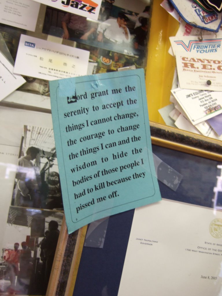
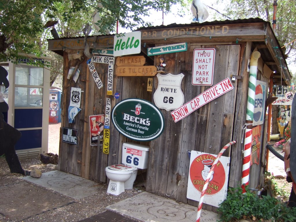
From there I continued on Westward. There wasn’t much that was really noteworthy that I haven’t previously taken note of. I stopped in Seligman, again. I believe I had basically the same meal, less one burger patty. I took some pictures of the scene, as well. One is a variation on what I can only think to call the ‘serenity prayer.’
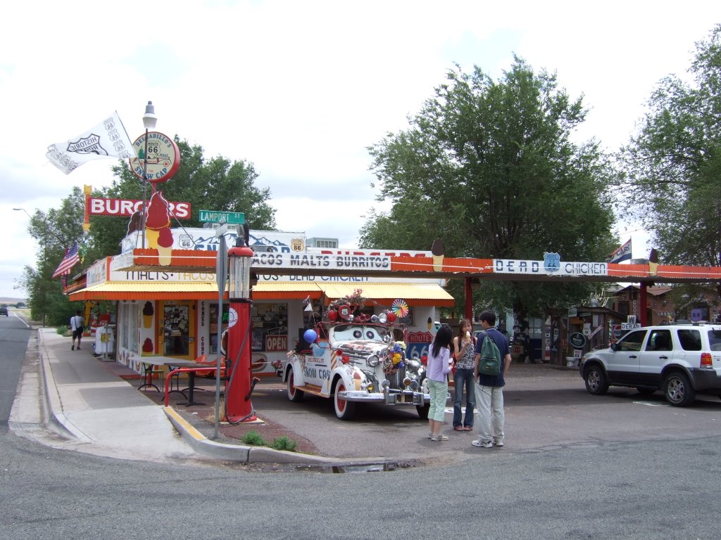
Here’s a look at what the place looks like from the intersection it’s on:
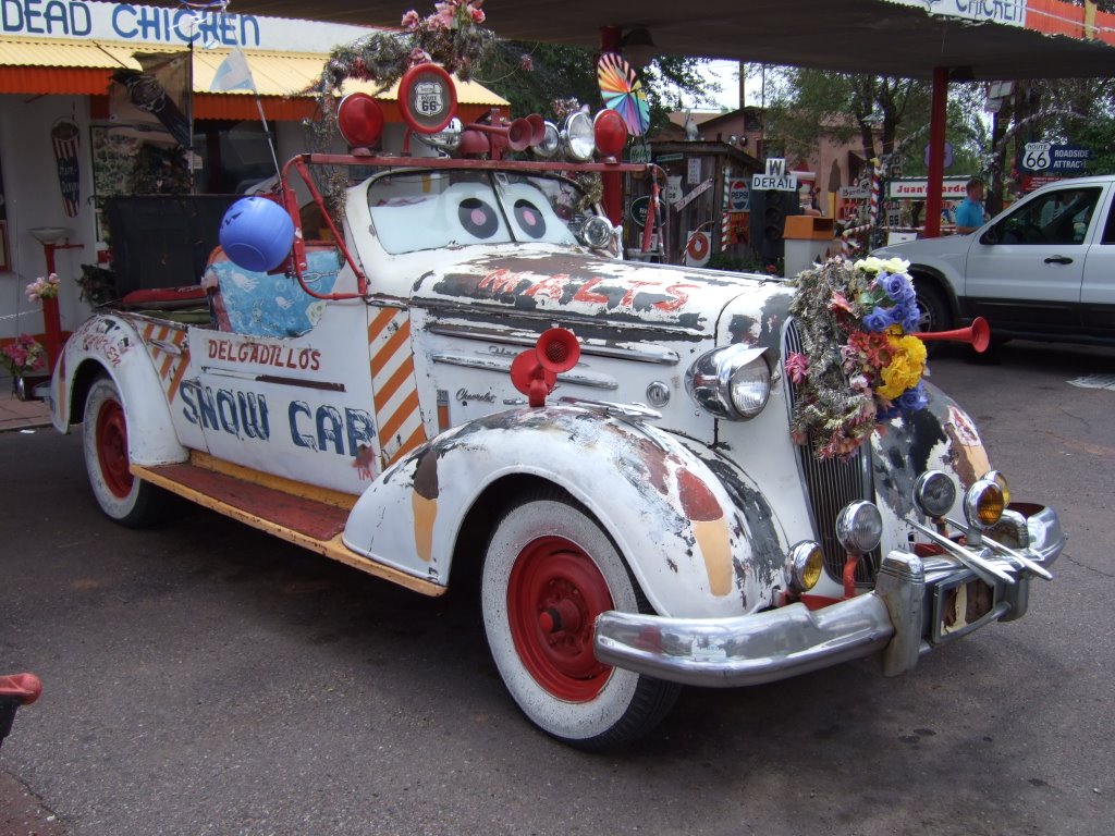
Here’s what I would guess would be their ride in parades:
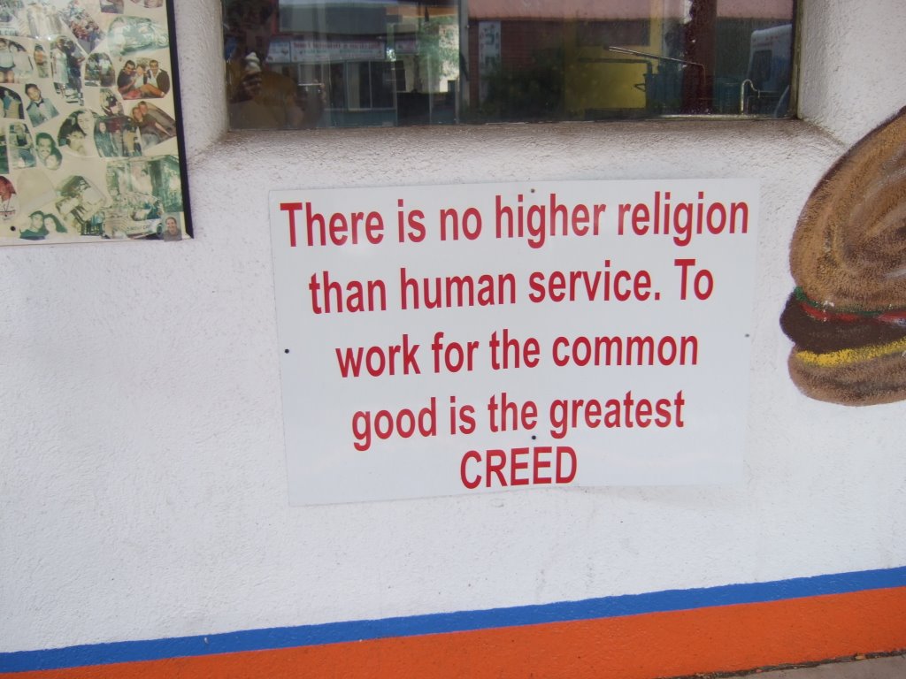
And here’s a sign painted on the wall that I thought was very appropriate and very well-represented by how they run their business:
The very ornate bathrooms:
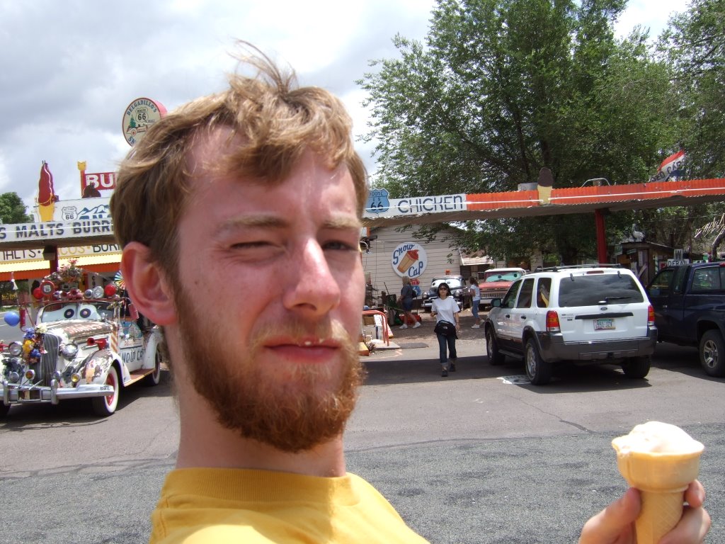
And here’s me enjoying an ice cream cone (yes, I was saving some for later, as a matter of fact):
I continued on my way westbound once again on the old Route 66. I saw the S on a hill for Seligman, I drove over some bridges that said ice formed on them first, and after a couple of hours, I found myself in Kingman, once again. This time, however, I would not be turning north, but continuing west. While there, I saw a sign that I’m fairly certain I disagree with.
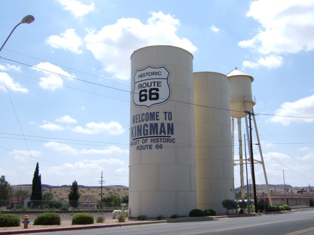
The sign says that Kingman is the heart of old route 66, and it just didn’t feel that way to me. I don’t exactly know where I would place the heart of the road, but when I look in my gut, Kingman just isn’t the answer. So, I guess I just feel that the water tower is wrong.
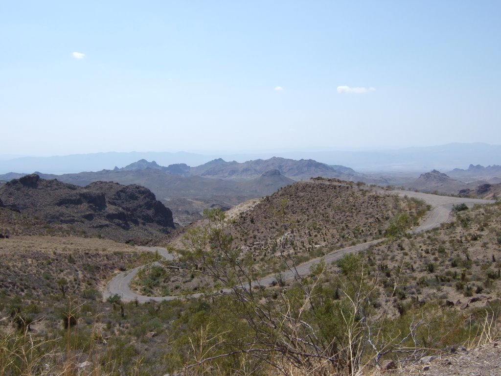
That road was extremely slow going, for multiple (extremely) valid reasons. Most of which contribute in some way to me wanting to drive that road again at some point. The curves are sharp and plentiful. You’ve got to take them slow for yourself so that you don’t go flying off of any desert mountain cliff sides, and so that you have time to react to any oncoming traffic that may or may not be hazardous. On top of all that, there’s scenery that you’ve got to go slow and try to absorb. I’ve got to say that the desert areas I’ve passed through haven’t been particularly friendly to me, but they’ve provided some pretty neat sights.
Then I came to an old gold rush town. Unfortunately, I can’t currently remember the name of the town, and I’m lazy and not near my map, but I will tell you that it was somewhere between several and 40 miles or so on the Arizona side of the boarder with California. The old gold rush town was very neat, except for me not stopping there. However, there was a certain craziness about, wandering the streets. And by craziness, I mean burros. Have a look.
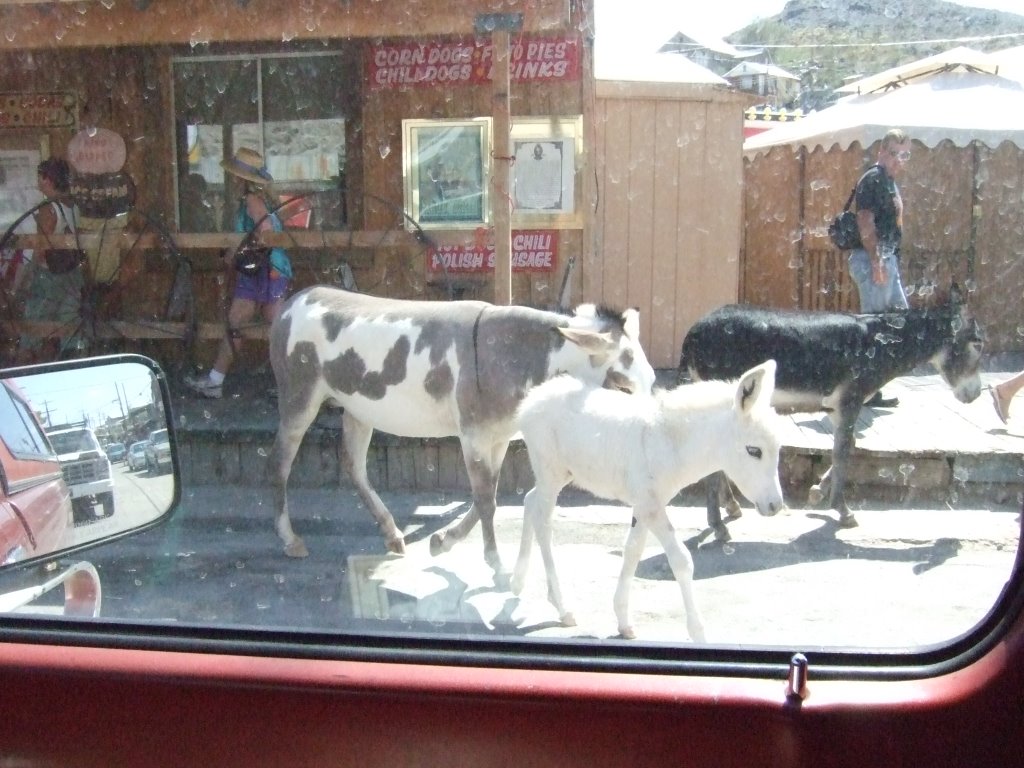
I probably saw about ten burros wandering the streets, being fed by tourists, and generally being the theme of the town(?). I don’t know if they’re wild, or if they get corralled at night, but I do know that I saw (and thought nothing of) many signs depicting the area’s being a ‘burro-crossing’ site, on the drive up.
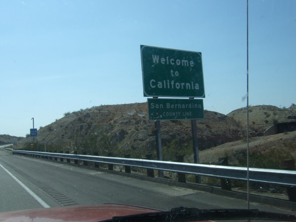
Within the next betweem-several-and-40-miles, I crossed a river and was in California:
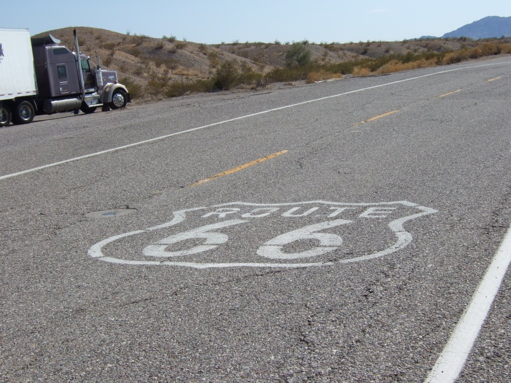
The road was difficult to keep track of at first, but soon became a bit easier. I didn’t see any of the ‘historic route 66 california’ signs until after I passed through San Berdoo, but I did see several instances of something better:
Then I was stunned to see the California gas prices of late July:
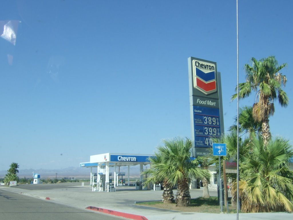
I didn’t need gas, thank goodness, but it was still a shocking sight to see. Then it was time to refocus on the road, I did so, and this is what I saw:
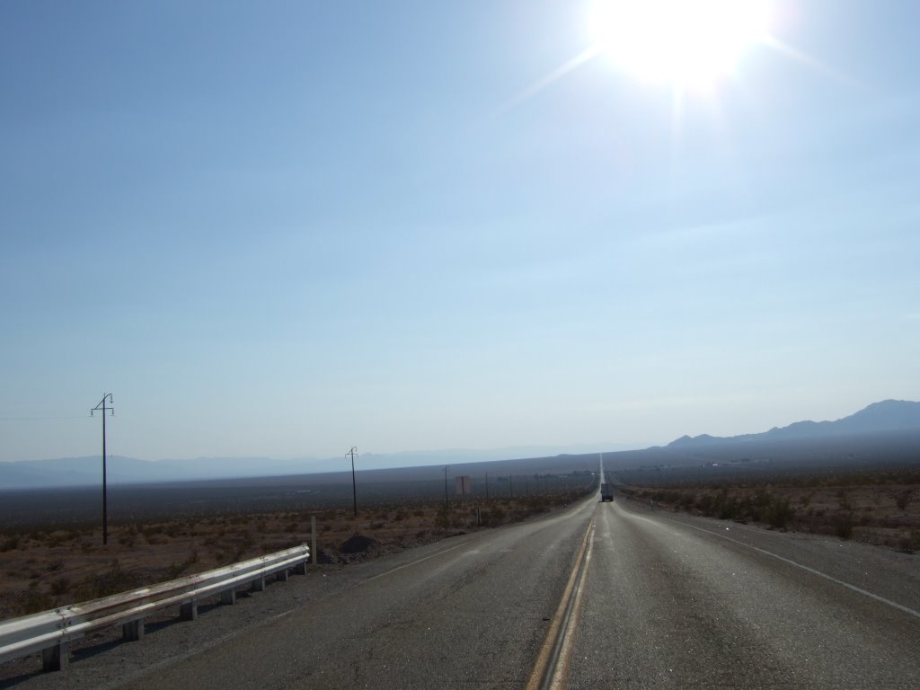
After quite another long while of driving (toward the sun), I glanced briefly at my book, and it said something about getting on the interstate at the previous entrance because the section of the Route 66 that I was on went into a U.S. Marine Weapons Depot, or something like that. So, I decided to turn ‘round, and head for the interstate. After turning around, but before interstating it up, I took a picture of the sun which had been fiercely discouraging (hotly contesting?) my advancement toward it.

After returning to the interstate I headed for Barstow. As far as I was (and am) concerned, Barstow was a thoroughly uninteresting little town. I searched up and down the main drag of the town, and found absolutely no camp grounds, and only one complex vaguely resembling an RV park (it was also a mobile home park). I opted to stay at the Super 7. Never heard of it? Well, neither had I, but their rates were significantly less than the American Inn, next door (which I had heard equally nothing of prior to that day). I watched tv for a bit, fiddled with my computer, trying to snag some of the American Inn’s wireless internet (failed), and then went to bed.
1 comment:
Wow. I didn't know gas got that high anywhere.
Post a Comment