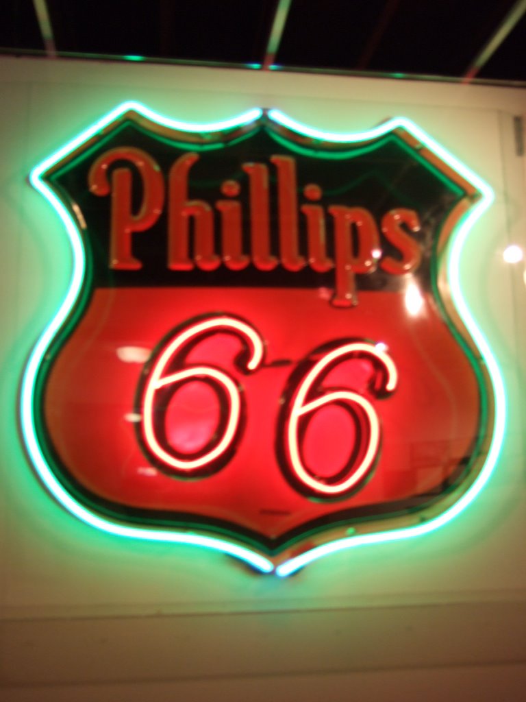
 Not only that, but I also found a museum and state park! They had an old Phillips 66 sign in the museum. It was just about the first instance of neon I’d seen along the way. Unfortunately it was in a museum, so it didn’t exactly have that ring of authenticity, at least not in the ‘experiencing it out there in the real world’ kind of way.
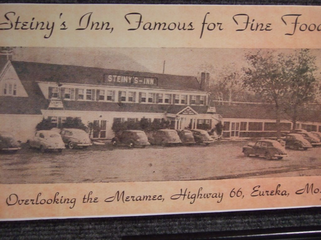
 As it turned out, the park facility and museum were housed in a former Route 66 Bar/Inn. Here’s a picture of it from its heyday:
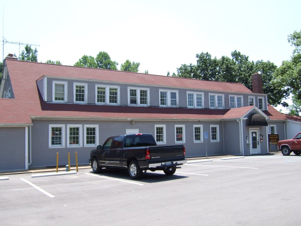
 And here’s one from the now:
 The park was sort of built around the road and I believe the Meramec River, but the ironic thing was that the road didn’t pass all the way through the park. Toward the park’s edge, the road closed signs were up, and the Old Road merged with the freeway. I had to go back out to the freeway to get back on Route 66. It always disgusts me a little when I have to do that.
I had another few instances of losing the road and finding it again, and I finally figured out how to use the book I’d bought (to a certain extent, and let me tell you, they don’t make it easy to decrypt...).
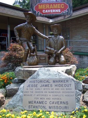
One such instance was near the Meramec Caverns. I’d said that if the road took me by them, I’d go in and have a look, but if it didn’t, so be it. Well, as it turned out, the road didn’t go by them, but I missed a turn (there was no sign) and ended up in the Cavern parking lot. So I decided to go in and have a look. Well, they had tours going every twenty minutes, but they lasted eighty minutes and cost fifteen dollars. I figured I’d seen enough on account of the gift shop and museum being built into the cave. That’s right, you walk inside a building, and suddenly you find yourself in a cave. It was rather odd, but very interesting. Oh, and apparently Jesse James stayed there for a while. They say it’s a comfortable sixty degrees all year round.
The park was sort of built around the road and I believe the Meramec River, but the ironic thing was that the road didn’t pass all the way through the park. Toward the park’s edge, the road closed signs were up, and the Old Road merged with the freeway. I had to go back out to the freeway to get back on Route 66. It always disgusts me a little when I have to do that.
I had another few instances of losing the road and finding it again, and I finally figured out how to use the book I’d bought (to a certain extent, and let me tell you, they don’t make it easy to decrypt...).
One such instance was near the Meramec Caverns. I’d said that if the road took me by them, I’d go in and have a look, but if it didn’t, so be it. Well, as it turned out, the road didn’t go by them, but I missed a turn (there was no sign) and ended up in the Cavern parking lot. So I decided to go in and have a look. Well, they had tours going every twenty minutes, but they lasted eighty minutes and cost fifteen dollars. I figured I’d seen enough on account of the gift shop and museum being built into the cave. That’s right, you walk inside a building, and suddenly you find yourself in a cave. It was rather odd, but very interesting. Oh, and apparently Jesse James stayed there for a while. They say it’s a comfortable sixty degrees all year round.
 As I was driving away from the caverns, I couldn’t help but marvel at how the trees arching over the road kind of formed their own cave. This picture is a little out of focus, which was unintentional, but I thought it came out kind of neat. So, here, for your potential viewing pleasure, it is:
 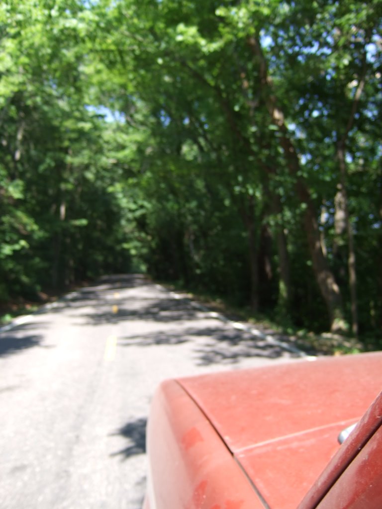 As I drove on, I continuously noticed the differences between how the Old Road bent and curved through the land and how the Interstate took a more straight on approach. Now, don’t get me wrong, there are an awful lot of stretches where both roads run the same course across the land, but I thought this was a decent example of their taking different courses:
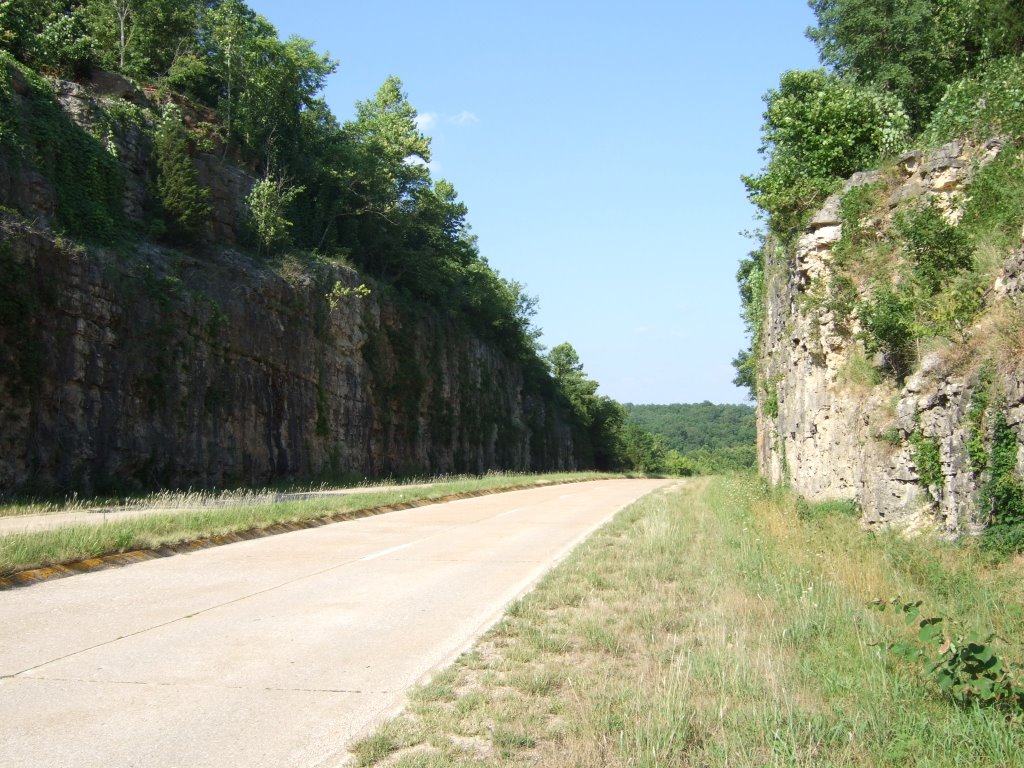
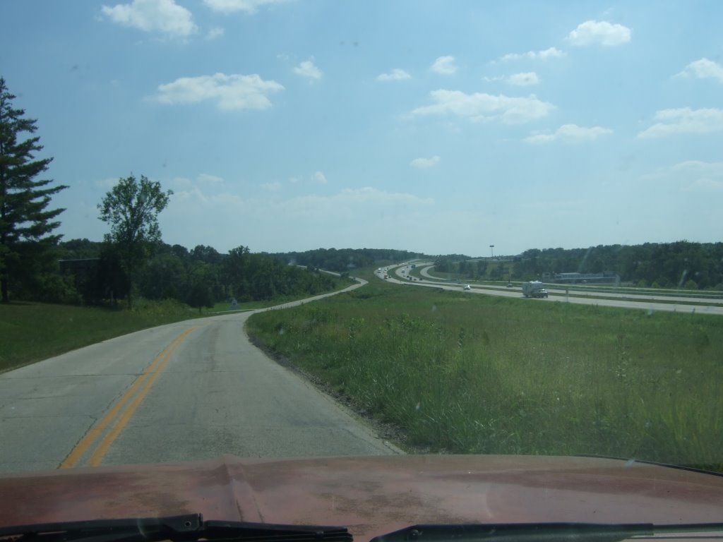 It took me a while to find, but I did indeed find the second major sight of Route 66 that I had wanted to see:
 It’s not really anything terribly out of the ordinary in this day and age, but I was thinking of the time and effort that must have gone into carving that out (and yes, I realize a hint of irony between what I just said and this picture...). This is at or near an area called ‘Devil’s Elbow’ (I’m not sure).
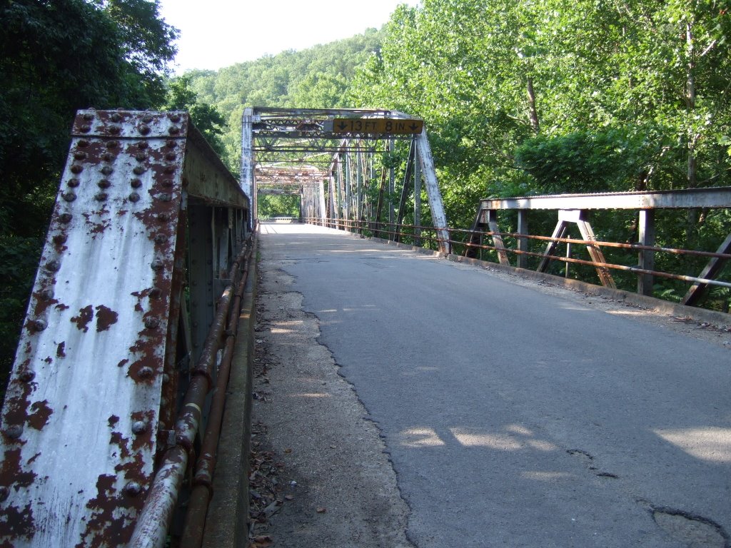
During the course of my wandering, and at the suggestion of the book, I found this old steel truss bridge, that the book claims was built back in 1923. I liked it quite a lot.
 As I continued on, I got closer to the freeway and then further away from it. This happened several times. On one such occasion away, I happened to see these cars:

They looked like they were in someone’s personal collection, but I couldn’t help wondering if they weren’t victims of 66.
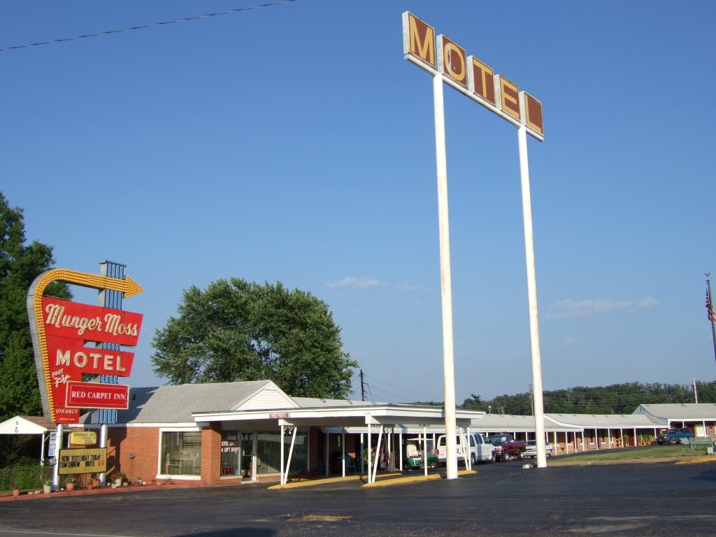
I was nearing the end of my day’s travels when I passed through (I don’t remember which town), and I saw a sign for a motel that I’d read about. I don’t know how far back its history on the Old Road goes, but it looks like it’s fairly substantial. The Munger Moss Motel.
 Before all was over for the day I had to break pretty far to the north of Lebanon, MO, and the Route, to get to my planned campground for the evening, but before I did, I took this picture:
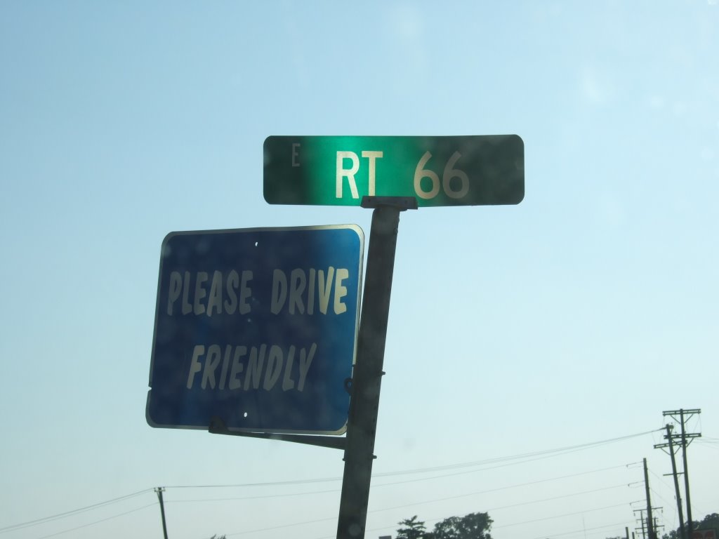 It made me think of a time I’ve never known, maybe a time that never existed, but a time when nearly everyone on the road was polite. I’ve seen several ‘Drive Friendly’ signs since, but not one on a RT 66 sign.
After that I headed up to my aforementioned campground at Bennett Springs, MO. Everyone and everything there was pretty nice. The woman I bought my pass from was really accommodating, as well. She even asked me if I’d like a space near the bathrooms. I obliged, and everything turned out quite nicely.
I found my spot, ate some food, brushed some teeth, and fell asleep. It was a pretty good day.
It made me think of a time I’ve never known, maybe a time that never existed, but a time when nearly everyone on the road was polite. I’ve seen several ‘Drive Friendly’ signs since, but not one on a RT 66 sign.
After that I headed up to my aforementioned campground at Bennett Springs, MO. Everyone and everything there was pretty nice. The woman I bought my pass from was really accommodating, as well. She even asked me if I’d like a space near the bathrooms. I obliged, and everything turned out quite nicely.
I found my spot, ate some food, brushed some teeth, and fell asleep. It was a pretty good day.
1 comment:
I'm posting a comment, I'm posting a comment!
Post a Comment