It’s been a while since I’ve had a chance to sit down and do any writing, so I might be a little rough on what happened to me on the day in question (that day being Sunday, July 9). However, I did take notes that day, because I knew I wouldn’t get a chance to type things out. So please, bear with me, as I sort out my own notes and photographs into some coherent con-blog-eration.
I woke up, and didn’t know what to do, unsurprisingly. I organized and typed out the previous day’s entry. I was within the confines of my truck’s bed and canopy at this point, and thought to myself, ‘how silly, there’s no one else around, why don’t I sit at that picnic table over yonder?’ So I climbed out of my truck, ambled over to the aforementioned table, sat, and recommenced typification. Then the bugs attacked me. They seem to have a knack for finding me and biting me. I don’t particularly understand it.
In any event, I left the campground, and headed south on US 93. A little ways down the road, I saw a neat little side road, so I took it. A little ways down that road, I saw another neat little side road, with a sign above it that read ‘Sula Cemetery.’ I thought that it would be interesting to see a (very) small town cemetery, so I took that turn. I should have been suspicious when I saw that the road name was that of a man. I got halfway up the road when I realized it was a driveway going toward someone’s house (and that was all). Then there was a no trespassing sign that looked particularly threatening. So, ‘what do I do?’ I thought. I decided to turn around. It ended up being an Austin Powers style one-eighty that took about five points to complete. I wondered what the people in the house must have thought when a little pickup truck comes halfway up their driveway and suddenly turns back.
I quickly refound the 93 and turned resouth. I stopped for gas and the town store, by which I of course mean the store was the town. Pretty much everything a town needs, all under one roof. It was a gas station, café, I think it was a bar, and apparently had a thriving tourism industry, considering that building was the town proper.
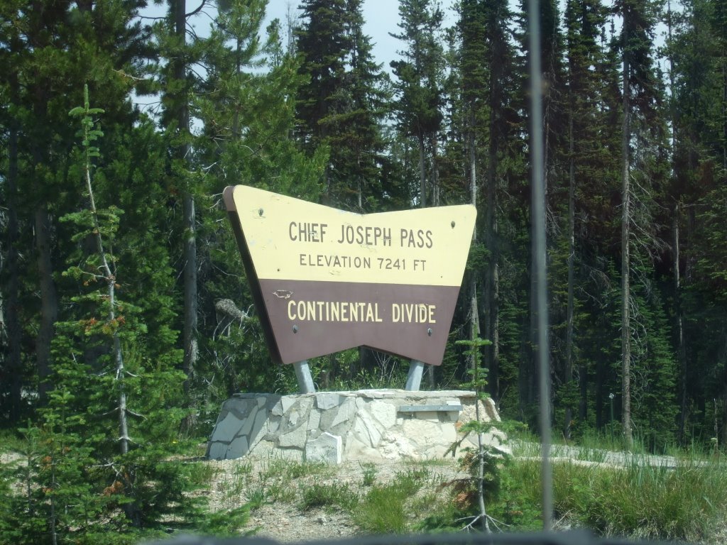
I got my gas and headed up, up into the mountains, once again. Shortly thereafter, I reached the top of Lost Trail Pass (it didn’t seem that lost to me), when I was suddenly given the choice of turning east and going deeper into Montana, or continuing on south, into personally unknown parts of Idaho. I took that left turn and, within about two minutes had inadvertently crossed the continental divide. I crossed it so fast I first took pictures of the sign on Chief Joseph pass from the east side of the divide. I then turned around and got a picture from the proper side. This one’s actually from the east side.

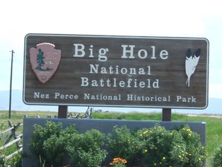
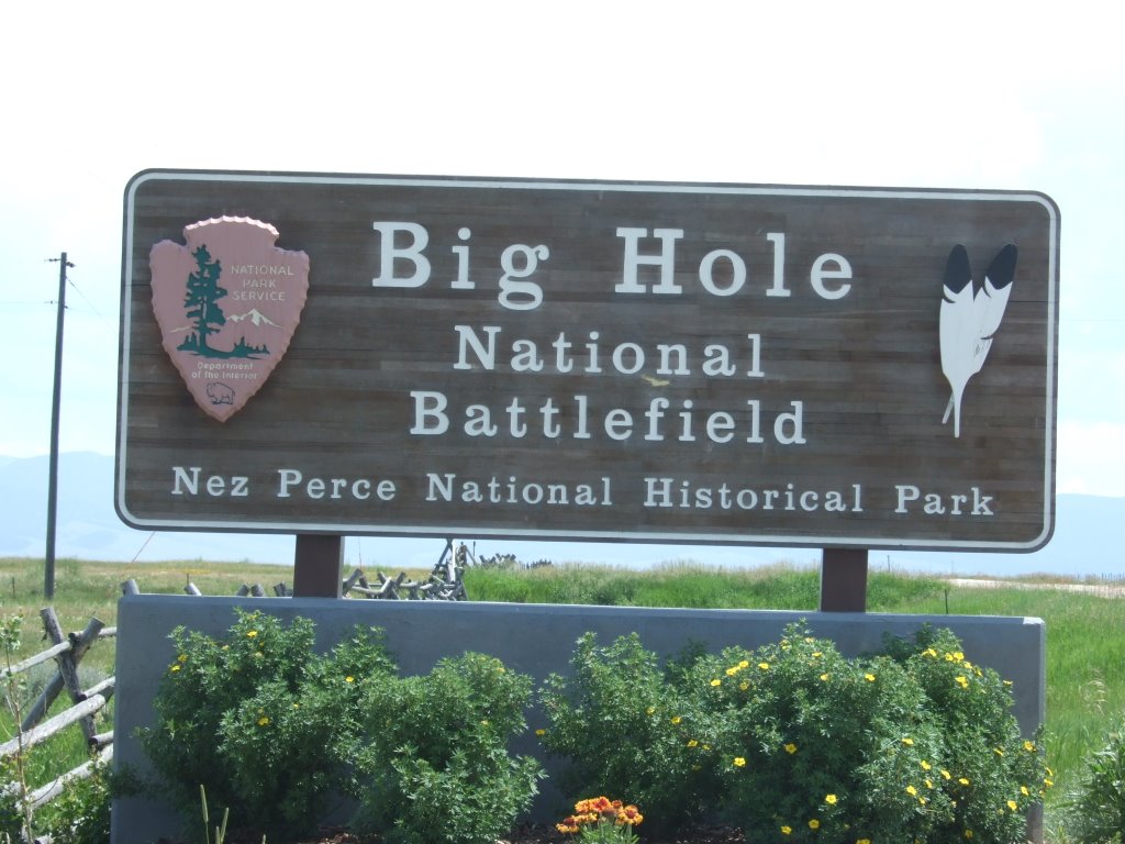
After turning around (once again), I headed down the mountain and into what I would later learn was the Big Hole Valley. I saw that there was a park or something where the Big Hole Battlefield was, and thought that I would go ahead and stop on in... until I saw the ‘fee area’ sign. Then I promptly turned myself (and my truck) around, took a few strategic pictures, and headed east once again.
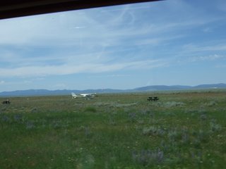
As I was heading east out of the Big Hole, I saw what proclaimed to be some town’s airport. I didn’t see but the one plane and a dirt road that went out a ways into a field.
I reached the town of Wisdom, MT, and had to figure out where to go from there. Choosing what seemed like the shortest path to Yellowstone, I turned south toward Dillon. Before ever reaching Dillon, however, I would experience two things totally unique (as far as I’m concerned) unto themselves.
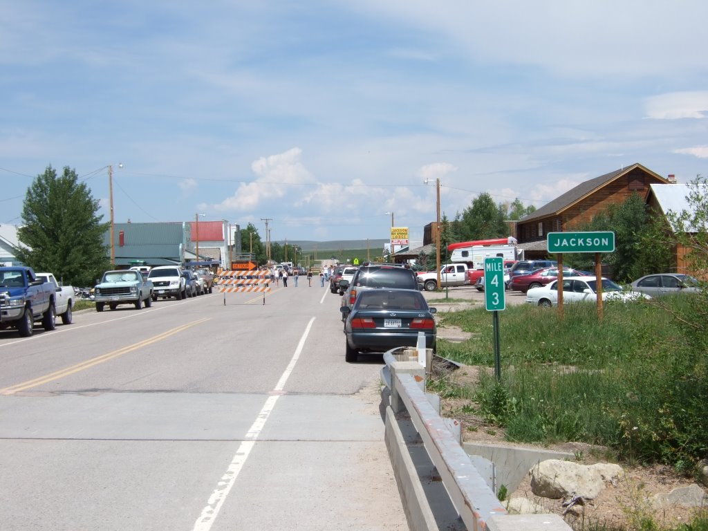
The first was the little town of Jackson, which I thought I was going to pass through on my way to Dillon. As a matter of fact, I never actually passed through Jackson, on account of the highway through town being blocked off. Honestly, the town is only about three city blocks long, and the highway was blocked off at both ends. My very first reaction to this realization was major frustration. You see, I was following a semi-truck with two trailers. The driver tried making the ninety degree turn off the highway onto the dirt ‘U’ shaped road that I found skirted the town and was serving as the detour for highway traffic. The semi tried diligently to make that turn, but the dirt road had traffic coming toward us, and had cars parked on both sides of it. The trucker tried about three times, each time backing up (and I backed up to give him room, and the truck behind me backed up to give me room—I’m not sure how far back this goes...) and finally his buddy just jumped out of the cab, ran over to the barricade, moved it, then waited for the truck to pass through, and replaced it. I took the dirt ‘U’ around town. When I got all the way through, I got to the other end of it just in time to see the big rig go by. I got in behind him and suddenly saw that there was a parking place left at a historic site, so I grabbed it, checked out the site (apparently there was a natural hot spring there that Clark found on his way back in ’06). Then I turned my attention toward the blocked off town of Jackson. There were people in the streets laughing and cheering. I was confused. It had to be some kind of festival, but what?
A older man came strolling out of the festivities, and I called out to him, “What’s going on back there?” “Oh that,” he says, “it’s Old-timers’ Day!”
He paused, “if you’da been here a half hour ago you coulda got a free sandwich! As it is you can still get in on the tug-a-war.”
I thanked him, and he continued on his way. I thought about investigating further, but opted not to, sighting meal time for insects, with myself as the main course.

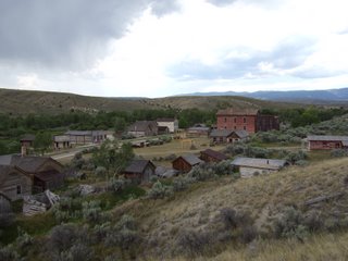
The second unique experience as mentioned above, is that of Bannack, MT. It was a gold rush town, and I suppose you can say that it still is. It was the first territorial capital of, well, the Montana Territory, and has long been abandoned. Now it’s an (in my opinion) incredibly well-preserved ghost town-park.
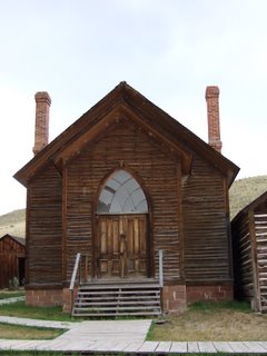
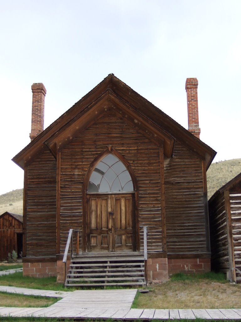
The town has many things that you’d expect to find in a frontier ghost town. A cut-throat saloon, an inhospitable jail, a once-bustling hotel, a fine church, and a dual purpose school/Masonic temple building.


It was incredibly fascinating. I’d heard a little about Bannack in the one of the stories the modern mountain man told back in Idaho on day 2. If not for that story, I probably would not have stopped, and not had the incredible experience of seeing such an amazing and historic site. It was great.
I eventually left Bannack (I spent literally hours there, and still left a little begrudgingly... I felt that time was getting away and that half of all energy spent on my part was in an effort to ward off bloodthirsty insects), and headed toward Dillon once more.
Just after I crossed under Interstate 15, I saw what I thought was a very interesting sight:
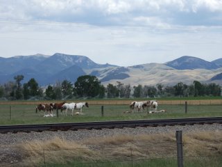
Nap time.
I stopped in Dillon, at the Visitor Information Center, which turned out to be closed at 5 o’clock on a Sunday. I called my parents and talked with them at length, and eventually decided to discontinue conversation, and continue driving.
The town of Twin Bridges proudly proclaimed itself as part of the Louis and Clark expedition, like so many other places I’d been to. It feels weird to me, that I have traveled to so many of the same places that these men and their company came to more than two hundred years ago, but moreover, that I had absolutely no intention of doing so.
Also, in Twin Bridges, I only found one bridge. They did have two water towers though.
After leaving the rest stop at Twin Bridges, I passed through Alder (Gulch), which is also in the tale of the modern mountain man which told of Bannack. Alder, though name changed, apparently had more staying power and other activities of income and industry that men and women could pursue, because it’s still a town today, though much evidence of it’s heritage as a gold rush town lingers. Evidence like the rock piles created by the dredging equipment, and even in some places parts of the equipment are left to rust.
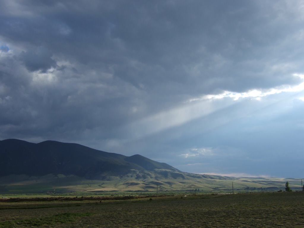
I believe it was between Alder and Virginia City that I stopped for this photograph. I thought it was quite a sight.
From there, I happened through Virginia City, which also retains its own gold rush history and flavor, but in a very different sort of way. I didn’t stop there, but it seemed very tourist-y to me, sort ‘old-west campy,’ I guess. Now that I think about it, that was one of the provisions of Bannack’s parkhood—that it not be made tourist-y, specifically ‘like Virginia City,’ the people lobbying for it’s parkhood were intent on preservation and restoration.
I came down yet another mountain pass, and found myself looking across the vast expanse of the Madison Valley. I bought gas in Ennis.
I camped somewhere along the Madison River, and as the sun was setting, took this picture. I thought of the line ‘purple mountains’ majesty... I think I’d only ever seen mountains tree-and-dirt-and-grass colored and bluish before.

 After turning around (once again), I headed down the mountain and into what I would later learn was the Big Hole Valley. I saw that there was a park or something where the Big Hole Battlefield was, and thought that I would go ahead and stop on in... until I saw the ‘fee area’ sign. Then I promptly turned myself (and my truck) around, took a few strategic pictures, and headed east once again.
 As I was heading east out of the Big Hole, I saw what proclaimed to be some town’s airport. I didn’t see but the one plane and a dirt road that went out a ways into a field.
 I reached the town of Wisdom, MT, and had to figure out where to go from there. Choosing what seemed like the shortest path to Yellowstone, I turned south toward Dillon. Before ever reaching Dillon, however, I would experience two things totally unique (as far as I’m concerned) unto themselves.
The first was the little town of Jackson, which I thought I was going to pass through on my way to Dillon. As a matter of fact, I never actually passed through Jackson, on account of the highway through town being blocked off. Honestly, the town is only about three city blocks long, and the highway was blocked off at both ends. My very first reaction to this realization was major frustration. You see, I was following a semi-truck with two trailers. The driver tried making the ninety degree turn off the highway onto the dirt ‘U’ shaped road that I found skirted the town and was serving as the detour for highway traffic. The semi tried diligently to make that turn, but the dirt road had traffic coming toward us, and had cars parked on both sides of it. The trucker tried about three times, each time backing up (and I backed up to give him room, and the truck behind me backed up to give me room—I’m not sure how far back this goes...) and finally his buddy just jumped out of the cab, ran over to the barricade, moved it, then waited for the truck to pass through, and replaced it. I took the dirt ‘U’ around town. When I got all the way through, I got to the other end of it just in time to see the big rig go by. I got in behind him and suddenly saw that there was a parking place left at a historic site, so I grabbed it, checked out the site (apparently there was a natural hot spring there that Clark found on his way back in ’06). Then I turned my attention toward the blocked off town of Jackson. There were people in the streets laughing and cheering. I was confused. It had to be some kind of festival, but what?
A older man came strolling out of the festivities, and I called out to him, “What’s going on back there?” “Oh that,” he says, “it’s Old-timers’ Day!”
He paused, “if you’da been here a half hour ago you coulda got a free sandwich! As it is you can still get in on the tug-a-war.”
I thanked him, and he continued on his way. I thought about investigating further, but opted not to, sighting meal time for insects, with myself as the main course.
I reached the town of Wisdom, MT, and had to figure out where to go from there. Choosing what seemed like the shortest path to Yellowstone, I turned south toward Dillon. Before ever reaching Dillon, however, I would experience two things totally unique (as far as I’m concerned) unto themselves.
The first was the little town of Jackson, which I thought I was going to pass through on my way to Dillon. As a matter of fact, I never actually passed through Jackson, on account of the highway through town being blocked off. Honestly, the town is only about three city blocks long, and the highway was blocked off at both ends. My very first reaction to this realization was major frustration. You see, I was following a semi-truck with two trailers. The driver tried making the ninety degree turn off the highway onto the dirt ‘U’ shaped road that I found skirted the town and was serving as the detour for highway traffic. The semi tried diligently to make that turn, but the dirt road had traffic coming toward us, and had cars parked on both sides of it. The trucker tried about three times, each time backing up (and I backed up to give him room, and the truck behind me backed up to give me room—I’m not sure how far back this goes...) and finally his buddy just jumped out of the cab, ran over to the barricade, moved it, then waited for the truck to pass through, and replaced it. I took the dirt ‘U’ around town. When I got all the way through, I got to the other end of it just in time to see the big rig go by. I got in behind him and suddenly saw that there was a parking place left at a historic site, so I grabbed it, checked out the site (apparently there was a natural hot spring there that Clark found on his way back in ’06). Then I turned my attention toward the blocked off town of Jackson. There were people in the streets laughing and cheering. I was confused. It had to be some kind of festival, but what?
A older man came strolling out of the festivities, and I called out to him, “What’s going on back there?” “Oh that,” he says, “it’s Old-timers’ Day!”
He paused, “if you’da been here a half hour ago you coulda got a free sandwich! As it is you can still get in on the tug-a-war.”
I thanked him, and he continued on his way. I thought about investigating further, but opted not to, sighting meal time for insects, with myself as the main course.
 The second unique experience as mentioned above, is that of Bannack, MT. It was a gold rush town, and I suppose you can say that it still is. It was the first territorial capital of, well, the Montana Territory, and has long been abandoned. Now it’s an (in my opinion) incredibly well-preserved ghost town-park.
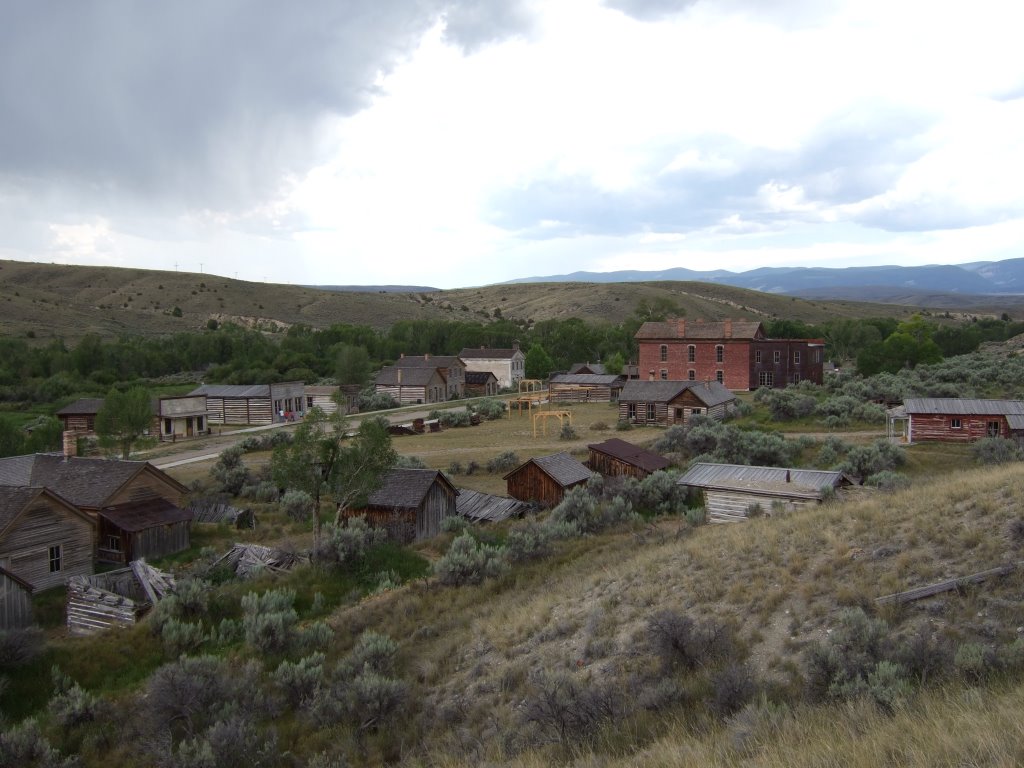 The town has many things that you’d expect to find in a frontier ghost town. A cut-throat saloon, an inhospitable jail, a once-bustling hotel, a fine church, and a dual purpose school/Masonic temple building.
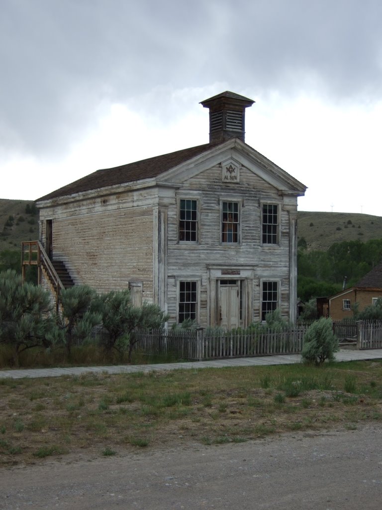
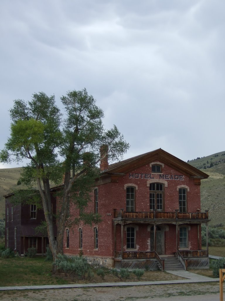 It was incredibly fascinating. I’d heard a little about Bannack in the one of the stories the modern mountain man told back in Idaho on day 2. If not for that story, I probably would not have stopped, and not had the incredible experience of seeing such an amazing and historic site. It was great.
I eventually left Bannack (I spent literally hours there, and still left a little begrudgingly... I felt that time was getting away and that half of all energy spent on my part was in an effort to ward off bloodthirsty insects), and headed toward Dillon once more.
Just after I crossed under Interstate 15, I saw what I thought was a very interesting sight:
It was incredibly fascinating. I’d heard a little about Bannack in the one of the stories the modern mountain man told back in Idaho on day 2. If not for that story, I probably would not have stopped, and not had the incredible experience of seeing such an amazing and historic site. It was great.
I eventually left Bannack (I spent literally hours there, and still left a little begrudgingly... I felt that time was getting away and that half of all energy spent on my part was in an effort to ward off bloodthirsty insects), and headed toward Dillon once more.
Just after I crossed under Interstate 15, I saw what I thought was a very interesting sight:
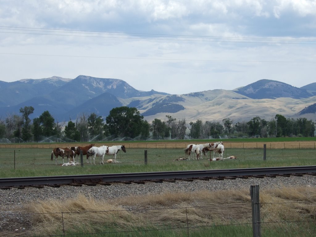 Nap time.
I stopped in Dillon, at the Visitor Information Center, which turned out to be closed at 5 o’clock on a Sunday. I called my parents and talked with them at length, and eventually decided to discontinue conversation, and continue driving.
The town of Twin Bridges proudly proclaimed itself as part of the Louis and Clark expedition, like so many other places I’d been to. It feels weird to me, that I have traveled to so many of the same places that these men and their company came to more than two hundred years ago, but moreover, that I had absolutely no intention of doing so.
Also, in Twin Bridges, I only found one bridge. They did have two water towers though.
Nap time.
I stopped in Dillon, at the Visitor Information Center, which turned out to be closed at 5 o’clock on a Sunday. I called my parents and talked with them at length, and eventually decided to discontinue conversation, and continue driving.
The town of Twin Bridges proudly proclaimed itself as part of the Louis and Clark expedition, like so many other places I’d been to. It feels weird to me, that I have traveled to so many of the same places that these men and their company came to more than two hundred years ago, but moreover, that I had absolutely no intention of doing so.
Also, in Twin Bridges, I only found one bridge. They did have two water towers though.
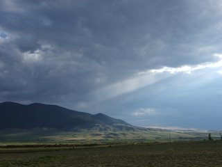
 After leaving the rest stop at Twin Bridges, I passed through Alder (Gulch), which is also in the tale of the modern mountain man which told of Bannack. Alder, though name changed, apparently had more staying power and other activities of income and industry that men and women could pursue, because it’s still a town today, though much evidence of it’s heritage as a gold rush town lingers. Evidence like the rock piles created by the dredging equipment, and even in some places parts of the equipment are left to rust.
I believe it was between Alder and Virginia City that I stopped for this photograph. I thought it was quite a sight.
After leaving the rest stop at Twin Bridges, I passed through Alder (Gulch), which is also in the tale of the modern mountain man which told of Bannack. Alder, though name changed, apparently had more staying power and other activities of income and industry that men and women could pursue, because it’s still a town today, though much evidence of it’s heritage as a gold rush town lingers. Evidence like the rock piles created by the dredging equipment, and even in some places parts of the equipment are left to rust.
I believe it was between Alder and Virginia City that I stopped for this photograph. I thought it was quite a sight.
 From there, I happened through Virginia City, which also retains its own gold rush history and flavor, but in a very different sort of way. I didn’t stop there, but it seemed very tourist-y to me, sort ‘old-west campy,’ I guess. Now that I think about it, that was one of the provisions of Bannack’s parkhood—that it not be made tourist-y, specifically ‘like Virginia City,’ the people lobbying for it’s parkhood were intent on preservation and restoration.
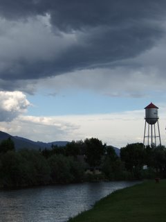
I came down yet another mountain pass, and found myself looking across the vast expanse of the Madison Valley. I bought gas in Ennis.
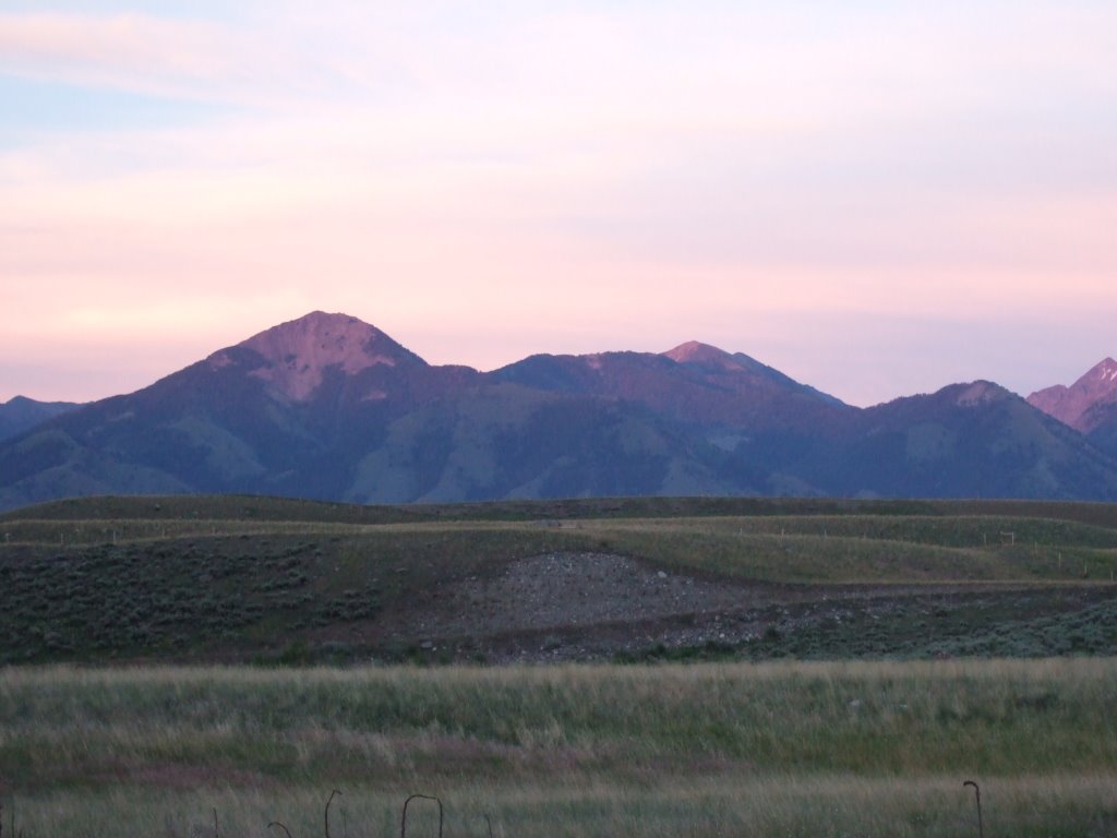
I camped somewhere along the Madison River, and as the sun was setting, took this picture. I thought of the line ‘purple mountains’ majesty... I think I’d only ever seen mountains tree-and-dirt-and-grass colored and bluish before.
From there, I happened through Virginia City, which also retains its own gold rush history and flavor, but in a very different sort of way. I didn’t stop there, but it seemed very tourist-y to me, sort ‘old-west campy,’ I guess. Now that I think about it, that was one of the provisions of Bannack’s parkhood—that it not be made tourist-y, specifically ‘like Virginia City,’ the people lobbying for it’s parkhood were intent on preservation and restoration.
I came down yet another mountain pass, and found myself looking across the vast expanse of the Madison Valley. I bought gas in Ennis.
I camped somewhere along the Madison River, and as the sun was setting, took this picture. I thought of the line ‘purple mountains’ majesty... I think I’d only ever seen mountains tree-and-dirt-and-grass colored and bluish before.
2 comments:
You know... we don't have cool shots like that around here.... sun filtering thru the clouds on the green fields.... We're so deprived.
Hey, ironically, the day after I had to GOOGLE 'doppleganger' (honestly, it sounded vaguely familiar, but I just don't remember ever hearing it before) I actually read a book that used that word....
I'd like to see more ghost town shots. I s'pose I'll tear 'em out of you when you get here.
Post a Comment