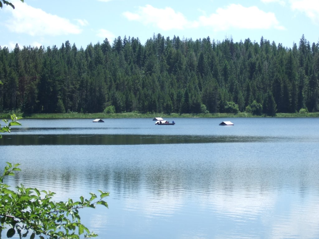
 Then I got back on the Winchester Highway 95 Business Loop and headed back to the real Highway 95. On my way through, I saw a closer view of something I’d seen back at the campground’s lake front. It appeared as though there were buildings in the lake. I couldn’t resist my chance to take a better shot. Maybe some of you can tell me what you think they are. At first I wondered if the water level was just really high, but I don’t think the water level could go much lower, considering the angle of the dock I stood near.
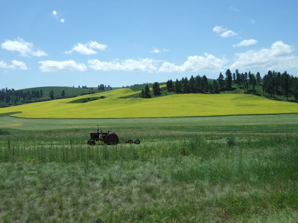
 On my way down the real Highway 95 I saw a couple of pretty amazing fields. One was a sort of bluish lavender, and the other was a bright yellow. I don’t know what sort of crops or well-maintained weeds they might be, but I thought they were quite pretty.
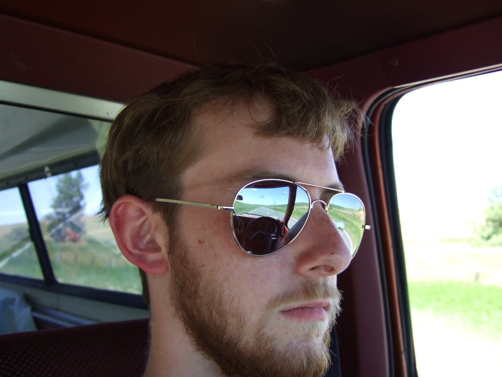
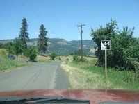
 I don’t know why, but I chose to take a picture of myself as I was driving. So, here for your viewing pleasure, it is.
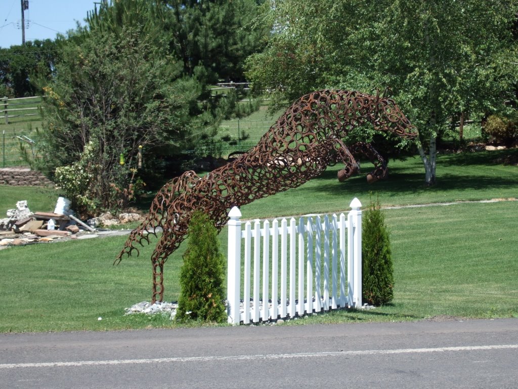
 Shortly thereafter, on the real Highway 95 proceeding toward the striving metropolis of NezPerce, pop. 523, I saw the strangest horse I’ve seen in quite some time. Not only was it jumping, it was also made (as far as I could tell) completely out of horseshoes.
 From Nezperce, my plan was to go on the Idaho 64 to a place called Kamiah (which is Cam-ee-ay, not Kum-I-uh, as I suspected), and join up with US 12 to Lolo, MT.
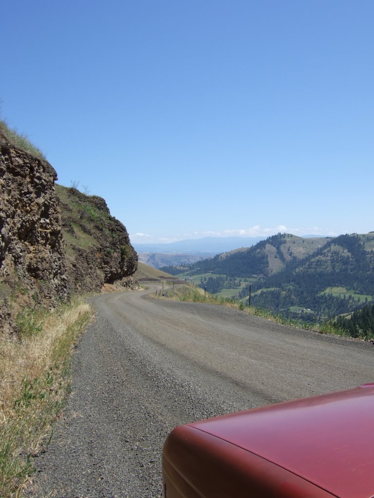 As I was driving the 64, I saw in the distance a valley, and I thought to myself, ‘oh, that valley looks neat, I wish I could get a better view of it,’ as the road I was on bent slowly away. To this and to all of you out there, I say this: let this be a lesson of proof to all those who say, “Be careful what you wish for...” I got my wish. Seven miles of no center-lined dirt road. Oh, and it’s a dirt road that hugs a cliff face for seven miles and is only wide enough for one automobile in many parts. Care to guess what else? I was on the outside, you know, the cliff-dropoff-side the whole way down. The first picture shows the severity of the drop a little bit, but you’ve got to look above the cut on the left side to have a better idea. Other than that, just notice how over the right side of the road, you can’t see anything... ANYTHING!
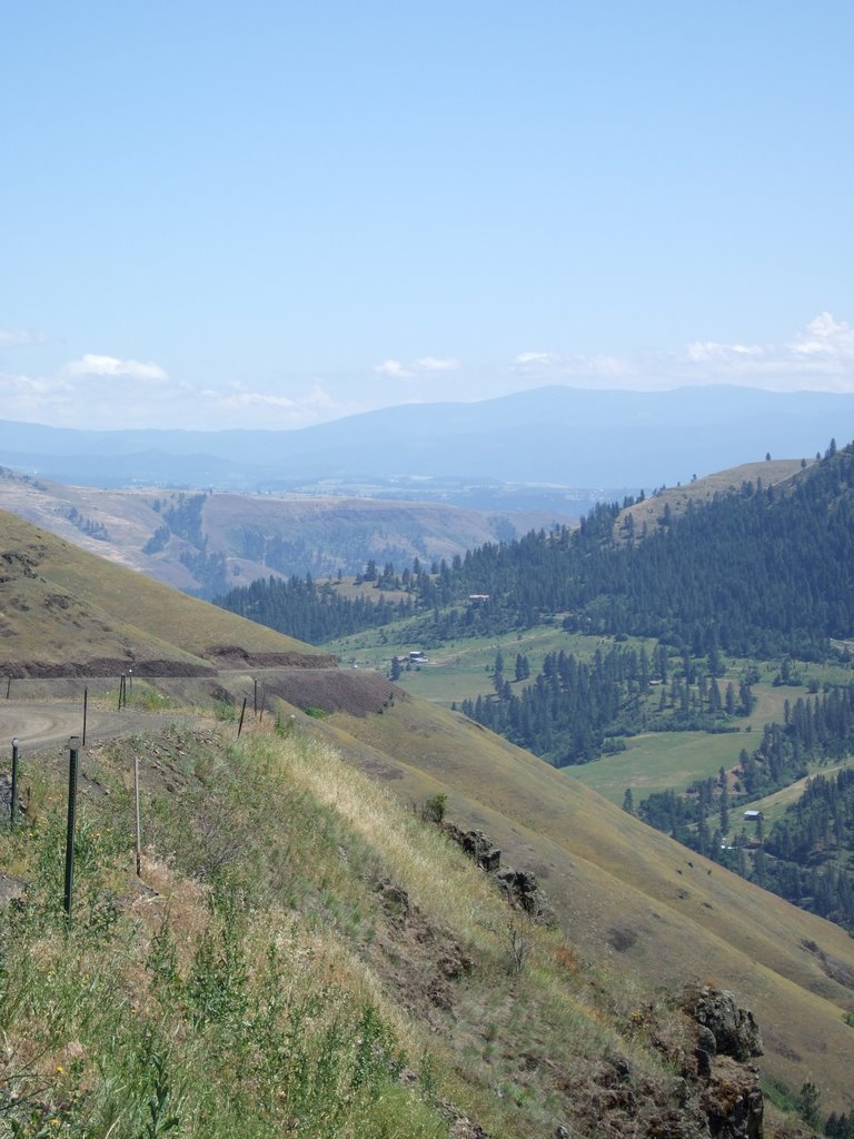 This photograph shows a little bit of the severity of angles a little bit also, but still, nothing quite like real life. Oh, and if you look at the cut for the roadbed that bends around the far hill, you may see a white dot. If not, I suggest you download the picture and find a way to zoom in. That white dot is a white car that went zooming past me as I was leisurely taking my pictures. ‘Zooming’ doesn’t even do justice to how fast that car was going. I was halfway wondering if they were going to just drive off one of those tight corners. They didn’t, as far as I know, but there’s really no telling, there wouldn’t be much evidence for some distance. No broken guard rails, no discernible tire tracks... all of which was going through my head as I never went above third gear... but mostly staying in second.
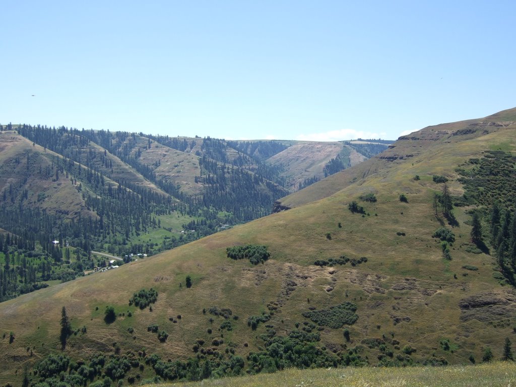 Then there’s this last photograph of the treacherous terrain I was crossing. Well, I didn’t exactly cross this, but it was very similar to what I did drive across/around. This view doesn’t seem altogether life-threatening, however.
 Finally, I come out of the windy cliff-side road onto a windy mountain road. The major difference being that there’s still a pretty severe drop on one side, but at least there are trees there to take your mind off the drop. Ah, Idaho 64, how I’ll miss you...
I drove on, stopped in Kamiah, bought some gas from a Texaco Grocery store. It was weird.
There was a Chevron that was completely full of cars, and cars lined up to the road, practically, and right next door was this grocery store Texaco with only one car at any of the pumps. So I pulled up, went inside the store, looked around, and went to the customer service desk and asked, “Is this where you buy gas?” The woman said, “Yes,” and I proceeded to ask my next question: “Do you accept Traveler’s checks?” To which she responded: “No, but I can cash it for you, and you can pay for gas with cash.” To which, in my head, I was totally confused. I wondered what, exactly, the difference was. Because I don’t see one.
Anyway, I bought the gas, did my calculations, and found that this time my truck had gotten over 24 and a half miles to the gallon. Which is thoroughly amazing, considering I did a lot more stopping on that tank of gas than the previous one.
After that, I started feeling guilty about not having talked to my parents since I left. They had asked me to call them and I had tried, but my cell phone (the one with greater coverage than my previous one) had been out of range for over eighteen hours. The last place I probably would have had service was on the hill overlooking Lewiston, but I didn’t want to call anybody until I’d made camp for the night. But by then I was out of range, and haven’t been in range since. Ironically, as I was driving through Kamiah, I saw a store that sold electronics, and among those listed were cell phones. It confused me as to why a place with no coverage would sell cell phones. Unless it were a booming teenage tourist town, in which case you’d think it would have coverage. Oh well.
The need to make a call brought me to: And now I’m done. So this morning of the third day, do I end the second day.
After I get this posted, I’ll hope that you’ve enjoyed reading it.
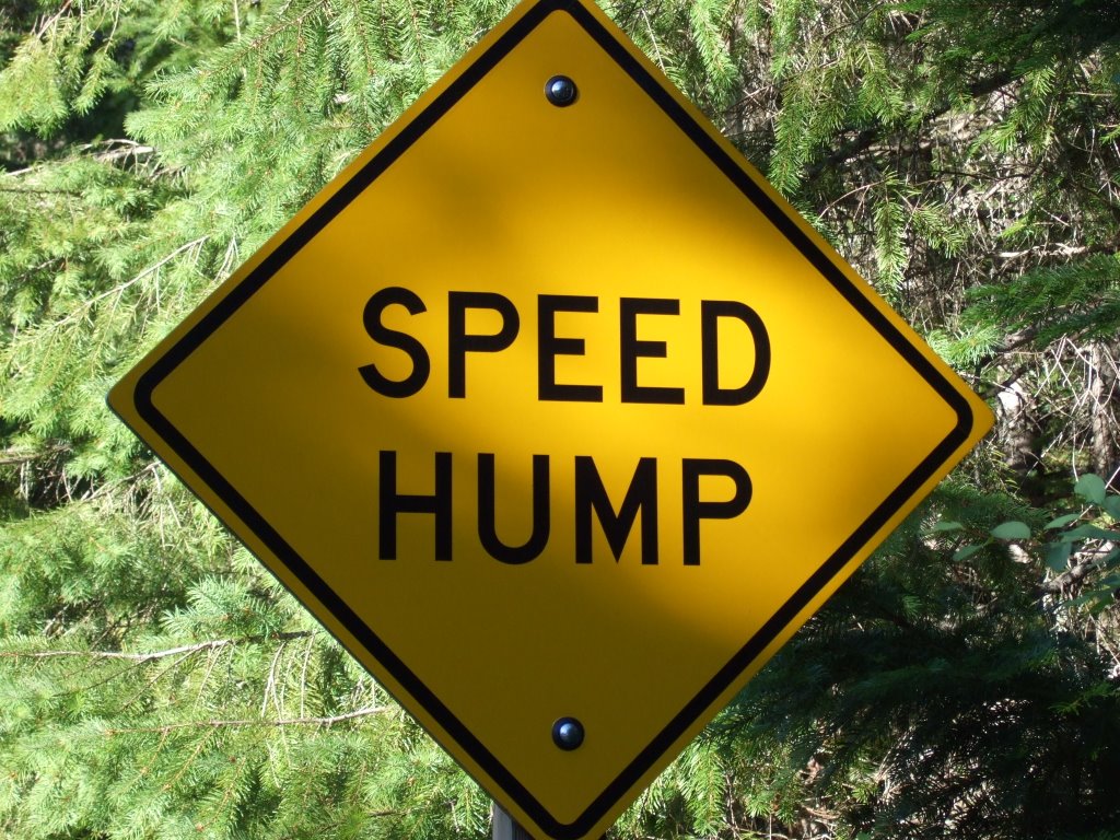
Oh, and one more even final-er thing: I saw... rather a strange sign in my campground. I thought it rather odd, and very worth sharing:
And now I’m done. So this morning of the third day, do I end the second day.
After I get this posted, I’ll hope that you’ve enjoyed reading it.
Oh, and one more even final-er thing: I saw... rather a strange sign in my campground. I thought it rather odd, and very worth sharing:
No comments:
Post a Comment