The sixteenth of July had arrived, and the time had come. All sight seeing aside, it was time to begin the historic road.
I awoke early, knowing that I was headed into Chicago, and wanting to avoid any ‘big city traffic’ it might have to offer. By early, I of course mean 5:30 in the a.m. Which is extremely early for me, and anyone else in a camp ground—unless they’re there for the fishing. I took myself a shower, organized everything to the best of my ability, and set forth southward. My map couldn’t tell me any particularly good ways of getting into Chicago from where I was, nor could it tell me how to get where I wanted to go, but I knew that the road I wanted began within a few blocks of the lake’s shore in Chicago’s downtown. So I headed out, and kept to roads that stayed on the lake’s shore.
I soon emerged from the wooded area of the park and entered a sort of run-down, former industrial, abandoned warehouse sort of district. It also seemed like it could double as a sort of low-income housing district. What was especially surprising to me, however, was the speed with which I passed from that area to an extremely upscale neighborhood. As a matter of fact, I was pretty convinced I’d found the neighborhood that Ferris Buehler had lived in. I had passed rapidly from apartment buildings that were falling apart, to three story houses with double doors and three car garages, circular driveways and fountains... you get the idea. I was in that neighborhood for quite some time.
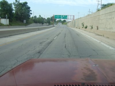
Then, suddenly and without warning, I was on a road that was marked on my map as a freeway, but not an interstate. I found that odd, but what I found more odd, was the fact that it looked abandoned. It looked as though it hadn’t been used by anyone in years, and that no one minded. It was just this sort of old run-down road... I was quite surprised that there were no roadblocks or anything. I even felt a little weird about being on the road at all. I thought that at any moment a Chicago police officer would come down off one of the high roads and ask me just what I was doing on this long-forgotten stretch of roadway. Honestly, I was on the road for about twenty minutes and saw a grand total of two other cars. Granted, it was a Sunday morning, but still. I can’t think of a four lane, separate direction road within twenty miles of Seattle that would only have three cars on it on a Sunday morning.
Here it is:
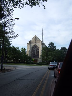
That road soon dumped me off back onto suburban streets, which I thought was quite puzzling. As I drove through the area, I saw some nice-looking churches. This is one such example:
I had finally found a road on my map that it looked like I could take into downtown Chicago and turn on Adams (the current start of Historic Route 66). It happened to be the road that most closely followed the lake’s shore. I thought that was quite handy, considering the fact that that was what I’d been trying to do all along. I soon ended up on that road, and found that (much to my chagrin) it was a limited-access road with no exit for Adams. So there I was, in a strange, gigantic city, driving around on roads I don’t know, looking for a road that I’m not sure where to find. I tried to take the next exit from the freeway that I was on, but it was odd. There was a right turn lane from the free way that forced you to go straight across the road that parallels the freeway. I ended up making a sort of ‘z’ and turning left across the road I was only supposed to go straight across, thinking that I needed to get a little further south.
It was hectic.
From there, I drove straight and came to a road that looked as though it only went into a hotel parking garage. What was worse, was the fact that it didn’t, but the road made a right turn around the hotel, and was made worse still by the compounded badness of a limousine (of which there were many) that had gotten stuck trying to make the turn out of the garage onto the narrow street that I, too, was trying to turn on.
So there I was, at every stop sign and light, trying in vain to study my map, for some clue that would guide me to that envisioned, but in reality unknown place I needed to be. I made another right, and was headed north. At some point I made yet another right and was headed back east. It was all quite surreal.
After that it gets a little hazy, because I know that I made a left turn to head back west (I could see the lake on my right side, so I know I’d been close to it), when suddenly I saw a sign I’d been longing for mightily:
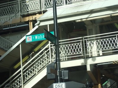
you may not be able to read it, but it says that I was at the intersection of Adams and Wabash, and that’s where it all begins.
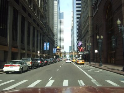
I drove a little further and thought to myself that I was in some kind of urban canyon, the scope of which I’d not personally seen equaled. So, it was worth a picture or two. Chicago’s Adams street canyon:
I knew that I would be seeing plenty of tall buildings, one of which would be the Sears Tower, but wasn’t entirely sure that I’d be able to pick it out of a line-up, especially from my vehicle-bound vantage point. I also knew that I’d be passing the tower on my right, and I couldn’t see much above about the second floor of any given building out my passenger window, but somehow I managed to get this picture:
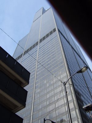
And now that I think about it, the situation I’ve just described doesn’t match up with my interpretation of my spatial relation to the object of my photograph. Maybe my map was wrong... Anyway, at the time I wasn’t entirely sure that the building I’d seen was in fact the Sears Tower, but a skyline picture you’ll see in a moment resolves that dispute.
I knew that I was on the right road, this Route 66, I just needed a way to be sure. And then, there appeared a sign, a sign confirming my choice in paths as having been correct (and one telling me not to park there):

Historic Route 66, Illinois. It was magical. Not literally, of course. There was no one waving a magic wand as I passed by, or pulling a rabbit out of their hat, but it felt really good after having thought about and planned this for so long to finally see some hard evidence of my time and money paying off.
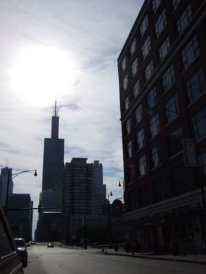
I continued on down the road (Ogden, at this point, I believe), when I looked in one of my mirrors and saw the Chicago Sunday morning Skyline. I thought it worth a picture, and it also confirmed my Sears Tower suspicions.
Progress was made as time went by. I saw the Chicago El in several places before ultimately making my way out of the city completely. I even saw an actual train go by. It was great.
I saw various signs indicating to me just how on the Route 66 that I was, including the historic signs, and many, many signs on stores and businesses.
There were several signs that indicated which way I’d need to go in order to stay on the historic route, and I followed them diligently. That is, until I came to one that forced me up onto the freeway. Well, that’s not exactly accurate—I followed that one too. It’s just that, the sign telling me to get on the freeway was the last Route 66 sign that I’d see for quite some time. Finally, I got frustrated and got off the freeway, consulted my map, and discovered a nearby town that the Old Road ran through. Joliet, IL. I found it, and found the road that I needed to make a right on, but couldn’t because the road had been cut up and parking lotted and buildinged over. I had to find a way around, and that didn’t turn out to be easy, but I managed.
Then, I was really out on the Old Road, America’s Main Street, and driving through Illinois’ corn country. Ah, corn. I’m not sure there’s been a state that I’ve passed through that I haven’t seen corn growing.
I saw some old landmarks of the road. There was a line of telephone poles that parallel the train tracks. Some of the poles are broken down, some of the wires are missing, and some of the poles are only being held up by the wires. I wasn’t sure how I felt about that. In a way, it seemed neat that you could see such history there, but in another way it seemed like no one cared. I’m still not quite sure what to think.
After that, the road kind of split, in a way. The road I was on made it’s turn, but there was another road that sort of came out from underneath my road and made a slower turn. That was the real Old Road.
I made my way along Route 66 as best I could. Sometimes I’d come off of it, and I’d find my way back. Sometimes, I wouldn’t see a sign for miles and miles, and I’d start to think I’d come off it, and get ready to turn around, when suddenly there would appear another sign. It was really neat how that kept happening to me.
Driving through Springfield was neat, and I hadn’t really expected to (that shows a demonstrable lack of knowledge of my undertaking), but since I was, and had seen some historic Lincoln signs, I decided to investigate.
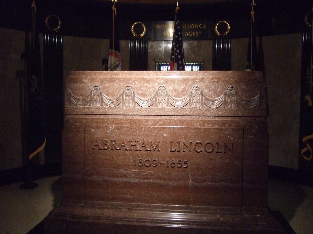
I missed one of my turns to follow 66, and ended up right near the cemetery where Lincoln is entombed, so I thought I’d stop by. As I passed through the gate, a man came up to my truck and gave me a brochure. It told me I was there on the day that the cemetery was celebrating its 150th anniversary. “What an amazing coincidence,” I thought. It does seem pretty unlikely.
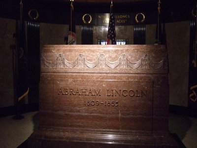
From there, I drove on, and toward Lincoln’s tomb. It was pretty massive. I made the path through the tomb, stopping to read each placard, and took a picture of the stone:
After that, I headed back out to Springfield, and saw their Capitol Building. It was neat. It didn’t seem like a particularly big city, however. It didn’t take me much time at all to get through it. As I was driving, I did wonder whether or not the Springfielders I’d met at the campground back in Gillette, WY were back in town or not, but I really had no idea. I continued the drive.
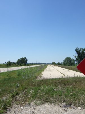
Soon thereafter, I was back in farmland, and got a better look at how the new historic Route 66 and the old one differ:
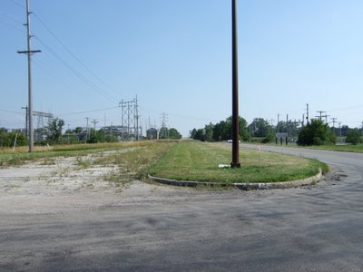
The older one is more overgrown.
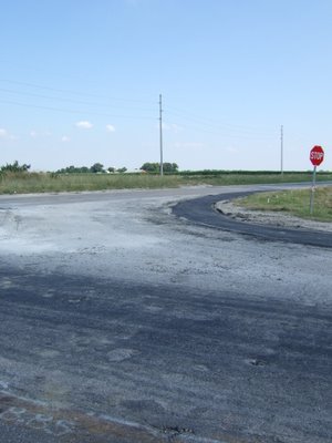
I did find several, nay, many instances where the old, old road is still in regular use, and it was quite surprising to me the state of disrepair it’s kept in. I mean, to look at it, you can see that some attempts have been made to make the road serviceable, but there have been no heroics.
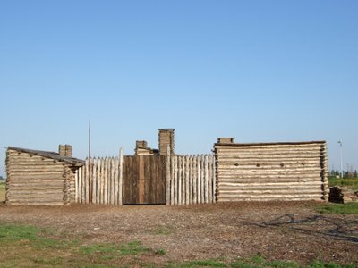
At this point, I was nearing the Mississippi, and the Illinois-Missouri border. This was where one of the two ‘Route 66’ sights that I’d really wanted to see was to be found. It’s called the Chain-of-Rocks Bridge, and somewhere in the middle of it has a 24 degree bend. It’s one of the few bridged constructed with a turn in it. I knew that it wasn’t open to traffic any more, but in the book I have, it says that there are several places to stop and get a look at it from. So, I searched, and I searched, and I searched for a place to get a look at it from. I ended up at yet another Lewis and Clark monument. This one a reconstruction of the fort they built the winter before they left on their historic mission of exploration.
At that site, there had been a sign that had an arrow and the words, “Chain-of-Rocks Canal,” and I thought, “Aha! Now we’re getting somewhere!” Alas, however, there was nothing to see. It really was just a canal. I was disappointed and dejected, and headed back to the main road.
I had lost 66 some time before, and had spent the better part of an hour trying to get it back, when I was finally ready to stop and ask for directions. I was on a highway, and I had to make a right when I finally saw a place that looked like it might have directions for me. I was about to make the left across the road I turned down, when, what do you know, I saw a ‘Historic Route 66’ sign on the road I’d turned down. I followed it.
The end of the road came up to greet me, and said ‘Road Closed, Local Traffic Only.’ I was once more dejected, but saw a glimmer of hope. It was a dirt road that branched off just before the road closed. I jumped at the chance, and drove that one to its end as well. I came to a clearing, and saw an expanse of moving water directly ahead of me, and up above the water and to my right (or north) was a large steel bridge crossing the river. And it had a bend about two thirds of the way across to the Missouri side. I’d found it.

I hung around and took pictures of it for a while, and wondered what it must have been like growing up on the banks of a river like this. Then I realized just how late it was, and that I needed to be getting on my way, if I was to find a place in Missouri to sleep.
I headed for an interstate to take me across the river because Route 66’s bridge, the Chain-of-Rocks Bridge has been closed for quite some time.
The next bridge I came to, the McKinley bridge, was closed as well. I have no idea why, but I do know that I started up it, found it closed, and had to make my way back down the wrong side of the divided road in order to continue south and recommence my search for an interstate bridge. I finally found one, after driving through one of the seedier, underbellier districts of Illinois that I was to pass through. I took the interstate and drove over the bridge, right into: a traffic jam. Bridges that cross borders are not good to me. This one probably took an extra half hour or so to cross because of the road construction.
My two goals at this point were to see the St. Louis Arch, and to go to sleep, preferably at a campground. I used a system of visual referencing to find the arch. That is to say, when I could see the Arch, I’d drive in its general direction. I found it, drove into the parking garage, where I was forced to take a ticket, but the first lane I drove into was ‘out of tickets’ so I had to ‘use other lane.’ The thing that confused me about the whole thing was that you don’t pay in advance, and it’s a flat six dollars. There’s no time charge, or anything, and they have a gatekeeper that you have to pay on your way out. So, my question remains: what is the point of the ticket-taking?
Anyway, I walked up to the top level, and saw the Arch. And my goodness, is it ever gigantic. I couldn’t get far enough away from it in the park to get the whole thing in the frame for my picture of it. That made me a little sad, but there wasn’t really anything I could do about it. So, after having called some friends, to tell them of my ‘jack-in-the-box’ style tourism, I took my pictures and left the arch, in search of sleep and a place to get it.

My next real objective was to find the interstate and get myself to the campground I knew was somewhere nearby. I found the interstate easily enough, but the campground was another matter, entirely. I drove for quite a ways on I-44, but then thought to myself, “the more I stay on this road, the less I’m doing what I want to be doing out here.” So I saw a sign for a Motel6, took the exit, and experienced more tales in the making.
I parked outside the office of the Motel6, went inside, and asked the man at the desk if they accepted traveler’s checks. He took a moment, tap-tap-tapped on his computer, looked up and innocently said, ‘nope.’ I was taken aback, partially because this was a motel for people who travel, and also because during the time he’d taken to look it up, I’d looked over at their sign which listed their accepted forms of payment as “Cash, Traveler’s Check, and Major Credit Card,” the sign went on to list the acceptable credit cards, but I need not go into that. I looked back at him and said, “your sign says you do.” He went back to tapping, then looked back at me and asked, “where does it say we do?” just as innocently as before. I pointed at their big sign right on the wall near his computer. He finally complied, and he asked me a couple more questions about what kind of room I wanted. The one that sticks out in my mind is the ‘Smoking, or Non,’ question, because I distinctly remember saying ‘non,’ but the room I was placed in reeked of smoke. It was gross, but I was tired. I called my parents, watched some television, and promptly fell asleep. The only other thing I remember about that is that I asked if there was any internet access, he politely told me “No, but if you have an AOL dial-up number, I’m sure you can use that...” And that is why, in my mind, I’ve decided to call it Motel Sux. I wasn’t expecting anything grand, but I only paid a few dollars less than the really nice motel I stayed at in Mitchell, SD. So, as far as comparison’s concerned, I don’t think I’ll be staying at a Motel Sux again.
 That road soon dumped me off back onto suburban streets, which I thought was quite puzzling. As I drove through the area, I saw some nice-looking churches. This is one such example:
 I had finally found a road on my map that it looked like I could take into downtown Chicago and turn on Adams (the current start of Historic Route 66). It happened to be the road that most closely followed the lake’s shore. I thought that was quite handy, considering the fact that that was what I’d been trying to do all along. I soon ended up on that road, and found that (much to my chagrin) it was a limited-access road with no exit for Adams. So there I was, in a strange, gigantic city, driving around on roads I don’t know, looking for a road that I’m not sure where to find. I tried to take the next exit from the freeway that I was on, but it was odd. There was a right turn lane from the free way that forced you to go straight across the road that parallels the freeway. I ended up making a sort of ‘z’ and turning left across the road I was only supposed to go straight across, thinking that I needed to get a little further south.
It was hectic.
From there, I drove straight and came to a road that looked as though it only went into a hotel parking garage. What was worse, was the fact that it didn’t, but the road made a right turn around the hotel, and was made worse still by the compounded badness of a limousine (of which there were many) that had gotten stuck trying to make the turn out of the garage onto the narrow street that I, too, was trying to turn on.
So there I was, at every stop sign and light, trying in vain to study my map, for some clue that would guide me to that envisioned, but in reality unknown place I needed to be. I made another right, and was headed north. At some point I made yet another right and was headed back east. It was all quite surreal.
After that it gets a little hazy, because I know that I made a left turn to head back west (I could see the lake on my right side, so I know I’d been close to it), when suddenly I saw a sign I’d been longing for mightily:
I had finally found a road on my map that it looked like I could take into downtown Chicago and turn on Adams (the current start of Historic Route 66). It happened to be the road that most closely followed the lake’s shore. I thought that was quite handy, considering the fact that that was what I’d been trying to do all along. I soon ended up on that road, and found that (much to my chagrin) it was a limited-access road with no exit for Adams. So there I was, in a strange, gigantic city, driving around on roads I don’t know, looking for a road that I’m not sure where to find. I tried to take the next exit from the freeway that I was on, but it was odd. There was a right turn lane from the free way that forced you to go straight across the road that parallels the freeway. I ended up making a sort of ‘z’ and turning left across the road I was only supposed to go straight across, thinking that I needed to get a little further south.
It was hectic.
From there, I drove straight and came to a road that looked as though it only went into a hotel parking garage. What was worse, was the fact that it didn’t, but the road made a right turn around the hotel, and was made worse still by the compounded badness of a limousine (of which there were many) that had gotten stuck trying to make the turn out of the garage onto the narrow street that I, too, was trying to turn on.
So there I was, at every stop sign and light, trying in vain to study my map, for some clue that would guide me to that envisioned, but in reality unknown place I needed to be. I made another right, and was headed north. At some point I made yet another right and was headed back east. It was all quite surreal.
After that it gets a little hazy, because I know that I made a left turn to head back west (I could see the lake on my right side, so I know I’d been close to it), when suddenly I saw a sign I’d been longing for mightily:
 you may not be able to read it, but it says that I was at the intersection of Adams and Wabash, and that’s where it all begins.
I drove a little further and thought to myself that I was in some kind of urban canyon, the scope of which I’d not personally seen equaled. So, it was worth a picture or two. Chicago’s Adams street canyon:
you may not be able to read it, but it says that I was at the intersection of Adams and Wabash, and that’s where it all begins.
I drove a little further and thought to myself that I was in some kind of urban canyon, the scope of which I’d not personally seen equaled. So, it was worth a picture or two. Chicago’s Adams street canyon:
 I knew that I would be seeing plenty of tall buildings, one of which would be the Sears Tower, but wasn’t entirely sure that I’d be able to pick it out of a line-up, especially from my vehicle-bound vantage point. I also knew that I’d be passing the tower on my right, and I couldn’t see much above about the second floor of any given building out my passenger window, but somehow I managed to get this picture:
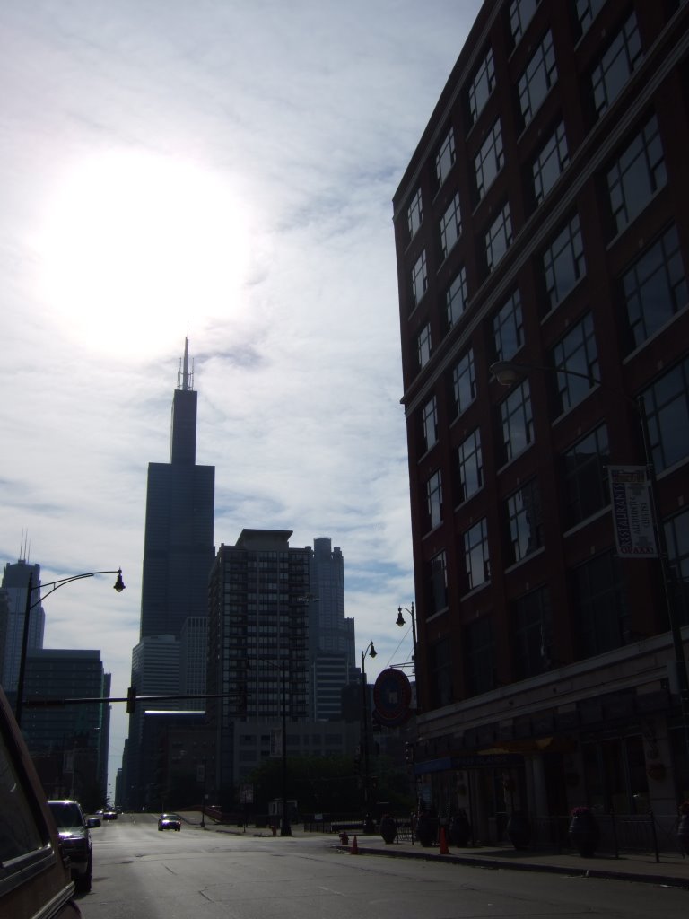
 And now that I think about it, the situation I’ve just described doesn’t match up with my interpretation of my spatial relation to the object of my photograph. Maybe my map was wrong... Anyway, at the time I wasn’t entirely sure that the building I’d seen was in fact the Sears Tower, but a skyline picture you’ll see in a moment resolves that dispute.
I knew that I was on the right road, this Route 66, I just needed a way to be sure. And then, there appeared a sign, a sign confirming my choice in paths as having been correct (and one telling me not to park there):
And now that I think about it, the situation I’ve just described doesn’t match up with my interpretation of my spatial relation to the object of my photograph. Maybe my map was wrong... Anyway, at the time I wasn’t entirely sure that the building I’d seen was in fact the Sears Tower, but a skyline picture you’ll see in a moment resolves that dispute.
I knew that I was on the right road, this Route 66, I just needed a way to be sure. And then, there appeared a sign, a sign confirming my choice in paths as having been correct (and one telling me not to park there):
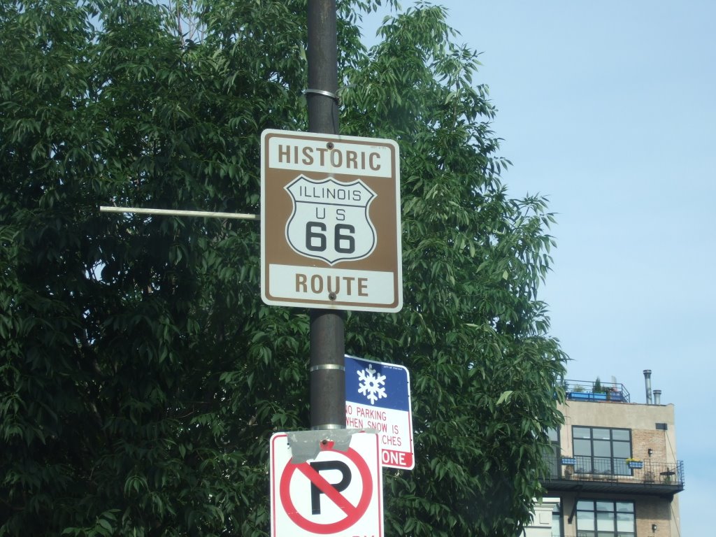 Historic Route 66, Illinois. It was magical. Not literally, of course. There was no one waving a magic wand as I passed by, or pulling a rabbit out of their hat, but it felt really good after having thought about and planned this for so long to finally see some hard evidence of my time and money paying off.
I continued on down the road (Ogden, at this point, I believe), when I looked in one of my mirrors and saw the Chicago Sunday morning Skyline. I thought it worth a picture, and it also confirmed my Sears Tower suspicions.
Historic Route 66, Illinois. It was magical. Not literally, of course. There was no one waving a magic wand as I passed by, or pulling a rabbit out of their hat, but it felt really good after having thought about and planned this for so long to finally see some hard evidence of my time and money paying off.
I continued on down the road (Ogden, at this point, I believe), when I looked in one of my mirrors and saw the Chicago Sunday morning Skyline. I thought it worth a picture, and it also confirmed my Sears Tower suspicions.
 Progress was made as time went by. I saw the Chicago El in several places before ultimately making my way out of the city completely. I even saw an actual train go by. It was great.
I saw various signs indicating to me just how on the Route 66 that I was, including the historic signs, and many, many signs on stores and businesses.
There were several signs that indicated which way I’d need to go in order to stay on the historic route, and I followed them diligently. That is, until I came to one that forced me up onto the freeway. Well, that’s not exactly accurate—I followed that one too. It’s just that, the sign telling me to get on the freeway was the last Route 66 sign that I’d see for quite some time. Finally, I got frustrated and got off the freeway, consulted my map, and discovered a nearby town that the Old Road ran through. Joliet, IL. I found it, and found the road that I needed to make a right on, but couldn’t because the road had been cut up and parking lotted and buildinged over. I had to find a way around, and that didn’t turn out to be easy, but I managed.
Then, I was really out on the Old Road, America’s Main Street, and driving through Illinois’ corn country. Ah, corn. I’m not sure there’s been a state that I’ve passed through that I haven’t seen corn growing.
I saw some old landmarks of the road. There was a line of telephone poles that parallel the train tracks. Some of the poles are broken down, some of the wires are missing, and some of the poles are only being held up by the wires. I wasn’t sure how I felt about that. In a way, it seemed neat that you could see such history there, but in another way it seemed like no one cared. I’m still not quite sure what to think.
After that, the road kind of split, in a way. The road I was on made it’s turn, but there was another road that sort of came out from underneath my road and made a slower turn. That was the real Old Road.
Progress was made as time went by. I saw the Chicago El in several places before ultimately making my way out of the city completely. I even saw an actual train go by. It was great.
I saw various signs indicating to me just how on the Route 66 that I was, including the historic signs, and many, many signs on stores and businesses.
There were several signs that indicated which way I’d need to go in order to stay on the historic route, and I followed them diligently. That is, until I came to one that forced me up onto the freeway. Well, that’s not exactly accurate—I followed that one too. It’s just that, the sign telling me to get on the freeway was the last Route 66 sign that I’d see for quite some time. Finally, I got frustrated and got off the freeway, consulted my map, and discovered a nearby town that the Old Road ran through. Joliet, IL. I found it, and found the road that I needed to make a right on, but couldn’t because the road had been cut up and parking lotted and buildinged over. I had to find a way around, and that didn’t turn out to be easy, but I managed.
Then, I was really out on the Old Road, America’s Main Street, and driving through Illinois’ corn country. Ah, corn. I’m not sure there’s been a state that I’ve passed through that I haven’t seen corn growing.
I saw some old landmarks of the road. There was a line of telephone poles that parallel the train tracks. Some of the poles are broken down, some of the wires are missing, and some of the poles are only being held up by the wires. I wasn’t sure how I felt about that. In a way, it seemed neat that you could see such history there, but in another way it seemed like no one cared. I’m still not quite sure what to think.
After that, the road kind of split, in a way. The road I was on made it’s turn, but there was another road that sort of came out from underneath my road and made a slower turn. That was the real Old Road.
 After that, I headed back out to Springfield, and saw their Capitol Building. It was neat. It didn’t seem like a particularly big city, however. It didn’t take me much time at all to get through it. As I was driving, I did wonder whether or not the Springfielders I’d met at the campground back in Gillette, WY were back in town or not, but I really had no idea. I continued the drive.
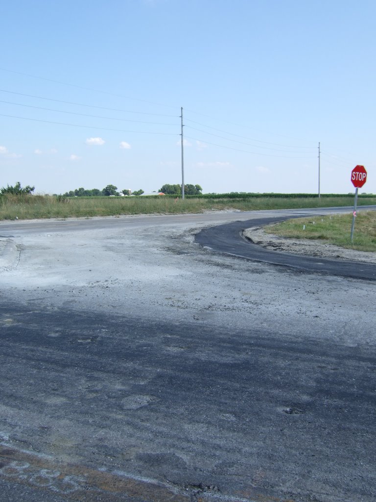
Soon thereafter, I was back in farmland, and got a better look at how the new historic Route 66 and the old one differ:
After that, I headed back out to Springfield, and saw their Capitol Building. It was neat. It didn’t seem like a particularly big city, however. It didn’t take me much time at all to get through it. As I was driving, I did wonder whether or not the Springfielders I’d met at the campground back in Gillette, WY were back in town or not, but I really had no idea. I continued the drive.
Soon thereafter, I was back in farmland, and got a better look at how the new historic Route 66 and the old one differ:
 The older one is more overgrown.
I did find several, nay, many instances where the old, old road is still in regular use, and it was quite surprising to me the state of disrepair it’s kept in. I mean, to look at it, you can see that some attempts have been made to make the road serviceable, but there have been no heroics.
The older one is more overgrown.
I did find several, nay, many instances where the old, old road is still in regular use, and it was quite surprising to me the state of disrepair it’s kept in. I mean, to look at it, you can see that some attempts have been made to make the road serviceable, but there have been no heroics.
 At this point, I was nearing the Mississippi, and the Illinois-Missouri border. This was where one of the two ‘Route 66’ sights that I’d really wanted to see was to be found. It’s called the Chain-of-Rocks Bridge, and somewhere in the middle of it has a 24 degree bend. It’s one of the few bridged constructed with a turn in it. I knew that it wasn’t open to traffic any more, but in the book I have, it says that there are several places to stop and get a look at it from. So, I searched, and I searched, and I searched for a place to get a look at it from. I ended up at yet another Lewis and Clark monument. This one a reconstruction of the fort they built the winter before they left on their historic mission of exploration.
 At that site, there had been a sign that had an arrow and the words, “Chain-of-Rocks Canal,” and I thought, “Aha! Now we’re getting somewhere!” Alas, however, there was nothing to see. It really was just a canal. I was disappointed and dejected, and headed back to the main road.
I had lost 66 some time before, and had spent the better part of an hour trying to get it back, when I was finally ready to stop and ask for directions. I was on a highway, and I had to make a right when I finally saw a place that looked like it might have directions for me. I was about to make the left across the road I turned down, when, what do you know, I saw a ‘Historic Route 66’ sign on the road I’d turned down. I followed it.
The end of the road came up to greet me, and said ‘Road Closed, Local Traffic Only.’ I was once more dejected, but saw a glimmer of hope. It was a dirt road that branched off just before the road closed. I jumped at the chance, and drove that one to its end as well. I came to a clearing, and saw an expanse of moving water directly ahead of me, and up above the water and to my right (or north) was a large steel bridge crossing the river. And it had a bend about two thirds of the way across to the Missouri side. I’d found it.
At that site, there had been a sign that had an arrow and the words, “Chain-of-Rocks Canal,” and I thought, “Aha! Now we’re getting somewhere!” Alas, however, there was nothing to see. It really was just a canal. I was disappointed and dejected, and headed back to the main road.
I had lost 66 some time before, and had spent the better part of an hour trying to get it back, when I was finally ready to stop and ask for directions. I was on a highway, and I had to make a right when I finally saw a place that looked like it might have directions for me. I was about to make the left across the road I turned down, when, what do you know, I saw a ‘Historic Route 66’ sign on the road I’d turned down. I followed it.
The end of the road came up to greet me, and said ‘Road Closed, Local Traffic Only.’ I was once more dejected, but saw a glimmer of hope. It was a dirt road that branched off just before the road closed. I jumped at the chance, and drove that one to its end as well. I came to a clearing, and saw an expanse of moving water directly ahead of me, and up above the water and to my right (or north) was a large steel bridge crossing the river. And it had a bend about two thirds of the way across to the Missouri side. I’d found it.
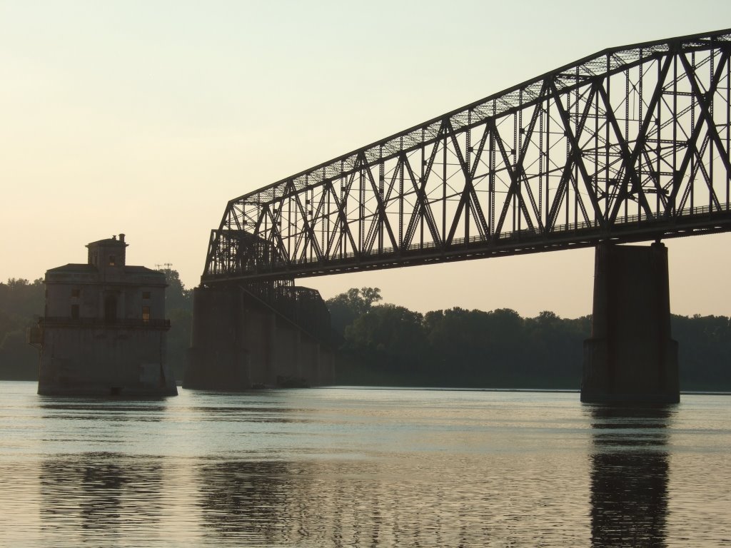 I hung around and took pictures of it for a while, and wondered what it must have been like growing up on the banks of a river like this. Then I realized just how late it was, and that I needed to be getting on my way, if I was to find a place in Missouri to sleep.
I headed for an interstate to take me across the river because Route 66’s bridge, the Chain-of-Rocks Bridge has been closed for quite some time.
The next bridge I came to, the McKinley bridge, was closed as well. I have no idea why, but I do know that I started up it, found it closed, and had to make my way back down the wrong side of the divided road in order to continue south and recommence my search for an interstate bridge. I finally found one, after driving through one of the seedier, underbellier districts of Illinois that I was to pass through. I took the interstate and drove over the bridge, right into: a traffic jam. Bridges that cross borders are not good to me. This one probably took an extra half hour or so to cross because of the road construction.
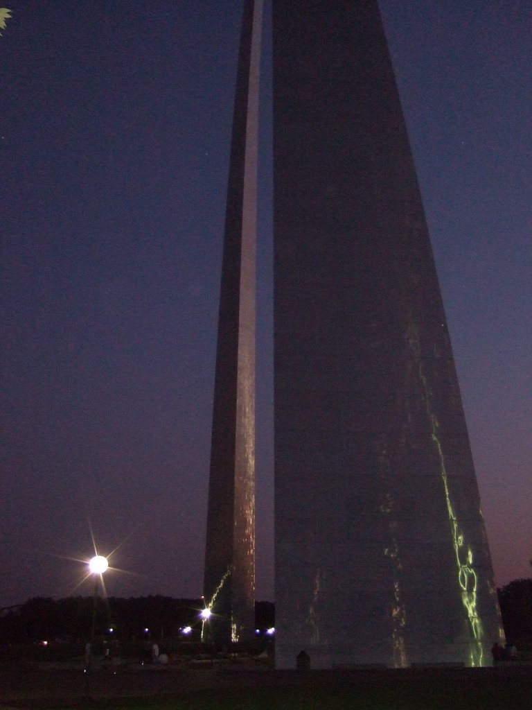
My two goals at this point were to see the St. Louis Arch, and to go to sleep, preferably at a campground. I used a system of visual referencing to find the arch. That is to say, when I could see the Arch, I’d drive in its general direction. I found it, drove into the parking garage, where I was forced to take a ticket, but the first lane I drove into was ‘out of tickets’ so I had to ‘use other lane.’ The thing that confused me about the whole thing was that you don’t pay in advance, and it’s a flat six dollars. There’s no time charge, or anything, and they have a gatekeeper that you have to pay on your way out. So, my question remains: what is the point of the ticket-taking?
Anyway, I walked up to the top level, and saw the Arch. And my goodness, is it ever gigantic. I couldn’t get far enough away from it in the park to get the whole thing in the frame for my picture of it. That made me a little sad, but there wasn’t really anything I could do about it. So, after having called some friends, to tell them of my ‘jack-in-the-box’ style tourism, I took my pictures and left the arch, in search of sleep and a place to get it.
I hung around and took pictures of it for a while, and wondered what it must have been like growing up on the banks of a river like this. Then I realized just how late it was, and that I needed to be getting on my way, if I was to find a place in Missouri to sleep.
I headed for an interstate to take me across the river because Route 66’s bridge, the Chain-of-Rocks Bridge has been closed for quite some time.
The next bridge I came to, the McKinley bridge, was closed as well. I have no idea why, but I do know that I started up it, found it closed, and had to make my way back down the wrong side of the divided road in order to continue south and recommence my search for an interstate bridge. I finally found one, after driving through one of the seedier, underbellier districts of Illinois that I was to pass through. I took the interstate and drove over the bridge, right into: a traffic jam. Bridges that cross borders are not good to me. This one probably took an extra half hour or so to cross because of the road construction.
My two goals at this point were to see the St. Louis Arch, and to go to sleep, preferably at a campground. I used a system of visual referencing to find the arch. That is to say, when I could see the Arch, I’d drive in its general direction. I found it, drove into the parking garage, where I was forced to take a ticket, but the first lane I drove into was ‘out of tickets’ so I had to ‘use other lane.’ The thing that confused me about the whole thing was that you don’t pay in advance, and it’s a flat six dollars. There’s no time charge, or anything, and they have a gatekeeper that you have to pay on your way out. So, my question remains: what is the point of the ticket-taking?
Anyway, I walked up to the top level, and saw the Arch. And my goodness, is it ever gigantic. I couldn’t get far enough away from it in the park to get the whole thing in the frame for my picture of it. That made me a little sad, but there wasn’t really anything I could do about it. So, after having called some friends, to tell them of my ‘jack-in-the-box’ style tourism, I took my pictures and left the arch, in search of sleep and a place to get it.
 My next real objective was to find the interstate and get myself to the campground I knew was somewhere nearby. I found the interstate easily enough, but the campground was another matter, entirely. I drove for quite a ways on I-44, but then thought to myself, “the more I stay on this road, the less I’m doing what I want to be doing out here.” So I saw a sign for a Motel6, took the exit, and experienced more tales in the making.
I parked outside the office of the Motel6, went inside, and asked the man at the desk if they accepted traveler’s checks. He took a moment, tap-tap-tapped on his computer, looked up and innocently said, ‘nope.’ I was taken aback, partially because this was a motel for people who travel, and also because during the time he’d taken to look it up, I’d looked over at their sign which listed their accepted forms of payment as “Cash, Traveler’s Check, and Major Credit Card,” the sign went on to list the acceptable credit cards, but I need not go into that. I looked back at him and said, “your sign says you do.” He went back to tapping, then looked back at me and asked, “where does it say we do?” just as innocently as before. I pointed at their big sign right on the wall near his computer. He finally complied, and he asked me a couple more questions about what kind of room I wanted. The one that sticks out in my mind is the ‘Smoking, or Non,’ question, because I distinctly remember saying ‘non,’ but the room I was placed in reeked of smoke. It was gross, but I was tired. I called my parents, watched some television, and promptly fell asleep. The only other thing I remember about that is that I asked if there was any internet access, he politely told me “No, but if you have an AOL dial-up number, I’m sure you can use that...” And that is why, in my mind, I’ve decided to call it Motel Sux. I wasn’t expecting anything grand, but I only paid a few dollars less than the really nice motel I stayed at in Mitchell, SD. So, as far as comparison’s concerned, I don’t think I’ll be staying at a Motel Sux again.
My next real objective was to find the interstate and get myself to the campground I knew was somewhere nearby. I found the interstate easily enough, but the campground was another matter, entirely. I drove for quite a ways on I-44, but then thought to myself, “the more I stay on this road, the less I’m doing what I want to be doing out here.” So I saw a sign for a Motel6, took the exit, and experienced more tales in the making.
I parked outside the office of the Motel6, went inside, and asked the man at the desk if they accepted traveler’s checks. He took a moment, tap-tap-tapped on his computer, looked up and innocently said, ‘nope.’ I was taken aback, partially because this was a motel for people who travel, and also because during the time he’d taken to look it up, I’d looked over at their sign which listed their accepted forms of payment as “Cash, Traveler’s Check, and Major Credit Card,” the sign went on to list the acceptable credit cards, but I need not go into that. I looked back at him and said, “your sign says you do.” He went back to tapping, then looked back at me and asked, “where does it say we do?” just as innocently as before. I pointed at their big sign right on the wall near his computer. He finally complied, and he asked me a couple more questions about what kind of room I wanted. The one that sticks out in my mind is the ‘Smoking, or Non,’ question, because I distinctly remember saying ‘non,’ but the room I was placed in reeked of smoke. It was gross, but I was tired. I called my parents, watched some television, and promptly fell asleep. The only other thing I remember about that is that I asked if there was any internet access, he politely told me “No, but if you have an AOL dial-up number, I’m sure you can use that...” And that is why, in my mind, I’ve decided to call it Motel Sux. I wasn’t expecting anything grand, but I only paid a few dollars less than the really nice motel I stayed at in Mitchell, SD. So, as far as comparison’s concerned, I don’t think I’ll be staying at a Motel Sux again.
2 comments:
Hi. I'm Leah. The horseshoe pitcher from springfield. Yes we made it home on the 16th. I'm glad you got to see a Lincoln site. Springfield is not big at all. People laugh when I say that. But it isn't.
If you think Route 66 in downtown Chicago is fun, just wait until you try finding 101 in San Francisco. We had quite an adventure, however the highlight of the evening was seeing an open convertible that had kissed a fire hydrant, which in turn was showering it with love (and a lot of water). He he he..... It was a site to behold, my favorite San Fran memory.
You should have watched 'Cars' before you left. Then you would have known exactly how abandoned and forlorn 66 really is. Hey, maybe you'll drive across the new patch of pavement that Owen Wilson paved in the movie! :)
love, gwynn
Google......
Post a Comment