Hello, all. As of this writing, yesterday was the day that I finally set out on my much talked about journey.
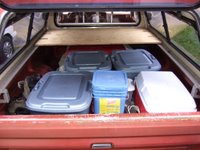
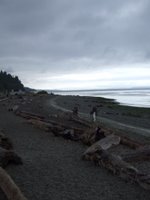
To get write (ha!) to the point, allow me to begin: I left my house yesterday at about ten before nine in the morning. I started going forward by going backwards. That is to say I started going east by going west. In short, I wanted to see the Puget Sound one more time before setting out wholesale for more eastern parts unknown, and, assuming I don’t radically alter my course and go all the way to the Atlantic, I figured this would be my last chance to see anything remotely ocean-like until I get to California (unless you count the great lakes as ocean-like).
I got on I-5 southbound in hopes of finding I-90 eastbound, and at some point was struck by the crazy notion of taking the express lanes. I figured that an exit as major as I-90 had to make it into the express lane scheme, didn’t it? I was badly mistaken. There was no such exit to be found, at least not by me. I ended up driving a couple of miles further south, turning around and getting stuck in the quagmire of I-5’s south of Seattle northbound traffic. It was no good.
Eventually I found my way back to I-90 and took the appropriate exit. I drove across the lake, through the east side, and on up over the pass without incident.
I saw a sign for a wayside bathroom and thought to myself, ‘now’s as good a time as any, plus I need to figure out where I’m going and when to turn,’ and so on. Well, I stopped and used the bathroom there, but I would rather not have. You see, they were brick and mortar buildings, like you find at regular rest areas, but that’s where the traditional rest area theme was quickly stopped. There was no real plumbing. The toilet was a seat with a hole leading to a pit. Just like an overgrown port-a-potty. Except with no port-a... Just gross potty, I guess.
After getting back to my truck, I used my handy handi-wipes to wipe my hands, and took out the map. I determined that the proper course would be to turn south on I-82 just after Ellensburg, because there was a scenic overlook there which I saw last summer but didn’t actually get to look over.
When I got to the overlook, I got out of my truck and sniffed the air. Something didn’t smell quite right. It smelled like burning, and, as many of you drivers of vehicles may know, that’s not a smell you want to smell when you’re alone in a parking lot after having driven a hundred some odd miles, and planning to drive thousands more. So I pop the hood, check things out, and see that there is rather a substantial quantity of smoke coming from, you know, the engine. Now, it doesn’t seem like that’s a good thing to me, either. However, my truck does have a history of burning some oil, so I’m hoping that that’s all it’s doing. We’ll see.
Oh yeah, a guy in scrubs pulled up in his Subaru Outback and asked me if I was broken down. After peering into the engine compartment I replied back to him as nonchalantly as I could, “No,” and closed the hood. Then I grabbed my cameras and headed for the scenic overlook. I took a few pictures, but I think the one that follows turned out the best.
Then, for whatever reason, I continued south on the 82—oh yeah, I remember now, it was because there were any places to turn around for about the next 10 miles. Anyway, I’m glad I kept going that way because otherwise I would have gotten back on I-90, and the day wouldn’t have been nearly as interesting.
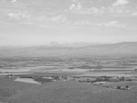
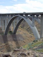
Headed south on the I-82 was nothing much of interest, that is, until I crossed the Redmon bridge and stopped at the subsequent rest area. The Redmon bridge spans what I will hazard a guess to call the Selah Canyon, and both are pictured below.
Also of note is the fact that from that rest stop, and other places along that stretch of road, you can see Mount Rainier. Which is odd to me, because I’m only used to seeing it in western Washington. Here it is from the east.
Under normal circumstances, I would have needed to fill up my truck’s fuel tank somewhere near that point in time and distance, but the gauge was being funny, so I decided to risk it, and head east instead of stopping in Yakima. The next town I saw that I was relatively certain that I could get gas at was about 80 miles away, and my trip odometer was over 200. I normally fill up between 200 and 240 (the gauge reads a quarter tank), if that tells you anything. At that distance yesterday, the gauge read slightly less than half. So I chanced it.
On my way to Othello I saw something I was quite surprised to see. It was sand, but sand like desert sand, like dunes are made of. I was quite amazed. So I took a picture. While driving.
After getting to Othello, I stopped at the first gas station I saw, asked them if they took travelers checks, and was told that, “No,” they don’t. I asked if they knew of any gas station around there that did, and they said, “Yes,” and gave me awfully confusing directions to the gas station that ultimately didn’t accept the either. So I tried another one, and it did. By the time I’d stopped at the last gas station I was so frazzled and worried about gas station willingness to accept my form of funds, I didn’t even notice what pump number I’d stopped at. And it turned out to be pump first, pay later. I haven’t stopped at one of those in years.
Then I was amazed. It didn’t take nearly as long to fill up my gas tank as I thought it would. Mostly because it didn’t take nearly as much gas. A little over 11 ½ gallons. Which means that my truck got better than 24 1/3 miles per gallon. And that’s pretty great considering it usually gets between 18 and 20. I was well pleased (and still am, for that matter).
After consulting the map once again, I determined that I wouldn’t get back on the interstate system. At least, not for a while. So I continued east on highway 26. Where, after many, many fields of things including, but not limited to: wheat and corn and (what I think must have been) mint(the mint fields were often quite strong in smell, but were occasionally extremely... pleasant) , I saw a building which made me realize just where I was:
Cougar country.
Ironically (or obviously, depending on how you want to look at things) the next place I stopped was Pullman. It sure was a big college town. It made me wonder how many people live there who are in no way connected with the school. I’d guess it’s not a very high percentage.
It was getting late, and I wanted to check my map and eat something, so I stopped at a Safeway. I was there for a surprisingly long time. I bought some ice while there. There was nothing particularly shocking about that Safeway.
I drove on, into the friscalating dusklight, and saw from the road a tall church steeple. I thought to myself, “I’ve become far too destination oriented, and not as journey oriented as I was wanting to be. Now’s my chance to go and see something just for the sake of curiosity.” That might be a little too detailed a description of my thought and how I thought it, but you get the idea. Anyway, I stopped in Colton and took a few pictures of the St. Gall church building. It was pretty amazing. Then the caretaker came out and told me that the doors were open if I wanted to go inside. I politely told him no thanks, and that I was just passing through, when he told me of another, bigger, more impressively large church building three miles to the south: St. Boniface. He said it was no coincidence either. Apparently there’d been some kind of feud between the Catholics of Colton and the Catholics of Uniontown, so the Uniontownsmen broke off, and went their own way, electing to build a bigger, better, 2 STEEPLED church for themselves to go to. And here they are for your viewing pleasure (see if you can guess which is which).
I snapped my photos with my digital camera, which makes that annoying shutter snapping sound, and continued on my merry way. Sometimes needing my sunglasses, sometimes not. The sun and the hills and the mirrors were reeking havoc on my eyes.
Then, suddenly and without warning, I was in Idaho. I don’t even know how it happened. One minute I was driving along in Washington, and then I was driving along in Idaho. How odd.
Shortly after my Idaho-entry shock subsided, I followed a turn in the road and could see that I was on the top of a large hill (mountain maybe?) and there was a city far below. I stopped at a weigh station and snapped a few photos. In this one there are two old cars on the edge of the hill by an antique shop. It makes me think that they are standing guard over the city.
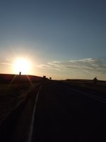
After that I turned around and took a picture of the setting sun. I thought it was neat.
From there I turned around again, but a different way (and a little further) and took a picture of mine and my truck’s shadows. The sun (as you’ve probably seen already) was quite low on the horizon.
A little ways down the road I saw another, better spot to pull off and see the sights. I thought it was awesome. In the dictionary way, and the surfer way, too, I guess. I could see some hills to the east, and the city of Lewiston a little to the south and west, more south though.
After that it was time for me to start thinking about hanging it up for the night. But where, oh where, to sleep? I thought a campground would be appropriate for my first night’s sleep. So I put my mind to finding a campground. It took me a very, very long time. In fact, there were many times that I thought about just pulling off on a wide patch of shoulder and sleeping there. In Driver’s Ed. they told us to do that if we were tired—but I don’t know if that flies when you’re curled up in a sleeping bag... Although I did see a truck and camping trailer pulled off just like I was thinking about, and the campers interior lights were on, so I think that’s what those people were planning. Hmmm...
Anyhow, I ended up stopping at the Winchester, ID state park and campground. There are two loops in the campground, an A loop (16.80 per night, no amenities) and a B loop (20.80 per night, water and electricity). I drove all up and down the A loop (sometimes the wrong direction—sometimes backwards because some people and their friends had too many cars and were blocking the road—and sometimes just because I went the wrong way down a one way stretch of road. Unfortunately all the empty camping spaces had tags on them telling me just how reserved they were. Alas, I made my way up to the B loop, where, after about three or four camping spaces I found an unreserved and empty space. Then it took me three trips from truck to campground money dropbox to get everything right. First I had improper change (and wasn’t about to give them any extra), then I forgot to write down my truck’s plate number. And then, finally when I thought I was going to be able to go and organize my truck, and then do some writing and then go to sleep, I find that they have a little amphitheater where they are playing “The Man From Snowy River.” So I sat and watched that, and then came back to my truck, organized it, went to the bathroom, brushed the teeth, came back, sat in my makeshift bed, didn’t sleep for about an hour, left myself some voice recordings, and then went into my fitful ‘I’m in a strange place’ kind of sleep. Which means I sleep for about five hours, and then wake up every half hour from then until I get up.
This morning, I’ve showered, eaten breakfast, and written this. We’ll see what else I can do with the day. Hopefully I can get this posted in the next day or two, so that all of you can read about my exciting and wondrous exploits... er... adventures.
 I got on I-5 southbound in hopes of finding I-90 eastbound, and at some point was struck by the crazy notion of taking the express lanes. I figured that an exit as major as I-90 had to make it into the express lane scheme, didn’t it? I was badly mistaken. There was no such exit to be found, at least not by me. I ended up driving a couple of miles further south, turning around and getting stuck in the quagmire of I-5’s south of Seattle northbound traffic. It was no good.
Eventually I found my way back to I-90 and took the appropriate exit. I drove across the lake, through the east side, and on up over the pass without incident.
I saw a sign for a wayside bathroom and thought to myself, ‘now’s as good a time as any, plus I need to figure out where I’m going and when to turn,’ and so on. Well, I stopped and used the bathroom there, but I would rather not have. You see, they were brick and mortar buildings, like you find at regular rest areas, but that’s where the traditional rest area theme was quickly stopped. There was no real plumbing. The toilet was a seat with a hole leading to a pit. Just like an overgrown port-a-potty. Except with no port-a... Just gross potty, I guess.
After getting back to my truck, I used my handy handi-wipes to wipe my hands, and took out the map. I determined that the proper course would be to turn south on I-82 just after Ellensburg, because there was a scenic overlook there which I saw last summer but didn’t actually get to look over.
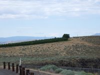
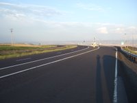
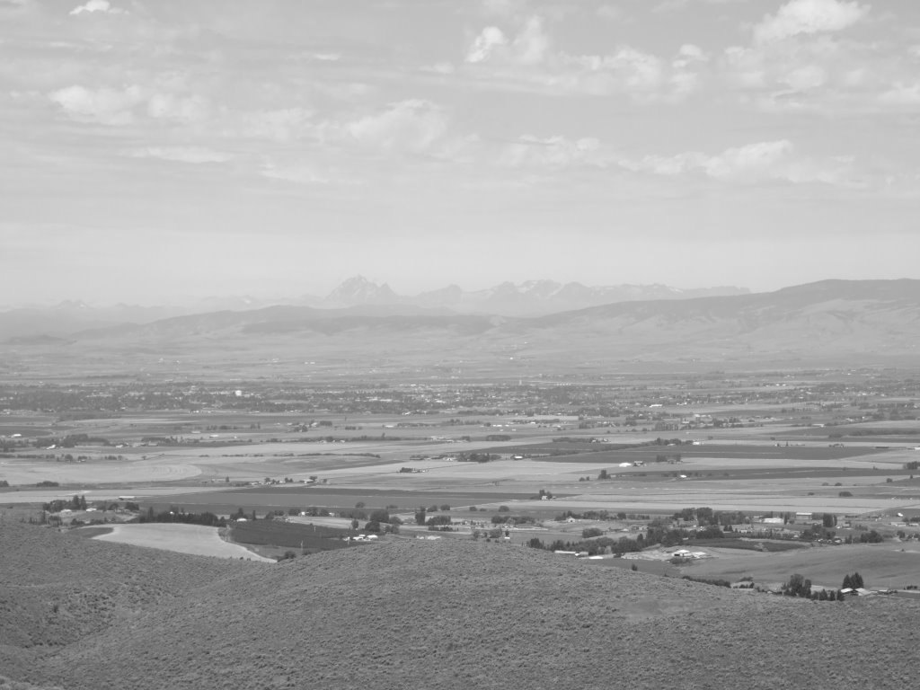
When I got to the overlook, I got out of my truck and sniffed the air. Something didn’t smell quite right. It smelled like burning, and, as many of you drivers of vehicles may know, that’s not a smell you want to smell when you’re alone in a parking lot after having driven a hundred some odd miles, and planning to drive thousands more. So I pop the hood, check things out, and see that there is rather a substantial quantity of smoke coming from, you know, the engine. Now, it doesn’t seem like that’s a good thing to me, either. However, my truck does have a history of burning some oil, so I’m hoping that that’s all it’s doing. We’ll see.
Oh yeah, a guy in scrubs pulled up in his Subaru Outback and asked me if I was broken down. After peering into the engine compartment I replied back to him as nonchalantly as I could, “No,” and closed the hood. Then I grabbed my cameras and headed for the scenic overlook. I took a few pictures, but I think the one that follows turned out the best.
I got on I-5 southbound in hopes of finding I-90 eastbound, and at some point was struck by the crazy notion of taking the express lanes. I figured that an exit as major as I-90 had to make it into the express lane scheme, didn’t it? I was badly mistaken. There was no such exit to be found, at least not by me. I ended up driving a couple of miles further south, turning around and getting stuck in the quagmire of I-5’s south of Seattle northbound traffic. It was no good.
Eventually I found my way back to I-90 and took the appropriate exit. I drove across the lake, through the east side, and on up over the pass without incident.
I saw a sign for a wayside bathroom and thought to myself, ‘now’s as good a time as any, plus I need to figure out where I’m going and when to turn,’ and so on. Well, I stopped and used the bathroom there, but I would rather not have. You see, they were brick and mortar buildings, like you find at regular rest areas, but that’s where the traditional rest area theme was quickly stopped. There was no real plumbing. The toilet was a seat with a hole leading to a pit. Just like an overgrown port-a-potty. Except with no port-a... Just gross potty, I guess.
After getting back to my truck, I used my handy handi-wipes to wipe my hands, and took out the map. I determined that the proper course would be to turn south on I-82 just after Ellensburg, because there was a scenic overlook there which I saw last summer but didn’t actually get to look over.
When I got to the overlook, I got out of my truck and sniffed the air. Something didn’t smell quite right. It smelled like burning, and, as many of you drivers of vehicles may know, that’s not a smell you want to smell when you’re alone in a parking lot after having driven a hundred some odd miles, and planning to drive thousands more. So I pop the hood, check things out, and see that there is rather a substantial quantity of smoke coming from, you know, the engine. Now, it doesn’t seem like that’s a good thing to me, either. However, my truck does have a history of burning some oil, so I’m hoping that that’s all it’s doing. We’ll see.
Oh yeah, a guy in scrubs pulled up in his Subaru Outback and asked me if I was broken down. After peering into the engine compartment I replied back to him as nonchalantly as I could, “No,” and closed the hood. Then I grabbed my cameras and headed for the scenic overlook. I took a few pictures, but I think the one that follows turned out the best.
 Then, for whatever reason, I continued south on the 82—oh yeah, I remember now, it was because there were any places to turn around for about the next 10 miles. Anyway, I’m glad I kept going that way because otherwise I would have gotten back on I-90, and the day wouldn’t have been nearly as interesting.
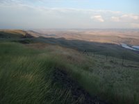
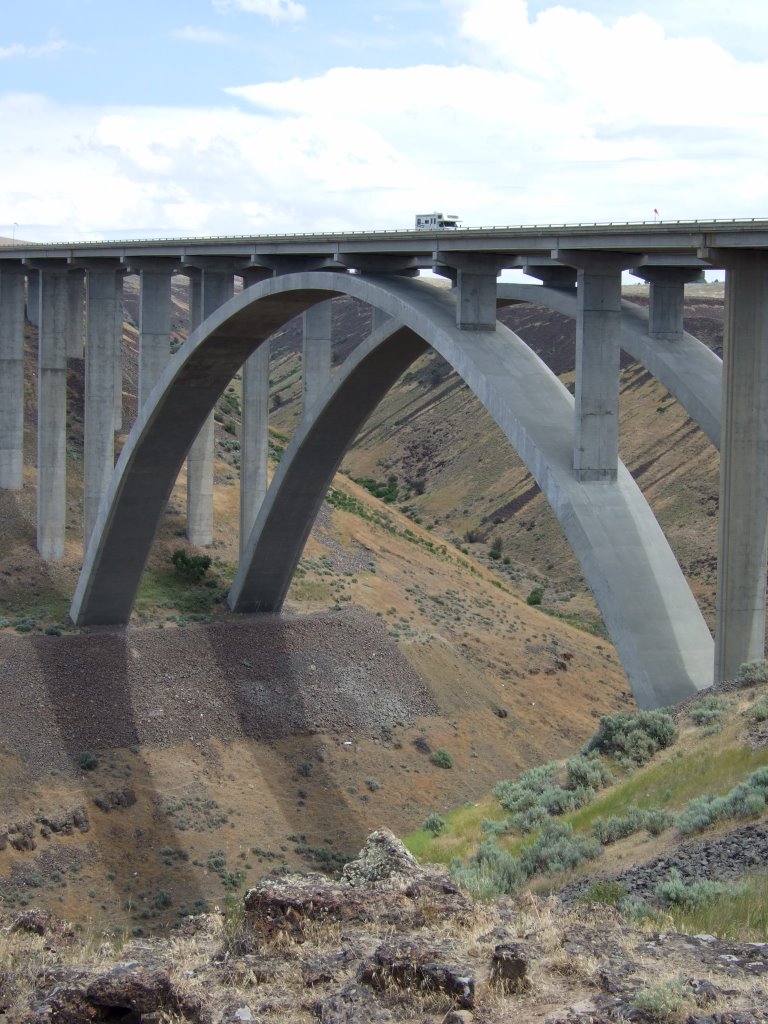
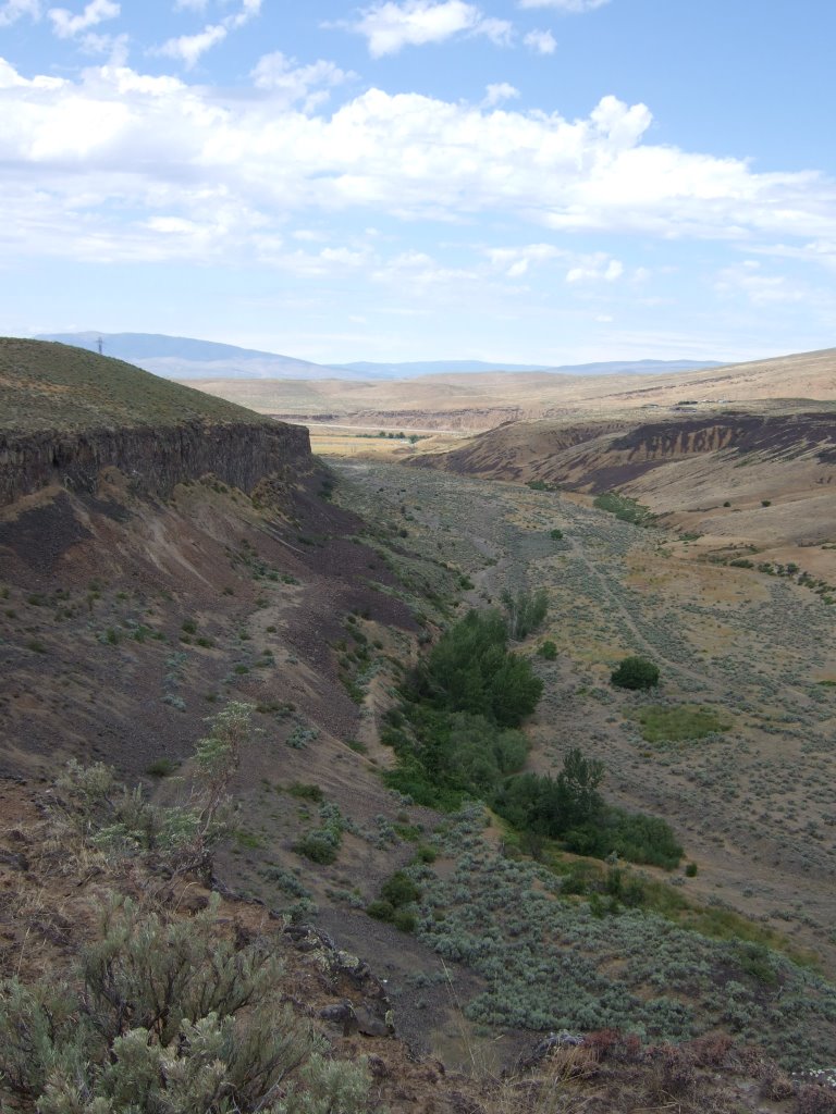
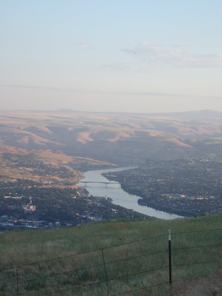
Headed south on the I-82 was nothing much of interest, that is, until I crossed the Redmon bridge and stopped at the subsequent rest area. The Redmon bridge spans what I will hazard a guess to call the Selah Canyon, and both are pictured below.
Then, for whatever reason, I continued south on the 82—oh yeah, I remember now, it was because there were any places to turn around for about the next 10 miles. Anyway, I’m glad I kept going that way because otherwise I would have gotten back on I-90, and the day wouldn’t have been nearly as interesting.
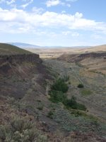
Headed south on the I-82 was nothing much of interest, that is, until I crossed the Redmon bridge and stopped at the subsequent rest area. The Redmon bridge spans what I will hazard a guess to call the Selah Canyon, and both are pictured below.
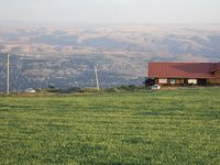
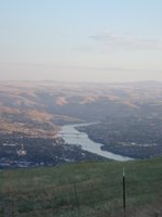
 Also of note is the fact that from that rest stop, and other places along that stretch of road, you can see Mount Rainier. Which is odd to me, because I’m only used to seeing it in western Washington. Here it is from the east.

 Under normal circumstances, I would have needed to fill up my truck’s fuel tank somewhere near that point in time and distance, but the gauge was being funny, so I decided to risk it, and head east instead of stopping in Yakima. The next town I saw that I was relatively certain that I could get gas at was about 80 miles away, and my trip odometer was over 200. I normally fill up between 200 and 240 (the gauge reads a quarter tank), if that tells you anything. At that distance yesterday, the gauge read slightly less than half. So I chanced it.
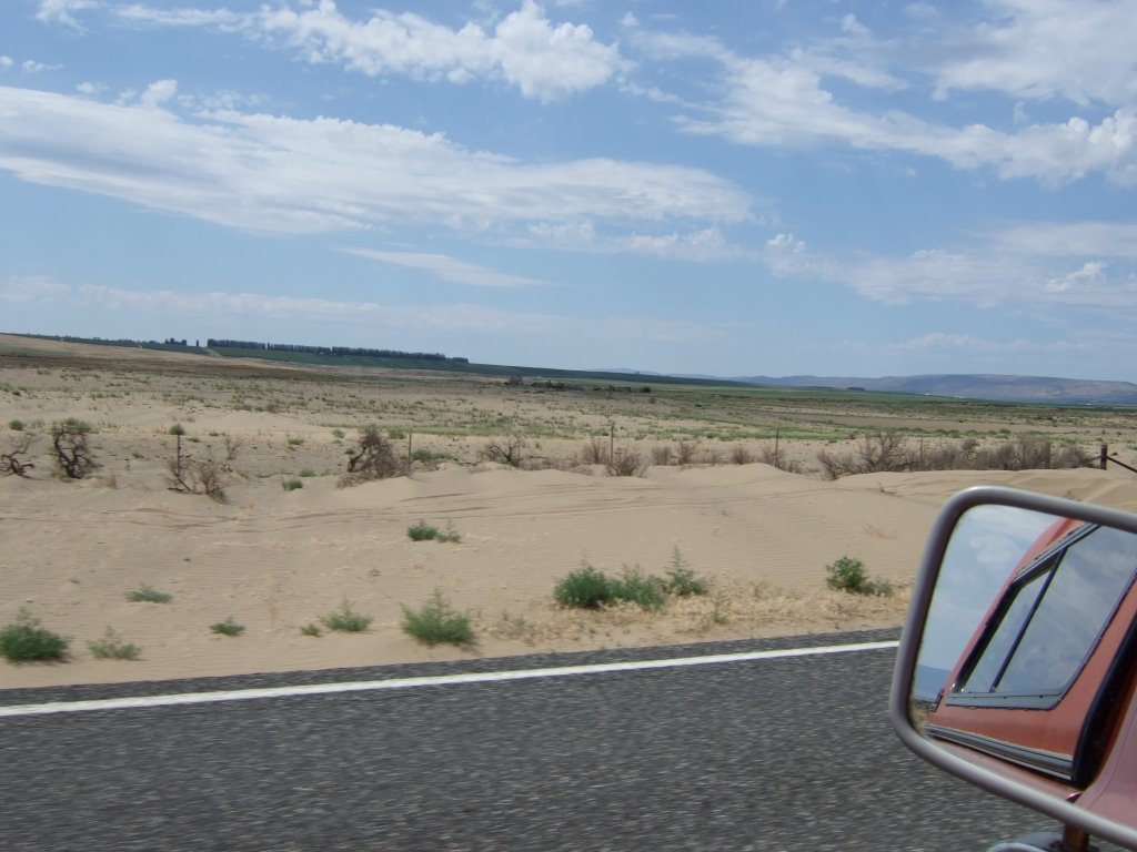
On my way to Othello I saw something I was quite surprised to see. It was sand, but sand like desert sand, like dunes are made of. I was quite amazed. So I took a picture. While driving.
Under normal circumstances, I would have needed to fill up my truck’s fuel tank somewhere near that point in time and distance, but the gauge was being funny, so I decided to risk it, and head east instead of stopping in Yakima. The next town I saw that I was relatively certain that I could get gas at was about 80 miles away, and my trip odometer was over 200. I normally fill up between 200 and 240 (the gauge reads a quarter tank), if that tells you anything. At that distance yesterday, the gauge read slightly less than half. So I chanced it.
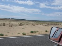
On my way to Othello I saw something I was quite surprised to see. It was sand, but sand like desert sand, like dunes are made of. I was quite amazed. So I took a picture. While driving.
 After getting to Othello, I stopped at the first gas station I saw, asked them if they took travelers checks, and was told that, “No,” they don’t. I asked if they knew of any gas station around there that did, and they said, “Yes,” and gave me awfully confusing directions to the gas station that ultimately didn’t accept the either. So I tried another one, and it did. By the time I’d stopped at the last gas station I was so frazzled and worried about gas station willingness to accept my form of funds, I didn’t even notice what pump number I’d stopped at. And it turned out to be pump first, pay later. I haven’t stopped at one of those in years.
Then I was amazed. It didn’t take nearly as long to fill up my gas tank as I thought it would. Mostly because it didn’t take nearly as much gas. A little over 11 ½ gallons. Which means that my truck got better than 24 1/3 miles per gallon. And that’s pretty great considering it usually gets between 18 and 20. I was well pleased (and still am, for that matter).
After consulting the map once again, I determined that I wouldn’t get back on the interstate system. At least, not for a while. So I continued east on highway 26. Where, after many, many fields of things including, but not limited to: wheat and corn and (what I think must have been) mint(the mint fields were often quite strong in smell, but were occasionally extremely... pleasant) , I saw a building which made me realize just where I was:
After getting to Othello, I stopped at the first gas station I saw, asked them if they took travelers checks, and was told that, “No,” they don’t. I asked if they knew of any gas station around there that did, and they said, “Yes,” and gave me awfully confusing directions to the gas station that ultimately didn’t accept the either. So I tried another one, and it did. By the time I’d stopped at the last gas station I was so frazzled and worried about gas station willingness to accept my form of funds, I didn’t even notice what pump number I’d stopped at. And it turned out to be pump first, pay later. I haven’t stopped at one of those in years.
Then I was amazed. It didn’t take nearly as long to fill up my gas tank as I thought it would. Mostly because it didn’t take nearly as much gas. A little over 11 ½ gallons. Which means that my truck got better than 24 1/3 miles per gallon. And that’s pretty great considering it usually gets between 18 and 20. I was well pleased (and still am, for that matter).
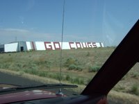
After consulting the map once again, I determined that I wouldn’t get back on the interstate system. At least, not for a while. So I continued east on highway 26. Where, after many, many fields of things including, but not limited to: wheat and corn and (what I think must have been) mint(the mint fields were often quite strong in smell, but were occasionally extremely... pleasant) , I saw a building which made me realize just where I was:
 Cougar country.
 Ironically (or obviously, depending on how you want to look at things) the next place I stopped was Pullman. It sure was a big college town. It made me wonder how many people live there who are in no way connected with the school. I’d guess it’s not a very high percentage.
It was getting late, and I wanted to check my map and eat something, so I stopped at a Safeway. I was there for a surprisingly long time. I bought some ice while there. There was nothing particularly shocking about that Safeway.
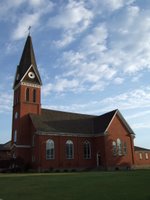
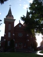
I drove on, into the friscalating dusklight, and saw from the road a tall church steeple. I thought to myself, “I’ve become far too destination oriented, and not as journey oriented as I was wanting to be. Now’s my chance to go and see something just for the sake of curiosity.” That might be a little too detailed a description of my thought and how I thought it, but you get the idea. Anyway, I stopped in Colton and took a few pictures of the St. Gall church building. It was pretty amazing. Then the caretaker came out and told me that the doors were open if I wanted to go inside. I politely told him no thanks, and that I was just passing through, when he told me of another, bigger, more impressively large church building three miles to the south: St. Boniface. He said it was no coincidence either. Apparently there’d been some kind of feud between the Catholics of Colton and the Catholics of Uniontown, so the Uniontownsmen broke off, and went their own way, electing to build a bigger, better, 2 STEEPLED church for themselves to go to. And here they are for your viewing pleasure (see if you can guess which is which).
Ironically (or obviously, depending on how you want to look at things) the next place I stopped was Pullman. It sure was a big college town. It made me wonder how many people live there who are in no way connected with the school. I’d guess it’s not a very high percentage.
It was getting late, and I wanted to check my map and eat something, so I stopped at a Safeway. I was there for a surprisingly long time. I bought some ice while there. There was nothing particularly shocking about that Safeway.
I drove on, into the friscalating dusklight, and saw from the road a tall church steeple. I thought to myself, “I’ve become far too destination oriented, and not as journey oriented as I was wanting to be. Now’s my chance to go and see something just for the sake of curiosity.” That might be a little too detailed a description of my thought and how I thought it, but you get the idea. Anyway, I stopped in Colton and took a few pictures of the St. Gall church building. It was pretty amazing. Then the caretaker came out and told me that the doors were open if I wanted to go inside. I politely told him no thanks, and that I was just passing through, when he told me of another, bigger, more impressively large church building three miles to the south: St. Boniface. He said it was no coincidence either. Apparently there’d been some kind of feud between the Catholics of Colton and the Catholics of Uniontown, so the Uniontownsmen broke off, and went their own way, electing to build a bigger, better, 2 STEEPLED church for themselves to go to. And here they are for your viewing pleasure (see if you can guess which is which).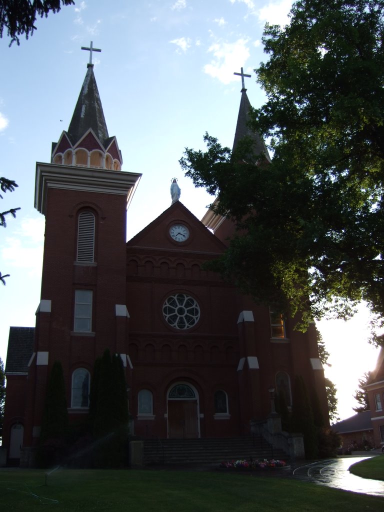
 I snapped my photos with my digital camera, which makes that annoying shutter snapping sound, and continued on my merry way. Sometimes needing my sunglasses, sometimes not. The sun and the hills and the mirrors were reeking havoc on my eyes.
Then, suddenly and without warning, I was in Idaho. I don’t even know how it happened. One minute I was driving along in Washington, and then I was driving along in Idaho. How odd.
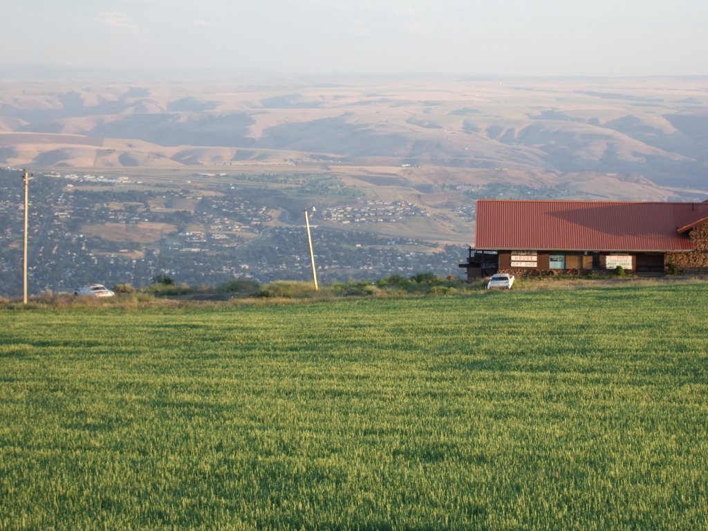
Shortly after my Idaho-entry shock subsided, I followed a turn in the road and could see that I was on the top of a large hill (mountain maybe?) and there was a city far below. I stopped at a weigh station and snapped a few photos. In this one there are two old cars on the edge of the hill by an antique shop. It makes me think that they are standing guard over the city.
I snapped my photos with my digital camera, which makes that annoying shutter snapping sound, and continued on my merry way. Sometimes needing my sunglasses, sometimes not. The sun and the hills and the mirrors were reeking havoc on my eyes.
Then, suddenly and without warning, I was in Idaho. I don’t even know how it happened. One minute I was driving along in Washington, and then I was driving along in Idaho. How odd.
Shortly after my Idaho-entry shock subsided, I followed a turn in the road and could see that I was on the top of a large hill (mountain maybe?) and there was a city far below. I stopped at a weigh station and snapped a few photos. In this one there are two old cars on the edge of the hill by an antique shop. It makes me think that they are standing guard over the city.
 From there I turned around again, but a different way (and a little further) and took a picture of mine and my truck’s shadows. The sun (as you’ve probably seen already) was quite low on the horizon.
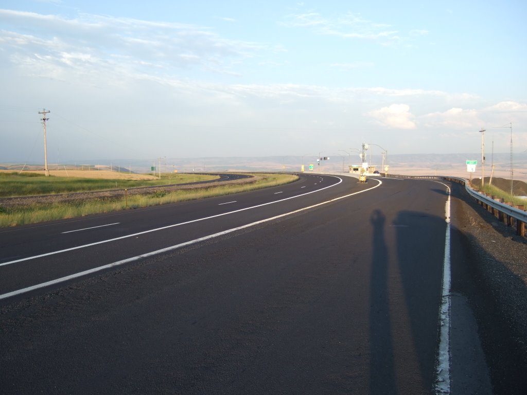
 A little ways down the road I saw another, better spot to pull off and see the sights. I thought it was awesome. In the dictionary way, and the surfer way, too, I guess. I could see some hills to the east, and the city of Lewiston a little to the south and west, more south though.
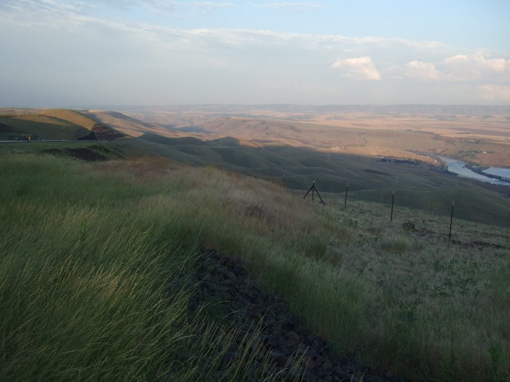
 After that it was time for me to start thinking about hanging it up for the night. But where, oh where, to sleep? I thought a campground would be appropriate for my first night’s sleep. So I put my mind to finding a campground. It took me a very, very long time. In fact, there were many times that I thought about just pulling off on a wide patch of shoulder and sleeping there. In Driver’s Ed. they told us to do that if we were tired—but I don’t know if that flies when you’re curled up in a sleeping bag... Although I did see a truck and camping trailer pulled off just like I was thinking about, and the campers interior lights were on, so I think that’s what those people were planning. Hmmm...
Anyhow, I ended up stopping at the Winchester, ID state park and campground. There are two loops in the campground, an A loop (16.80 per night, no amenities) and a B loop (20.80 per night, water and electricity). I drove all up and down the A loop (sometimes the wrong direction—sometimes backwards because some people and their friends had too many cars and were blocking the road—and sometimes just because I went the wrong way down a one way stretch of road. Unfortunately all the empty camping spaces had tags on them telling me just how reserved they were. Alas, I made my way up to the B loop, where, after about three or four camping spaces I found an unreserved and empty space. Then it took me three trips from truck to campground money dropbox to get everything right. First I had improper change (and wasn’t about to give them any extra), then I forgot to write down my truck’s plate number. And then, finally when I thought I was going to be able to go and organize my truck, and then do some writing and then go to sleep, I find that they have a little amphitheater where they are playing “The Man From Snowy River.” So I sat and watched that, and then came back to my truck, organized it, went to the bathroom, brushed the teeth, came back, sat in my makeshift bed, didn’t sleep for about an hour, left myself some voice recordings, and then went into my fitful ‘I’m in a strange place’ kind of sleep. Which means I sleep for about five hours, and then wake up every half hour from then until I get up.
This morning, I’ve showered, eaten breakfast, and written this. We’ll see what else I can do with the day. Hopefully I can get this posted in the next day or two, so that all of you can read about my exciting and wondrous exploits... er... adventures.
After that it was time for me to start thinking about hanging it up for the night. But where, oh where, to sleep? I thought a campground would be appropriate for my first night’s sleep. So I put my mind to finding a campground. It took me a very, very long time. In fact, there were many times that I thought about just pulling off on a wide patch of shoulder and sleeping there. In Driver’s Ed. they told us to do that if we were tired—but I don’t know if that flies when you’re curled up in a sleeping bag... Although I did see a truck and camping trailer pulled off just like I was thinking about, and the campers interior lights were on, so I think that’s what those people were planning. Hmmm...
Anyhow, I ended up stopping at the Winchester, ID state park and campground. There are two loops in the campground, an A loop (16.80 per night, no amenities) and a B loop (20.80 per night, water and electricity). I drove all up and down the A loop (sometimes the wrong direction—sometimes backwards because some people and their friends had too many cars and were blocking the road—and sometimes just because I went the wrong way down a one way stretch of road. Unfortunately all the empty camping spaces had tags on them telling me just how reserved they were. Alas, I made my way up to the B loop, where, after about three or four camping spaces I found an unreserved and empty space. Then it took me three trips from truck to campground money dropbox to get everything right. First I had improper change (and wasn’t about to give them any extra), then I forgot to write down my truck’s plate number. And then, finally when I thought I was going to be able to go and organize my truck, and then do some writing and then go to sleep, I find that they have a little amphitheater where they are playing “The Man From Snowy River.” So I sat and watched that, and then came back to my truck, organized it, went to the bathroom, brushed the teeth, came back, sat in my makeshift bed, didn’t sleep for about an hour, left myself some voice recordings, and then went into my fitful ‘I’m in a strange place’ kind of sleep. Which means I sleep for about five hours, and then wake up every half hour from then until I get up.
This morning, I’ve showered, eaten breakfast, and written this. We’ll see what else I can do with the day. Hopefully I can get this posted in the next day or two, so that all of you can read about my exciting and wondrous exploits... er... adventures.
2 comments:
Aren't road trips great FUN!!! Especially when you stay off the interstates!
I think you were mistaken about Mt Rainier. That wasn't the real thing. It was really Eastern Washington's cheap imitation of our impressive, grand mountain. Everyone knows it's just flat over there and they don't have any real mountains.
Oh, I just thought of something that I need to google....
love,
gwynn
There's gotta be a way to turn off that noise.
Post a Comment