 This location is said to have a resemblance with the Holy city of Jerusalem. I don’t see it, myself, but I don’t really know what Jerusalem looks like.
 Once again I stopped at a park just to realize that it was a pay park, and that no thanks, I didn’t want any. But I still took my pictures. It was the Buffalo Bill State Park. The fact that I didn’t go in didn’t make much difference to me, no how. I kept on a-goin’ and saw the beautiful lake that is held up by the monstrous Buffalo Bill Dam—which I went to, it was free, I even got a little cart ride over to it, oh, and the people behind me on the cart were from the Everett area.
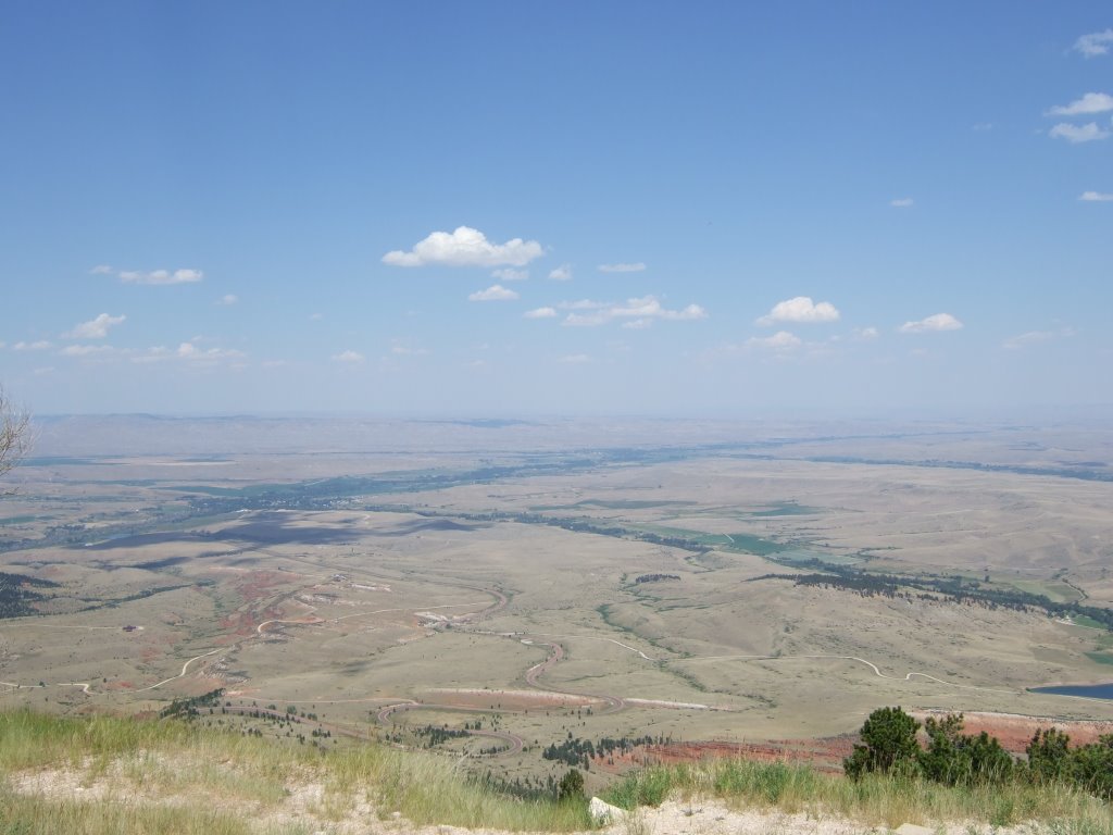
 This is the view from atop the (at time of construction) world’s tallest archway dam (I believe is what they said).
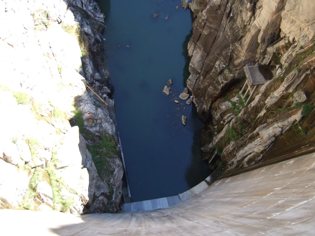 Here is the only decent picture I could get of the dam. It’s pretty tall.
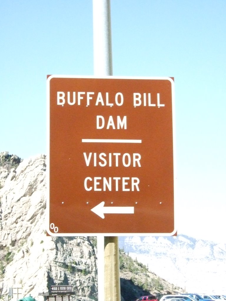
And a sign for the Dam Visitor Center.
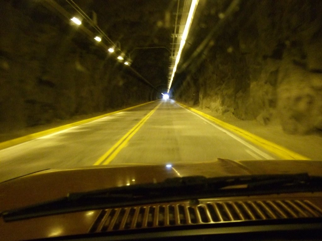
 Here is a dark picture I took while driving through a tunnel. The picture isn’t really of anything in particular, I just like it, and therefore am sharing it with you all.
 After I got to and out of Cody, WY, I was driving on these seemingly endless stretches of slightly hilly, slightly rocky desert. It was fenced on both sides of the road, and that made me wonder if people were trying to grow things in the fence, keep things out, or just what was going on. And then I saw a herd of horses. I wasn’t expecting it, so I didn’t get a picture, but the second herd I saw, well, I was ready for ‘em. I, for whatever reason, has a suspicion that they might be the wild horses called Mustangs.
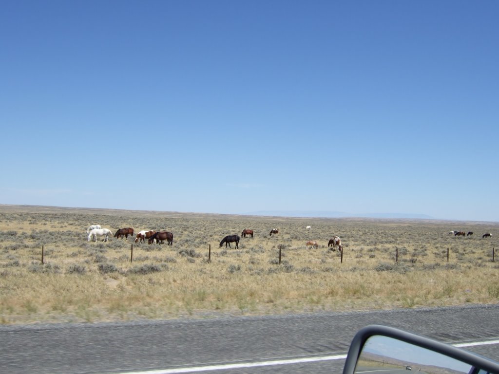 A few more miles down the road, I stopped at a historic marker that told about horses and how Mustangs range these lands. The marker also told of how horses have few natural predators, so there are periodic roundups to prevent Mustang overpopulation. I found it interesting. And I think it confirmed my suspicion.
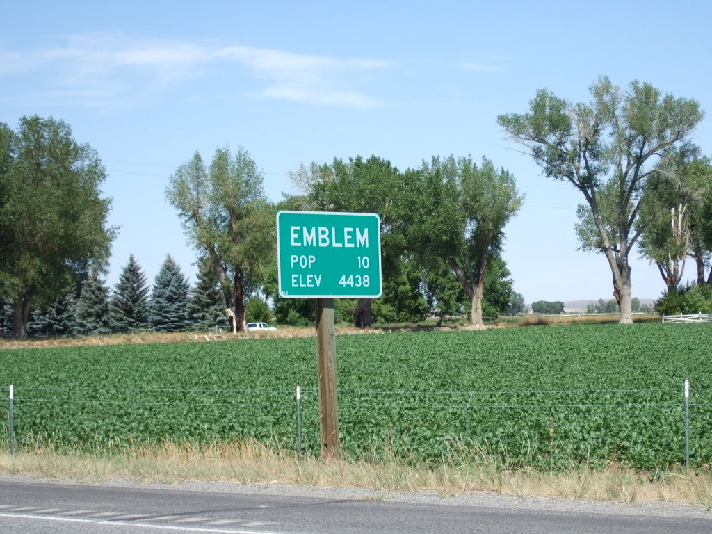
I was just driving along after that, and I’d seen some mileage signs. There was apparently a town called ‘Emblem’ coming up. I’d never heard of it, nor should I have, as far as I know, but I don’t know now that I’ll ever forget it. I drove by the first sign on the way into town and assumed that a number had fallen off the sign, but when I got through to the other side, I couldn’t help but take this picture:
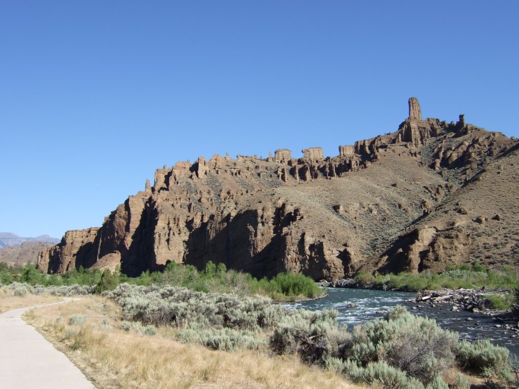
 After another while of driving and a stop in Greybull (where a strange town siren went off, followed by an equally strange different siren went off—to no reaction by the townspeople—I found out in the post office that there was either a fire, or a wreck on the highway and the siren was the fireman alert), I saw some of those rocks that look like the ‘painted desert,’ and took pictures accordingly. I had no idea how closely I would see more rocks of that sort. They weren’t exactly the same, but the rocks I’d taken pictures of and found interesting were actually the opening to a pass which I didn’t know I was going to take.
I don’t remember the exact name of this formation, but I know the word “pyramid” is in the name. I know that because of how thoroughly unsurprised I was to find that out. It looks human-carved.
After another while of driving and a stop in Greybull (where a strange town siren went off, followed by an equally strange different siren went off—to no reaction by the townspeople—I found out in the post office that there was either a fire, or a wreck on the highway and the siren was the fireman alert), I saw some of those rocks that look like the ‘painted desert,’ and took pictures accordingly. I had no idea how closely I would see more rocks of that sort. They weren’t exactly the same, but the rocks I’d taken pictures of and found interesting were actually the opening to a pass which I didn’t know I was going to take.
I don’t remember the exact name of this formation, but I know the word “pyramid” is in the name. I know that because of how thoroughly unsurprised I was to find that out. It looks human-carved.
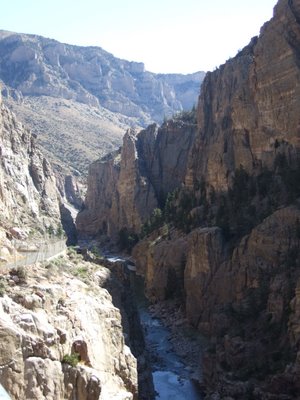
 As I went further up the mountain, I found the Shell Falls. After finding myself unable to get a good picture of the falls, I decided to check out the ¼ mile nature walk around the site. From one point I got a different view of the pyramid formation (at least that’s what I think that one is), and on the left side of it, you can probably see what’s called “Elephant Head Rock.”
 I reached the top of the pass and found the change in altitude brought a very dramatic change in landscape. It was a sort of rolling grassland up there at the top of the mountain. At one point I thought I was very clever for seeing a single animal far off on a hill side. I took out my camera and telephoto lens quite hurriedly, zoomed in as far as I could, and am pretty sure it was a horse. All by itself on the side of a hill at the top of a mountain. Then I felt kind of dumb.
The elevation dropped a little, and that brought me to more windy mountainside roads. There was a scenic turnout that I took, and got this photo:
 To me, it almost looks like the photograph was taken from space or some other aerial reconnaissance.
Shortly after that I got back on I-90, and the landscape got dramatically boring. Nothing much comes to mind on I-90, not until I stopped in Gillette, anyway.
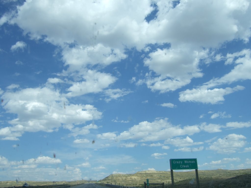
But first I saw this sign and thought it interesting, apparently there’s a story behind it…
To me, it almost looks like the photograph was taken from space or some other aerial reconnaissance.
Shortly after that I got back on I-90, and the landscape got dramatically boring. Nothing much comes to mind on I-90, not until I stopped in Gillette, anyway.
But first I saw this sign and thought it interesting, apparently there’s a story behind it…
 I stopped in Gillette, anyway, looking for a motel. I figured it was time to do some laundry and uploading and just generally sleeping in a bed. Unfortunately for me, the lowest priced motel I could find was a single King Sized bed for one hundred twenty USD. Which was about 60 more than I was willing to pay for anything, at that point.
I was in luck, however, for I spied with my little eye a campground nearby. A campground with laundry facilities and internet access. For $22 (plus applicable tax). It was awesome. I spent most of that night figuring out bloggering and how I was to make it happen.
As I was bloggering, a girl asked me for help with her computer, which, as it turned out, was not actually her computer (but that’s neither here nor there). Unfortunately I was able to offer her no real assistance, and went back to my bloggery. At some point later on, a conversation was started, and it was revealed that she and her family were in Gillette for the World Horseshoe Pitching Tournament 2006. I was shocked, I was awed. I had no idea that Horseshoe Pitching was competitive, let alone both competitive enough and popular enough to warrant a WORLD TOURNAMENT. I was utterly fascinated.
After hearing many tales of pitching and locales (both where people were from, and where the Tournament had been in past years), the world became less busy, and people went off to sleep. I stayed up for a little while longer, and then joined the ranks of the sleeping.
I stopped in Gillette, anyway, looking for a motel. I figured it was time to do some laundry and uploading and just generally sleeping in a bed. Unfortunately for me, the lowest priced motel I could find was a single King Sized bed for one hundred twenty USD. Which was about 60 more than I was willing to pay for anything, at that point.
I was in luck, however, for I spied with my little eye a campground nearby. A campground with laundry facilities and internet access. For $22 (plus applicable tax). It was awesome. I spent most of that night figuring out bloggering and how I was to make it happen.
As I was bloggering, a girl asked me for help with her computer, which, as it turned out, was not actually her computer (but that’s neither here nor there). Unfortunately I was able to offer her no real assistance, and went back to my bloggery. At some point later on, a conversation was started, and it was revealed that she and her family were in Gillette for the World Horseshoe Pitching Tournament 2006. I was shocked, I was awed. I had no idea that Horseshoe Pitching was competitive, let alone both competitive enough and popular enough to warrant a WORLD TOURNAMENT. I was utterly fascinated.
After hearing many tales of pitching and locales (both where people were from, and where the Tournament had been in past years), the world became less busy, and people went off to sleep. I stayed up for a little while longer, and then joined the ranks of the sleeping.
No comments:
Post a Comment